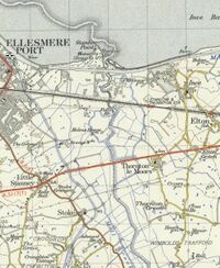
Gowy
The Rivers Gowy and Weaver rise in almost the same field at Peckforton. The head of the Gowy is about sixteen miles from where it empties into the Mersey estuary "as the crow flies", but the wandering of the river adds at least nine more miles to that. It used to wander even more before many of its meanderings were straighened out - mostly by Italian POW's in WW2 (there were POW camps at Knutsford and Crewe Hall). Surprisingly, this short and often insignificant looking river and its branches have been made to work incredibly hard, they powered around twenty or more water-mills. The Gowy flows entirely within Cheshire.
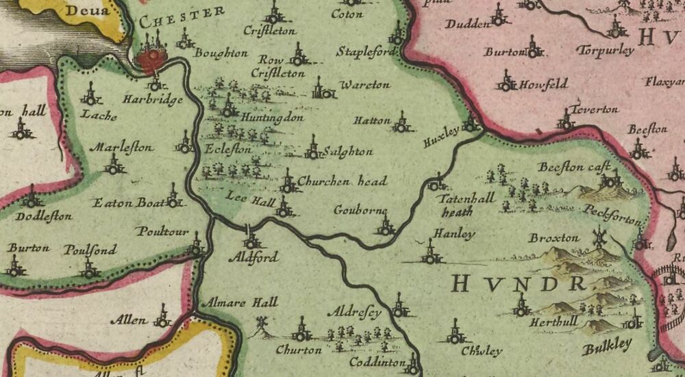
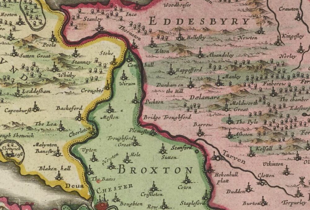
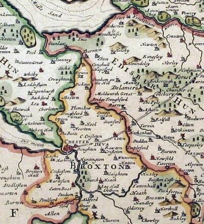
Early maps and descriptions give a seemingly improbable course for the Gowy, with the river splitting in two at least twice and branches emptying into the River Dee via Aldford Brook and Backford Gap. Ormerod cites a very peculiar version of the course of the Gowy, with it actually dividing the Wirral from the rest of Cheshire by flowing into both the Dee (as Flookersbrook) and the Mersey:
- "That, therefore, which they call the Gowy, hath his head not far from Bunbury, and runneth north-west by Beeston Castle, to Teerton and Huxley, where it divideth itself into two parts ; one goeth west to Tattenhall, Gosburn, Lea Hall, and at Aldford falleth into the Dee. The other part goeth northwards to Stapleford, Hocknel-plat, and Barrow (where it taketh in a brook that Cometh from Tarporley and Tarvin), and so passeth to Plemstow-bridge, Trafford, Picton, and Thornton, where it divideth itself again into two parts; one of which keepeth its course north-west to Stanley, Stanney, and Poole, and afterwards falleth into the Marsey. The other part goeth south-west to Stoke, Croughton, Chorlton, the Baits, and so falleth into the Dee, hard by Chester, being there called Flooker's-brook, and divideth Wirral from the rest of Cheshire; and therefore some imagine that it is called Wirral."
This supposed course of the river is used to define parts of the bounary of the Broxton Hundred. However, it may well be that significant parts of the river were diverted at various times and in various places, particularly to power water-mills, or to prevent or reduce flooding. Even today, the boundaries are often the old ones and do not always follow the mid-line of the river. However diversion of the river was never on the scale that Ormerod implies. Why Ormerod should get it so wrong is a mystery, as he lived at nearby Chorlton Hall in Backford while writing his "History of Cheshire" and should have been familar with the local hydrology. One possible theory (little more than speculation) is that the Gowy had a reputation for flooding and this linked it in a very loose sense to other minor local rivers which were prone to flood, such as what later became "Finchett's Gutter" (hence "Stone Bridge" - see Flookersbrook) and Golborne Brook (see Civil War) which may have been the site of the dawn ambush which started the Battle of Rowton Moor.
Geology
The Gowy flows over a thick layer of glacial and coastal deposits which overlay several related types of sandstone. One of these sandstone formations, the Sherwood Sandstone, is the UK’s second most important aquifer. Near the coast there are peat beds. Nowhere does the Gowy flow over rock or fall steeply enough to produce a natural waterfall or rapids. Its porous bed means that water is frequently exchanged with the surrounding ground. Near the sea, there are deeply incised buried drainage channels, probably dating from the ice ages, which are filled with gravel and invisible on the surface. These undoubtedly influence groundwater flow but have a very complex form which has not been accurately mapped, although the important groundwater resources along the Gowy have been studied in some detail. The drift cover has the effect of smoothing the topographic surface of the pre-glacial landforms. Drift cover in the Gowy Valley is at a depth of 30 metres below sea level. Drift cover is of substantial thickness in places, for example it exceeds 30 metres thickness in the NNW-SSE trending steep-sided valleys along the River Gowy between Helsby and Tarvin.
Beneath the sandstones are the Pennine Coal Measures Group and Millstone Grit Formations and underlying these are the shales and limestones of the "Craven Group", which have been a target for shale gas exploration ("fracking"). These Carboniferous rocks date from the geological period prior to the desert conditions in which the Cheshire sandstones were formed. The gross geology of the Cheshire plain is that of a "graben" where later sandstone survives between the older rocks of the Wrexham and Macclesfield coal-measures to the east and west. Coal measures exist beneath the Cheshire plain, but are too deep to mine. Ince is an exception in that the deep-buried coal measures (normally 1.5 km down) are faulted upwards to form a "horst" (but still at 0.94 km down, too deep for practical mining, especially given the hydrology). This horst is bordered by the Waverton fault zone to the west, and the Dungeon Banks fault zone to the east. The only surface indication of this immense underground feature may be the slight rise at the mouth of the Gowy.
The topological character of the river's course can conveniently by divided into four sub-regions:
- The early reaches of the river drain uplands at about 300 feet of altitude. These upland areas are largely drained by the River Weaver and so the volume of the Gowy is quite modest and it is seldom more than a few feet wide during normal weather conditions. It takes a wandering course to reach the level of the canal and railway at about 150 feet.
- The river then passes through a gap in the sandstone ridge running down the center of the Cheshire plain. The gap is probably the result of glacial activity and meltwater flow. While the Gowy may have contributed to the final detail of the valley it did not itself carve out the bulk of it.
- The Gowy emerges from the gap about 100 feet above sea level, onto lowland pasture between Huxley and Stamford Bridge. The land is flat enough to require some drainage ditches but not a excessive number. The land is extensively cleared and there is only a little surviving woodland, some of which may have been left as cover for the foxes that the gentry loved to hunt. The most obvious features in the Cheshire landscape, as seen from the air, are the fields. Some of them are rectangular, very regular and plainly recent. Others are less regular and are presumably older. A few fields are markedly oval and were either assarts formed at the edges of extensive woodland or, as is more likely, they are the sites of small woods or copses that have been destroyed to provide extra pasture or land for crops. Marl pits are frequent. Secondary calcium carbonate deposits are common at a depth of 1-2m in the till, and before cheap lime was made available in the 19th century this "marl" was dug and spread on the surrounding fields to reduce acidity. On sandy soils this practice of marling also increases fertility and moisture holding capacity.
- Below the Roman crossing at Stamford bridge, the Gowy makes its way to the sea in across a broad coastal plain which was once subjected to tidal inundation and is still intersected by many drainage ditches. This land was probably marginal until the construction of the Manchester Ship Canal and the railways reduced the risk of tidal flooding, although the tithe maps indicate that much of the ditching was in place by the 1830's. The slopes of the valley sides provide somewhat drier ground as a pastoral fringe. In relatively recent times this area would have been influenced by changes in sea-level. Relatively recent changes to sea-level, include a period of transgression in Roman times that peaked in the late fourth century, when previously unaffected areas would have been subject to inundation. Sea level fell to close to present levels by the seventh century, rising again until the late thirteenth century, from which it has fallen to present levels.
It has long been the contention of historians that the county's lands had largely been enclosed by the 17th century, and it is interesting that the scattered farmhouses of west Cheshire, many of which are of 17th-century date, tend to confirm this. Those of them that are of timber-frame construction frequently contain re-used structural timbers, implying the existence of even earlier buildings at the same locations or nearby. It is a common myth that any odd-looking timber used in an old building is re-used "ship timber". That is simply untrue. Once forests had been cleared, wood became a valuable commodity and when enclosures gathered scattered land-holdings in close-knit groups any farm-house that was built would use recycled materials from earlier constructions. Enclosure was delayed by some land-owners and in Cheshire the subject is a complex one. Enclosure has may other effects than simply producing hedgerows (which are not as old as some might think) and are of course an entirely man-made aspect of the landscape. Footpaths and rights of way were established, as were many country roads. The Christleton Enclosure award created several new roads from Christleton to Cotton and Hockenhull Platts, to Waverton and across Birch Heath and Stamford Heath to the Chester-Tarvin turnpike. At Bunbury, allotments were set-up for small-scale vegetable farming.
Mineral resources along the river are mostly limited to a few sand and gravel pits, although copper was found just south of its source. One consequence of the copper find has been the inspiration for a model of the fictional Peckforton Light Railway (not located at Peckforton). The general boggyness of the rivers banks and a tendency to flood in parts of its shallow valley has meant that no major settlement has developed along its banks and hamlets or small villages such as there are tend to be located on drier ground set back at some distance from the River. There is farming land along almost all of the river, with little forest remaining. Agriculture is now dominated by pasture, but the presence of the mills indicate that corn was grown, as does the fact that the arms of Cheshire feature sheaves. Apart from where it passes through the gap in the Sandstone Ridge, a gap defended by the castle at Beeston, the valley of the river is little used for commerce along its length. The natural processes of vegetation succession have reduced many marl-pits to small, shallow features, over-shaded with trees and with little open water. Nevertheless, it is estimated that Cheshire’s 16,000 ponds represent some 10% of all farm ponds in England and Wales, and still provide an important wildlife resource.
Some have suggested that the river may once have formed a natural border between England and Wales, and note that in earlier times, this river was possibly called the Tarvin. It is suggested that the name Tarvin comes from the Brittonic word for boundary, which is still present in the Welsh language as tervyn/terfyn and could have resulted from the Latin terminus being incorporated into Brittonic. The boundary could refer to the eastern extent of the Roman "prata legionis", the land annexed by the Romans (from the Cornovii) to support their fortress at Chester. The Gowy was later the boundary between the Saxon land divisions (hundreds) in this area, in particular forming the western boundary of the Eddisbury Hundred. The Gowy may well have been an important boundary from a very early age and one for which the "permiability" varied with changes in sea-level as discussed above. There is some evidence that there were cultural differences accros this boundary from the "stone age": the stone axes discovered in the Wirral and western Cheshire are mostly from North Wales, whereas those found in the Mersey and Weaver valleys come from Cumbria.
The Source
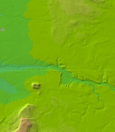
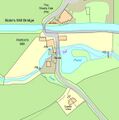
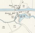
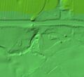
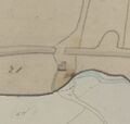
<== CLICK ON THE WALKING MAN TO GET MAPS, LIDAR ETC.
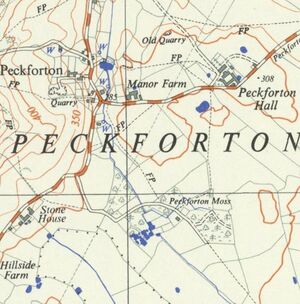
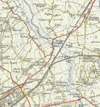
The official source of the Gowy is near grid-reference SJ539563 (see the 1909 OS map). From Peckforton Moss the stream flows northwards through the hamlet of Peckforton, where the first mill down from the source of the river Gowy was located, as shown on the 1909 OS map. Only scant signs of the millpond remain, but surprisingly the remains of the mill can be stumbled upon. Even the millstones have been located due to the work of landscape geographer David Keogh. Inscriptions on some of the surviving stonework appears to give a date of 1698, although it is unclear whether that is meant as a date of building or later graffiti. In corn mills rotation about a vertical axis was required to drive its stones. The horizontal axis rotation of the wheel was converted into the vertical rotation by means of gearing, which also enabled the runner stones to turn faster than the waterwheel. The usual arrangement has been for the waterwheel to turn a horizontal shaft on which is also mounted a large "pit wheel". This meshes with the "wallower", mounted on a vertical shaft, which turns the (larger) "great spur wheel" (mounted on the same shaft). This large face wheel, set with pegs, in turn, turned a smaller wheel (such as a lantern gear) known as a "stone nut", which was attached to the shaft that drove the runner stone. The number of runner stones that could be turned depended directly upon the supply of water available. As waterwheel technology improved mills became more efficient, and by the 19th century, it was common for the great spur wheel to drive several stone nuts, so that a single water wheel could drive as many as four stones.
The development of the water-mill was an important technology milestone. It superceeded the use of manual threshing which was a laborious process. From the late 10th century onwards, there was an expansion of grist-milling in Northern Europe. In England, the Domesday survey of 1086 gives a precise count of England's water-powered flour mills: there were 5,624, or about one for every 300 inhabitants: often quoted as one for every thirty households. Windmills only appeared in England from about 1180. The invention of mechanical fulling by waterpower was apparently introduced to these islands by religious orders, particularly the Cistercians. Fulling mills for wool turned England into a major cloth-making country from the 14th century. They were known as "walk mills" in northern England and "tuck mills" in the South-west.
The river has only fallen a few feet to reach this point and so the fact that it has the strength to power a mill is remarkable. However it would be wrong to assume that this was a flour mill. Many of the mills along the Gowy may have produced animal feed, which does not need to be as finely ground. Feed was needed as the farming practice in Cheshire was to move the animals indoors for the winter months amd tillage was often limited by landlords to increase the dairy output. The river already has less than 300 feet to fall before it reaches the tidal waters of the Mersey. In 1901 a local farmer found a neolithic stone hammer near here. The hammer was made of Cumberland granite and must have been either traded 5-6k years ago or made locally from a glacial "erratic".
Peckforton appears in the Domesday survey of 1086, when it was held by Wulfric (possibly Wulfric Spot). The survey lists land for two ploughs. Peckforton fell in the ancient parish of Bunbury in the Eddisbury Hundred.
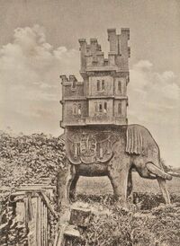
Near the head of the river Gowy, a red sandstone carving depicting an elephant bearing a castle as a howdah stands in the garden of Laundry Cottage on Stone House Lane in Peckforton village. It dates from around 1859 and is listed at grade II. It was carved by John or William Watson, a local stonemason then working on Peckforton Castle who also carved stone lions now at Spurstow and Tattenhall. The elephant and the castle are each carved from a single piece of stone, which derives from the same quarry as Peckforton Castle. The elephant has a tasselled saddle, supporting the castle which has three tiers, with a turreted gatehouse and a keep with turrets at the corner. Some of the castle windows are glazed. The original purpose of the carving is unclear. The device formed part of the crest of the Worshipful Company of Cutlers and is often associated with public houses, but there has never been a pub called The Elephant and the Castle in Peckforton. An elephant also appears in the arms of the Corbett family, local landowners before 1626. The "canting" arms of the Corbets is usually a raven (from "corvus"), but the "crest" on the top of the shield is an elephant and castle. There are links between the Corbets and the Cottons of Combermere Abbey - Stapleton Cotton, 1st Viscount Combermere (14 November 1773 – 21 February 1865) extensively modified Combermere, saw military service in India, and was appointed a Knight of the Order of the Star of India on 19 August 1861. Maybe the elephant was intended for Cotton - the elephant and castle is actually used as a heraldic motif at Combermere and Cotton once famously confronted a tiger while hunting on an elephant. According to one local source, the carving was originally intended as a beehive, although there is no evidence it has ever been used as one (curiously the "canting" arms of the Beestons, as featured at Bunbury Church, has bees). The elephant is one of several listed structures in Peckforton.
Peckforton Castle was built between 1844 and 1850 for John Tollemache, the largest landowner in Cheshire at the time, owning 28,651 acres (115.95 km2). His estate exceeded those of the Duke of Westminster who owned 15,138 acres (61.26 km2), Lord Crewe with 10,148 acres (41.07 km2) and Lord Cholmondeley with 16,992 acres (68.76 km2). He was described by William Ewart Gladstone as "the greatest estate manager of his day". Tollemache's first choice of architect was George Latham of Nantwich, but he was not appointed, and was paid £2,000 in compensation. Instead Tollemache appointed Anthony Salvin, who had a greater reputation and more experience, and who had already carried out work on the Tollemache manor house, Helmingham Hall in Suffolk. The castle was built by Dean and Son of Leftwich, with Joseph Cookson of Tarporley acting as clerk of works. Stone was obtained from a quarry about 1 mile (2 km) to the west of the site, and a railway was built to carry the stone. The castle cost £60,000.
Even at it's very source the waters of the river Gowy are robbed away by man. The headwaters actually seep down from Bulkeley Hill, where the remains of a tramway used in the construction of the Bulkeley Hill reservoir and water main, including a massive anti-surge valve at the top of the tramway can still be seen. There are foundations for a haulage angine at the top of the line, and a crossing point half-way. The climb up the track is approximately 105 metres of ascent. The tramway is on the route of the water-main supplying the water to the Potteries. This is actually a far more modern structure than might be thought. It was only in 1937 that the Staffordshire Potteries Water Board gained authority for the erection of pumping stations at Peckforton and Tower Wood in Cheshire, with a reservoir on Bulkeley Hill, whence the water would gravitate to a large storage reservoir at Cooper’s Green near Audley, for distribution to Tunstall and the Potteries. Most of these enterprises were held up by the Second World War and it wasn't until 1953 that the Peckforton scheme and its linking aqueduct to Audley had been completed. There are two boreholes where water is pumped from the Sherwood Sandstone aquifer which is near to the surface: Close to the Coppermine Inn (three pumping stations) and at Peckforton Gap. There is a holding reservoir at the Gap, from where water is pumped up 110 metres to a covered reservoir on Bulkeley Hill at 210 metres above sea level. From there a 27 inch steel pipe feeds the water under gravity to the reservoir at Cooper’s Green, Audley, 140 metres above sea level. While the sandstone under the Cheshire plain contains a vast aquifier the level has been affected to the point where the deep well at Beeston Castle is now dry and the springs and seepages which feed the Gowy are no-doubt much diminished. The canal takes no water from the Gowy and at times even overflows into it. Instead the canal is fed from the River Dee to the Hurleston Reservoir, which is filled by water which passes along the canal from the Horseshoe Falls at Llantysilio. As well as supplying the canal, the reservoir is used for drinking water, holding 85 million gallons (390 Ml). Around 12 million gallons (55 Ml) flow along the canal each day to supply it. The use of the canal as a water feeder ensured that it survived, including the Pontcysyllte Aqueduct, when other canals fell into disrepair.

These upper sections of the river Gowy appear to have either been shifted in their course several times or some of the early mapping is innaccurate, and drainage ditches may have been mistaken for the course of the river. In places the river even appears to dissappear beneath the ground. Some modern maps even label the river Gowy as the stream which flows from Spurstow Hall, through Woodworth Green, towards the canal at Calveley and only joins the true Gowy at Tilstone. As the Gowy makes its relatively short journey to the sea, or rather the Mersey estuary the influence of man becomes more marked. It's valley is used for a canal and railway, mills have been built at almost every opportune location and often it's course has been shifted by their leats. Further downstream its waters were divided for mills to such an extent that the main course was at times very diminished. The river's mouth now lies in the midst of a vast petrochemical complex and there have been long arguments as to whether "fracking" should be allowed in its lower valley.
Tithe maps
Tithes were originally a tax which required one tenth of all agricultural produce to be paid annually to support the local church and clergy. Parishes were created across England in the 11th and 12th centuries, with their associated parish churches. A major impetus to this development was the legal exaction of agricultural tithes specific to the support of churches and their clergy; landowners needed to establish parish churches on their lands in order to retain tithe income within their estates, and to this purpose sought to raise former field churches to parish church status. This was generally performed by a lord of a manor by rebuilding a church within the boundary of his manor, or within that of a newly subinfeudated (sub-let) manor, and then transferring proprietary rights of certain individual named fields, mills or messuages (i.e. houses on the manor which earned rents) to establish a "glebe". The lord of the manor, having incurred a great expense in building the church and parsonage and having suffered a loss of income due to his donation of property to the glebe, quite reasonably insisted on the right to select the individual who would act as the parson (parish priest), from which office he could not be ejected by the lord until the priest's death. This right became the "advowson" - a right to present a canditdate. After the Reformation much land passed from the Church to lay owners who inherited entitlement to receive tithes, along with the land. Depending on how the tithes were apportioned, a parson may be a rector (received direct payment of both the greater and lesser tithes of his parish) or a vicar (received only the lesser tithes with the greater tithes going to the lay holder). A parish priest who received no tithes (where the land-owner kept the lot) was legally a perpetual curate (to distinguish him from assistant curates). The title of perpetual curate was abolished in 1968.
By the early 19th century tithe payment in kind seemed a very out-of-date practice, while payment of tithes per se became unpopular, against a background of industrialisation, religious dissent and agricultural depression. The 1836 Tithe Commutation Act required tithes in kind to be converted to more convenient monetary payments called tithe rentcharge. The Tithe Survey was established to find out which areas were subject to tithes, who owned them, how much was payable and to whom. Enquiries were directed to every parish or township listed in the census returns. The results of these enquiries are in the tithe files, which cover the whole of England and Wales, and not only those places where tithes remained uncommuted by 1836. For parishes where tithes were still being paid in kind, the land had to be surveyed and valued, to arrive at total parish rentcharge figures, and to calculate each individual landowner’s liability to pay tithe. Assistant tithe commissioners travelled to these parishes to hold meetings with parishioners about valuations, and to settle the terms of the commutation of their tithes.
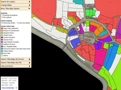
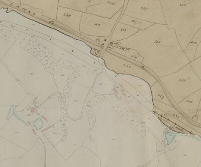
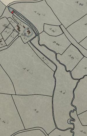
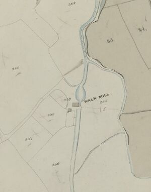
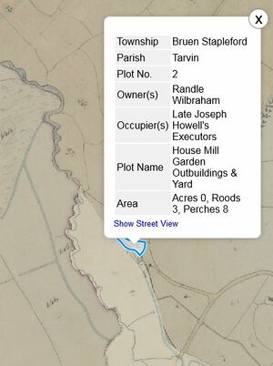
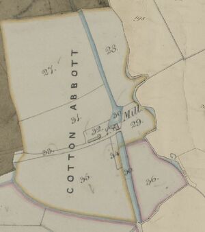
One result of the Tithe Commutation Act was the production of "Tithe Maps". These show the ownersship, occupation and often the use of land at the time, and provide useful details such as field names. They enable properties such as water-mills and smithys to be identified. The agreed terms were formalized in a document called a tithe agreement, if all parties concurred, or a tithe award, if the assistant commissioner had to arbitrate in a dispute. The agreement or award formed the basis of the tithe apportionment, which was the legal document setting out landowners’ individual liabilities. Each apportionment was accompanied by a map; both were signed by the Tithe Commissioners. Tithe rentcharge then became payable. Cheshire Archives and Local Studies has made the county Tithe Maps available online at no charge. These maps show much of the life along the Gowy that has almost become lost in modern times.
Peckforton
- "PECKFORTON, a township, in the parish of Bunbury, union of Nantwich, First division of the hundred of Eddisbury, S. division of the county of Chester, 4½ miles (S. S. W.) from Tarporley; containing 309 inhabitants. It comprises 1741 acres, of which the soil is half clay, half sand. Horseley Bath, a mineral spring formerly in considerable esteem, is in the township" - A Topographical Dictionary of England. Originally published by S Lewis, London, 1848.
Roughly opposite the marshy remains of Peckforton Mere and the now drained ground which was Ridley Pool was a cottage provided with stone faces. This has been a source of some confusion. This is not the noted "image house", although it has been confused with it in some guidebooks. Coward mentions the confusion in his "Cheshire Traditions and History". The "real" image house is a little way further down the Gowy between Beeston hamlet and Bunbury.
Tollemache
Members of the Tollemache family (pronounced "TOL-mash") had a significant impact on the economy and politics of East Anglia since the reign of Edward I and are believed to have been living in Suffolk since before the Norman conquest.

The Cheshire branch of the family arose through intermariage. The Tollemache family married into the Wilbraham family. The Wilbrahams of Woodhey traced their ancestry back to Sir Richard de Wylburghham, Lord of Wymincham and Radnor in right of his second wife. He died about 1273. His second wife was Letice, eldest daughter and coheiress of William de Venables of Wymincham and Radenore, younger son of Sir William Venables, baron of Kinderton. Woodhey was obtained about 1416 by the marriage to Thomas de Wilberham of Radnor to Margaret the daughter and heiress of John de Golborne. After Sir Thomas’s death in 1692 the Wilbraham baronetcy became extinct. There being no male heirs, the Woodhey estate passed by marriage to Lionel Tollemache, Lord Huntingtower, who had married Thomas Wilbraham’s second daughter, Grace, in 1680. Lionel Tollemache was the eldest son of Elizabeth Dysart, the formidable chatelaine of Ham House, Surrey. Accused of witchcraft by her enemies because of her political influence, Elizabeth was also rumoured to have poisoned her husband. Tollemache certainly appears to have been plagued with ill-health throughout much of his life. Augustus Hare, in The Story of My Life (1900) suggested that this was as a result of his being slowly poisoned by his wife, who had used up his fortune turning Ham House into a grand palace and now needed new sources of income with which to pay off her creditors. There is no evidence to back up such a claim however and it must be seen that Elizabeth's reputation has suffered from its subsequent association with that of her second husband, John Maitland, 1st Duke of Lauderdale, whom it was said she charmed even as her husband 's health deteriorated. Tollemache travelled to France in search of cures for his debilitating sickness, but died in Paris.
Activity in Cheshire was put on a firm footing by Admiral John Richard Delap Halliday. He was the son of Major John Halliday (died 1794) who owned plantations in Antigua and St Christopher. These plantations were established by the Scots ancestors of the Hallidays. John Halliday was the owner of sugar plantations and married Elizabeth Delap whose family had been early settlers in Antigua. Admiral John assumed the additional name of Tollemache after succeeding to the Peckforton, Helmingham and various Cheshire estates in 1821 upon the death of Wilbraham Tollemache, the brother of his mother Jane. After Admiral Halliday had in this way become Admiral Tollemache he stood for parliament as a Radical — the constituency he chose was in Cheshire. It has been suggested that his reason was probably his love for the excitement of an electrion and, not least, to rouse the ire of what he described as his "squirearchical neighbours".
John Halliday fought one naval action which has become celebrated. This was in 1810 when he was in command of H.M.S. Repulse, a 74 gun ship taking part in the blockade of the port of Toulon. On 31 August in that year Repulse's lookout reported that several French ships were in sight; these were in pursuit of 18-gun Cruizer-class brig-sloop H.M.S. Philomel. The French fleet comprised 8 ships of the line and a covering force of 4 frigates. At first it looked certain that the flying Philomel would be taken or perhaps de-stroyed, the supporting British fleet being out of touch and unable to intervene. Without a moment's hesitation Repulse made sail and placed herself between the French and their intended victim. As soon as he was in range of shot John opened fire on the leaders of the chase. His immediate and spirited action, as well as his accurate broadsides, quickly discouraged the French frigates in the van — the Penelope, Pomme and Adrienne — and they broke off the contest. The whole French fleet, cheated of what had looked to be a certain victory, then withdrew to Toulon. Once the outcome was clear, H.M.S. Philomel made a signal — "Well done Repulse. Repulsed the enemy. Saved me nobly."
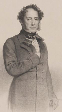
His son John Tollemache built Peckforton. Tollemache served as High Sheriff of Cheshire for 1840 and was then elected to the House of Commons as MP for Cheshire South from 1841 to 1868, and Cheshire West from 1868 to 1872. He believed in a self-reliant labouring class and made popular the idea of his tenants having a cottage with sufficient land to keep a few animals. His catch-phrase for this was "three acres and a cow", although the saying has been attributed to others. He built around fifty-five farmhouses at a cost £148,000 and spent a similar amount on cottages. Portrayed by his son as an eccentric despot, Tollemache’s widely admired benevolent paternalism was evidently coloured by a highly authoritarian regime at home, where he is said to have fathered at least 25 children. His many foibles included the burning of clothes left lying around his hallways and the wearing of a wig, despite having a full head of hair.
Tollemache is often associated with slavery: he had received £12,667 as compensation for the freedom of 822 slaves on Antigua in 1839. Part of this funded Peckforton but much went to the holders of a debt secured on the estate. His father, Vice Admiral John Richard Delap Tollemache, had himself built Tilstone Lodge, around 1832. The Vice Admiral had taken his mother’s name, and the family represented the union between slave wealth from the Delap Halliday family of Antigua and the landed English wealth of the Tollemaches.
John Tollemache passed away in 1890 at the ripe old age of 85. Only 12 of his sons survived him. He was succeeded by Wilbraham Tollemache. He was elected to the House of Commons for Cheshire West in 1868 (succeeding his father), a constituency he represented until 1885. In 1890 he succeeded his father as second Baron Tollemache and took his seat in the House of Lords. The last member of the Tollemache family to live in the castle was Lord Bentley; who left Peckforton in 1939 and took up residence in Eastbourne. During World War II, in Lord Bentley’s absence the Castle provided care and a safe home to disabled evacuee children. Over the years, Lord Bentley was the author of several books on croquet and on contract bridge.
The Storm
By Stone House Lane stands the ancient Peckforton Oak on its grassy knoll. Known locally as the ‘Big Oak’, this huge tree was already old when John Wesley, the founder of Methodism, preached beneath its branches in October 1749. The tree later survived the freak "Peckforton Cyclone", a tornado which occurred on the evening of 27th October 1913. According to a contemporary eyewitness, "a dark column of spinning air approached from the south, accompanied by thunder, lightning and torrential rain". During "four violent hours", Castlegate Farm, below Beeston Castle, lost its roof, hundreds of mature trees were uprooted, several cattle were hurled over a hedge: three of the cattle were killed, and a local man was hurled sixty metres into his neighbour’s orchard. As reported at the time:
- "The storm in Cheshire destroyed Lord Tollemache's extensive greenhouses at Peckforton Castle, while on the hill opposite hundreds of trees were uprooted. “According to most accounts the storm lasted two or three minutes only.”
In fact, the "storm" lasted for at least five hours, but moved quickly and spent only a few minutes at each place. The storm responsible was first noted in South Devon at 1600 on Monday 27 October 1913 and it tracked more or less NNE, as far north as Cheshire where it passed Runcorn at approximately 2100, heading into Lancashire. Six people were killed in South Wales. The storm tracked along its course leaving scores injured and much property damaged. The windspeed was not recorded, as no weather stations in the affected area seem to have had an anemometer and estimates of its strength are thus based on damage done. Changes in air pressure, however, were recorded in several places. They revealed a sudden fall followed by a return to the previous pressure after an interval of fifteen to thirty minutes. The Albion Steam Coal Colliery, at Cilfynydd, was situated within a few metres of the western edge of the tornado track and a drop in pressure from 29.20 to 28.91 inches (988.8 to 979.0 millibars), was recorded. It was followed by an almost immediate rise.
Mr. H. Billet of the Meteorological Office, at the request of the M.P. for East Glamorganshire, Clement Edwards, was sent to the region visited by the storm and spent three days in South Wales collecting information. His report was published in September 1914 as a Geophysical Memoir. The Met office investigators stated:
- "This fall of 0.3 inch, or 1/100 of the normal atmospheric pressure of 15lbs to the square inch, means a sudden change in the atmospheric pressure of 0.15 lb per square inch, or about 20 lbs per square foot. Such a change of pressure, if applied suddenly to the outside of a closed building, must produce an effect similar to an explosion within, and it is thus easy to understand how windows or even whole walls are blown outwards, as at the generating station at Treforest".
Actually, to shatter buildings in this way the peak overpressure might have been as high as 3 psi, with wind speeds possibly over 102mph. The Met Office investigation concluded with these points:
- ". . . a genuine tornado of the type common enough in parts of America . . . The straight track with clean cut lateral limits, the violent electrical phenomena, the heavy rainfall, the roaring noise, the sudden decrease of barometric pressure, resulting in the blowing out of walls of buildings, as if by explosion from within, are all features which are common in descriptions of American tornadoes. The width of the track, three hundred yards and the rate of advance, 36 miles per hour, are of the same magnitude as in American tornadoes".
Peckforton Mere
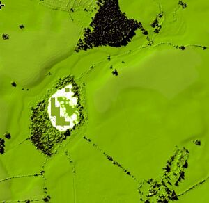
The "fort" at Peckforton Mere used to be much larger during the prehistoric period and the promontory to the east of it which houses the fort would have jutted out into it. The signage at the mere explains that the mere was formed as a "kettle hole" when an iceberg was grounded during some kind of fluvial event in the ice-age.
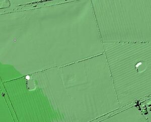
The River Gowy originally flowed out of the mere on the north side and this formed the northern defence of the fort. The present stream course lies further north than the original river and has been diverted by recent drainage operations. The fort has a bank and external ditch cutting off a piece of high ground which used to be a promontory and curving around it on the north and south sides, leaving the west side open to be defended in antiquity by the mere and the old course of the Gowy. The original bank and ditch are only partially visible as upstanding earthworks and can only be made out on the LIDAR with some difficulty, although the shape of the promontory is fairly clear. The fort, thought to be iron age, survives reasonably well in spite of the ploughing which has reduced some of its defences. It is small compared to a very similar site at Oakmere in Cheshire. The enclosed area is enough to support a collection of buildings for a single family settlement rather than a larger farming village.
Beeston
Beeston Crag, on which Beeston Castle is built, is one of a chain of rocky hills stretching across the Cheshire Plain. Like the neighbouring Peckforton Hills it is formed from easterly dipping layers of sandstone of Triassic age, part of a thicker sequence known as the New Red Sandstone. The lower slopes of the hill are formed from sandstones of the Wilmslow Sandstone Formation whilst those above are formed from the Helsby Sandstone Formation which is around 245 million years old. Both sandstones were quarried at multiple sites within the castle grounds but these workings are long abandoned. The hill is capped by a small outcrop of sandstones assigned to the Tarporley Siltstone Formation (and formerly known as the Keuper Waterstones).
Along the eastern margin of the hill is the Peckforton Fault, a major north-south aligned geological fault which downthrows the strata to the east by about 200m. A low ridge of glacial moraine extends east from the castle lodge and is interpreted as marking an ice front during the retreat (or stagnation in situ) of the Irish Sea ice sheet which had invaded Cheshire from the northwest during the last ice age. To avoid this moraine the Gowy takes a detour to the east.
Pits dating from the 4th millennium BC indicate the site of Beeston Castle was inhabited or used as a communal gathering place during the Neolithic period. Archaeologists have discovered Neolithic flint arrow heads on the crag, as well as the remains of a Bronze Age community, and of an Iron Age hill fort. The rampart associated with the Bronze Age activity on the crag has been dated to around 1270–830 BC; seven circular buildings were identified as being either late Bronze Age or early Iron Age in origin. It may have been a specialist metalworking site.

There are many legends surrounding Beeston Castle. Local legend holds that Richard II hid his extensive Royal Treasure hereabouts before sailing to Ireland to quell an uprising in 1399. Richard never reclaimed his treasure as he was captured, upon his return, at Flint by Henry Bollingbrooke (Duke of Lancaster, and later Henry IV) and imprisoned at Chester Castle for a while in 1399. Many attempts have been made to find the "treasure" over the years and none of them have been successful. Stories have suggested that there are "secret" passageways leading from the well to a nearby farmhouse, a possible escape or re-supply route if the castle was under siege. Local legends place the treasure at the foot of the castle well (said to be around 365 feet deep - an impressive feat of mediaeval engineering) or in passages running off the well. Other tales tell of "demons" guarding the treasure in the well, the sight of which would instantly drive the beholder mad or strike them dumb. However the well has been explored by camera and neither demons nor treasure were encountered.
The river's redirection
The course of the Gowy can be traced on the 1908 OS map and also on a map from 1829--31. What is very clear from a comparison of the two maps is that the the course of the Gowy appears to have been modified such that it now flows through the hamlet of Beeston. The tithe map seems to suggest that this redirection was done before 1846.
Haycroft is a deserted medieval village in the civil parish of Spurstow, located at SJ5553157178, immediately east of Haycroft farm. They were discovered by aerial photography. The remains appear to be concentrated to the north east and south west of a former watercourse which ran down a shallow valley to the north west of the present village of Spurstow, flowing into the original course of the Gowy and thence to Bunbury. These remains were probably part of the village of Spurstow which has shrunk or slightly relocated in the post-medieval period. The earthworks include the platforms, 25–40 metres2 in area, for about six houses with adjoining enclosures. A raised feature, bisecting the site and running north-south across the settlement is a causeway which has been built up in more recent times to provide dry access. It follows the line of a former field boundary. Each house platform is between 25 metres and 40 metres square with a ditch 2 metres wide to define it. Each of these platforms would have been occupied by one or more medieval buildings. The settlement may have fronted the present lane running south east from the farm. This was a former route from Ridley Green to Beeston Moss and Beeston Castle. There are traces of medieval ridge and furrow in the northern part of the site and these run up to but not into the area of house platforms. The ridge and furrow is interpreted as the remains of the field system associated with the medieval village. The site is a scheduled monument.
The village of Spurstow is mentioned in the Domesday survey. The area was historically important in salt extraction, with an 18th-century brine spa known as Spurstow White Water or Spurstow Spa, which is rich in magnesium sulphate (Epsom salts). This was credited with health-giving effects. The spa still existed in the mid-19th century and can still be found today. Bath House is a half-timbered house in Lower Spurstow, dating from the late 16th century, which might have housed visitors to the nearby spring. The eventual destination of the water flowing from the spring is the River Weaver.
The "real" Image House
The Image House is at the corner of the A49 and Betty's lane. This features in "The Shiny Night" by Beatrice Tunstall. The story, supposedly based on "one of the very few real events of witchcraft in Cheshire", is about a young poacher named Seth Shone who in some versions kills a gamekeeper, is transported to Botany Bay for eight years (or in some versions seven years), returns to "Clock Abbot", as Bunbury is called in the book, and sets about getting his revenge on his enemies. These enemies are some combination of the local squire, his gamekeeper, several of his men or the local constable depending on the version. He makes images of them, names them and curses them violently, and places these "Voodoo dolls" on the walls of his house for all to see. The house still has a porch supported on carved oak posts with sandstone heads as caps and stone carved male figures, wearing hats, which flank the first floor windows. Beatrice Tunstall, author of The Shiny Night (1931), The Long Day Closes (1934) and The Dark Lady (1939) had her home on the walls of Chester near the Northgate.
The present cottage, is dated early C19, of red brick in Flemish Bond with a slate roof, on two storeys, with 2 bays, and lean-to additions to south gable and a rear (west) sandstone plinth. The boarded door in the front porch is supported on carved oak posts with sandstone heads as caps. There are stone carved male figures, wearing hats, which flank the first floor windows. The 1839 Tithe maps have a different layout of buildings on the site (with a single building) and have the land owned by John Tollemanch and a cottage in the tennancy of Robert Vickers.
There are a few problems with the legend as recorded. "Botany Bay" was intended as a penal colony in 1788, but the site offered neither a secure anchorage nor a reliable source of freshwater. Sydney Cove offered both of these, being serviced by a freshwater creek and so that was settled instead: in fact the actual book has him in Van Diemen's Land (Tasmania) and returning before 1837. A part of the legend is that Shone was able to build the house in a day and have a fire lit in the hearth. "Tŷ unnos" (pl.: tai unnos; English: one night house, also hafodunnos) is an old Welsh tradition that has parallels in other folk traditions in other areas of the British Isles. It was believed by some that if a person could build a house on common land in one night, the land then belonged to them as a freehold. There are other variations on this tradition, for example that the test was to have a fire burning in the hearth by the following morning and the squatter could then extend the land around by the distance they could throw an axe from the four corners of the house. There are several problems with this aspect of the tale: Tŷ unnos has no status in English common law and a two-storey brick house cannot be built in a day (even with "the help of friends") as the mortar in the lower walls would not set quickly enough.
Seth's curse apparently backfires on him with the 1865-66 "Rinderpest" epidemic. This did affect the area seriously, placing the county of Cheshire in debt for thiry years, although landlord Tollemanch apparently did a good deal to help out those affected.
Bunbury
- "BUNBURY, a township, a parish, and a subdistrict in the district of Nantwich, Cheshire. The township lies on the Chester canal and the Chester and Crewe railway, near the Calveley station, 3½ miles SSE of Tarporley; and it has a post office‡ of the name of Higher Bunbury, under Tarporley, and fairs on 11 and 12 Feb., and 30 and 31 July. Acres, 1,140. Real property, £4,229. Pop., 990. Houses, 209. The parish contains also the townships of Tiverton, Tilstone-Fearnall, Beeston, Alpraham, Calveley, Wardle, Haughton, Spurstow, Ridley, Peckforton, and Burwardsley. Acres, 16,830. Real property, £28,879. Pop., 4,727. Houses, 927. The manor belonged to Hugh Lupus; and passed to the Bunburys. A college for a master and six chaplains was founded here, in 1386, by Sir Hugh de Calveley; and was purchased from the Crown, in the time of Elizabeth, by Thomas Aldersey of London, who gave the income for charitable uses. The living is a vicarage, united with the p. curacies of Peckforton and Calveley, in the diocese of Chester. Value, £117.* Patrons, the Haberdashers' Company. The church is later English; has a side chapel and a pinnacled tower; was injured by the royalists in 1643; underwent complete restoration in 1865; and contains monuments of Calveley, the Cheshire hero of the 14th century, and Beeston, the commander against the Spanish armada. The p. curacies of Tilstone and Burwardsley are separate benefices. There are seven dissenting chapels, two national schools, and charities £46.-The subdistrict contains three parishes and part of another. Pop., 7,959." - John Marius Wilson's Imperial Gazetteer of England and Wales (1870-72)
Archaeology suggests almost continuous occupation of the site since very early times. Bunbury was reputedly derived from Buna-burh, meaning the "redoubt of Buna". Just prior to 1066 it was held by a certain Dedol of Tiverton. It was listed as Boleberie in the Domesday Survey of 1086 and the lord of the fief was Robert FitzHugh. A Norman family later acquired the surname of De Boneberi, during and after the reign of King Stephen. They were allegedly a cadet line of the Norman family of De St Pierre, associated with Hugh of Avranches, Earl of Chester. Much later, in the era of the English Civil War and on the date of 23 December 1642 some of the prominent gentlemen of Cheshire met in Bunbury and drew up the Bunbury Agreement (see below). The terms of the agreement were intended to keep Cheshire neutral during the English Civil War. It proved to be a forlorn hope because the national strategic importance of Cheshire and the city port of Chester meant that national interests overruled local ones.
Bunbury was a victim of the Blitz during World War II. German aircraft returning from a night raid on Liverpool in 1940 jettisoned surplus bombs over the village, obliterating Church Row (the houses have since been rebuilt). The blast caused minor damage to the exterior of St Boniface's Church and the immediate area. The original village centre surrounding the church was hit, damaging shops beyond repair. This has largely caused the current centre to evolve in the geographical heart of the village. Bunbury was used as the location for Home Fires (known in the series as Great Paxford), a television drama.
There have been many descriptions of Bunbury Church written over the years. One of the earlier being that of Rylands and Beazley. Other are referenced on the Church Website. Rylands notes one tomb which has an interesting link to Chester. It bears the inscription:
- "George Lowe into rest November 24, 1876 | aged 83 years entered [a textfollows]. On the other side, in gothic letters: Beneath rest the mortal remains of | George Cliff Lowe | born October 5th-1821 and died at Newhaven, U.S.A., August 17th-1872. |"
The Lowe family of Chester were noted goldsmiths with a shop in Bridge Street (it is still there in 2020 and contains a small family museum). They were also at times Clockmakers and Rylands notes that George (1793- 1876) was a goldsmith at Gloucester, and subsequently went to live at Bunbury; he repaired the Ridley Chapel, and, in 1873, gave a new clock to the church in memory of his son George Cliff Lowe. A later member of the Lowe family was to decide to run away to sea rather than join the family business: he was Harold Lowe (21 November 1882 – 12 May 1944) the fifth officer of the RMS Titanic.
Hugh Calveley
Sir Hugh Calveley - whose tomb (one of the best of its time) is here although he may not be, was born the youngest son of David de Calveley of Lea, and his wife, Joanna. The family held the manor of Calveley in Bunbury. Estimates of the year of his birth range from 1315 to 1333. It is possible that he was a close relative, maybe even a half-brother, of Sir Robert Knollys. Along with many other Englishmen, the young Hugh Calveley served in Brittany, supporting Jean de Montfort's English-backed bid to become Duke of Brittany against the French-backed claimant, Charles de Blois, during the Breton War of Succession. An anonymous Breton poet's account of the Combat of the Thirty in 1351 has "Hue de Caverle" as a knight fighting on the English side (where he was defeated, captured, to be ransomed later). One estimate of the date of his knighthood is 1346, though documents from 1354 do not refer to him as a knight, and there is some evidence that he was only knighted later, in 1361. In 1359 Sir Robert Knollys and Calveley invaded the Rhône Valley. The city of Le Puy fell to them in July. The campaign ended when their way to Avignon was barred by the army of Thomas de la Marche, Deputy for Louis II, Duke of Bourbon, at which point both English commanders retreated. At the Battle of Auray on 29 September 1364, Calveley had the command of the reserve division of the forces of Jean de Montfort, under the command of Sir John Chandos. Charles de Blois was killed at Auray, enabling Jean de Montfort to claim the Duchy without further conflict.
After the conclusion of the Breton civil war, Calveley, along with many other soldiers, found himself unemployed. These soldiers, banding together in the "Free Companies" (i.e. mercenaries), continued to support themselves by raiding widely, causing a huge problem for the Kingdom of France. The solution to the problem was found when Aragon, France and the Papacy agreed to provide money to pay for the Free Companies to wage a campaign to support Count Enrique of Trastamara's bid for the throne of Castile, which at the time was held by Enrique's half-brother, Pedro of Castile. Calveley signed up as the most prominent of the English captains on this campaign, in which he was involved from 1365 to 1367. When hostilities resumed between England and France in 1369, Calveley was once again involved, first in raiding the possessions of Gascon nobles who had defected to the French. He took part in at least three further campaigns in the period to 1374; notably, he was one of the joint commanders of the English army disastrously defeated by Bertrand du Guesclin at the Battle of Pontvallain, 4 December 1370, though he managed to escape. From 1375 to 1378, Calveley was governor of Calais, an important port. Thereafter, he became one of the two Admirals of the English fleet, taking part in several sea battles. In July 1379, he was involved in a raid on Brittany led by Sir John Arundel, Marshal of England. On their return voyage, 20 ships and about 1000 men were lost at sea in a storm. Calveley was one of only 8 survivors.
There is no clear evidence for or against Calveley being buried at Bunbury, and the tomb may be merely a cenotaph erected by his campaign companion (and probably close relative), Sir Robert Knollys. There is a memorial board on the north wall of the chancel to Dame Mary Calveley (d. 1705) with an inscription wrich referes to money being left to "sweep and make clean" the monument under which she and her husband are interred. In an attempt to clarify this uncertainty the tomb was opened on 25 April 1848, and according to Jno.Fenna, Churchwarden:
- "I found the fragments of an oak coffin, apparently of uncommon size, almost crumbled to dust; the handles of the sides being iron were nearly entire. By the side of his coffin lay a lead coffin quite fresh, with the initials D.M.C. which I suppose to be that of Dame Mary Calveley. I measured some of the bones, which I have no doubt were Sir Hugh's, from their extraordinary size, . . the thigh-bone, was two inches or more larger than the average size of men. He is supposed to have measured seven feet six inches in height when he lived. There is a mark on the wall in Bunbury Church [probably lost in the 1865 restoration] which old people say was the memorandum of his height."
Despite the above statement, later historians (after Bridge, 1908) consider the bones
- “were quite clearly those of Dame Mary Calveley (ob.1705) and her husband, another Sir Hugh Calveley (ob.1648).”
This later Mary Calveley built Bridge House in Lower Bridge Street, Chester after the death of her husband left her a young and very wealthy widow.
George Beeston - Elizabethan Sea-Captain
The manor of Beeston, but not the castle, was owned by the de Bunburys, who later took the name Beeston. Sir George Beeston (1500-1801, who has a memorial in St Boniface's Church, Bunbury) was, again acccording to local legend, commander (at the age of 89 if Ormerod is to be believd) of the Dreadnought at the time of the Spanish Armada in 1588. In fact, Sir George Beeston was only born in 1520, although he did command the Dreadnought. In February 1588, at Queenborough, he commanded the four ‘great ships’ that were to sail with Charles Howard, 2nd Lord Howard of Effingham, and after the Armada battle he was knighted by Howard on board the Ark Royal. The latin inscription on his tomb may be translated as:
- "Here lies buried George Beeston, knight, a promoter of valour and truth; having been brought up from his youth in the arts of war he was chosen one of his company of pensioners by the invincible King Henry the Eighth, when he besieged Boulogne [1544]; he merited [the same] under Edward the Sixth in the battle against the Scots at Musselburgh [1547]. Afterwards under the same King, under Mary, and under Elizabeth, in the naval engagements as captain or vice-captain of the fleet, by whom, after that most mighty Spanish fleet of 1588, had been vanquished, he was honoured with the order of knighthood; and now, his years pressing heavily on him, when he had admirably approved his integrity to princes, and his bravery to his adversaries, acceptable to God, and dear to good men, and long expecting Christ, in the year 1601 and in the ... of his age, he fell asleep in Him, so that he may rise again in Him with joy. And together with him rests a most beloved wife, Alice, daughter of [Thomas] Davenport of Henbury, esquire, a matron most holy, chaste, and liberal to the poor, who, when she had lived in matrimony 66 years, and had borne to her husband three sons, John, Hugh, and Hugh, and as many daughters, Ann, Jane, and Dorothy, passed into the heavenly country in the year 1591 and in the [refer below] year of her age, with Christ for ever to live. The dutifulness of their son Hugh Beeston, esquire, the younger, Receiver General of all the revenues of the Crown as well as in the county palatine of Chester as in the counties of North Wales, set up this monument to parents most excellent and beloved."
Bunbury Mill
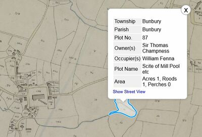
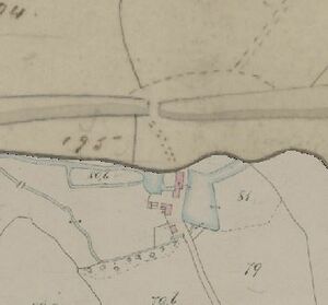
The mill has quite an interesting history, because it is said that there has been a corn mill on the site as far back as 1290. Bunbury is the only mill on the Gowy which is an overshot mill, as it it the only place where the gradient is steep enough. The other mills are less powerful undershot mills. The present building dates from about 1844, when an earlier mill was apparently destroyed by fire. Curiously, the 1839 Tithe map does not indicate the clear presence of an active mill but refers to the "site of the mill pool" and has the mill buildings marked as a house and garden owned by Sir Thomas Champness and occupied by a William Fenna. A William Fenna was churchwarden at Bunbury in 1718 (he is associated with the provision of the church candelabra) and the Fenna's seem to have been a moderately prosperous local family. The 1908 OS map gets the direction of the Gowy completely confused with the river flowing out of the mill pond in both directions.
The mill was initially used to produce flour and animal feed. Bad flooding occurred in 1960, when there was a violent storm, which amongst other things, uprooted trees close to the mill and blocked the weir gate. The miller, Tom Parker, whose name still appears on the outside of the building, was unable to free the tree, and the build-up of water eventually burst the millpond wall, flooding the mill and wrecking the machinery. This forced the mill to close, as renovations would have been far too costly, and the products were no longer in high demand.
Nantwich Rural District Council bought the site to use it for water treatment. It was supposed to be destroyed 6 years later, but the locals gathered to protest, as they wanted the mill to be repaired, not only for reasons of heritage, but also to create more jobs in the area. By 1977, Bunbury Mill was back up and running. But this time it was owned by North West Water Authority, part of United Utilities, which is the organization that first turned it into a museum and education centre. The mill closed once again in 2010, but volunteers were kind enough to keep an eye on the machinery, and make sure everything was in working order. The Bunbury Watermill Trust was then established, and in April 2012 the mill was given to the Trust, reopening it to visitors. The group Friends of Bunbury Mill has been established to support the work of the trustees. Tours of the working mill are available. The site includes the mill pond, a wildlife pool and 2 acres of grounds. Facilities include a picnic area and a visitor centre with a café and public toilets. There are many other listed buildings in Bunbury.
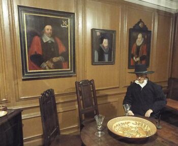
Bunbury School
The school was built in 1874 and designed by the Chester architect John Douglas. It was built as a grammar school to replace a school nearer to Bunbury Church, which had been founded in 1594 by Thomas Aldersey. It later became a primary school. Aldersey was born in Bunbury. His father, John Aldersey (c. 1494–1554) of Aldersey Hall, was a landowner from Spurstow. His mother, Anne (or Agnes), was the daughter of Thomas Bird of Clutton or Colton. Several members of the Aldersey family were prominent in 16th-century Chester. Thomas Aldersey was the second of several sons of the marriage. He was educated in Bunbury, possibly at the Chantry House. Aldersey was apprenticed to the London merchant Thomas Bingham in 1541, becoming a liveried member of the Worshipful Company of Haberdashers on 13 July 1548. Exposure to Protestant Reformist speakers in London, including Christopher Goodman and Jan Łaski, led him to become a Protestant. Mary I's accession in 1553 made his religious and political convictions dangerous, and in 1555 he was charged over his attention to Goodman's writings. His efforts, which continued throughout his life, to aid the Protestant exiles who left England for Emden in Germany in establishing trading relationships gained him the support of William Cecil and other prominent Protestants. Christopher Goodman would eventually return to Chester and was instrumental in getting the Chester Mystery Plays banned.
Aldersey founded a grammar school at Bunbury in 1575, which was incorporated on 2 January 1594 as "The Free Grammar School of Thomas Aldersey in Bunbury" – now Bunbury Aldersey School. He gave the school, together with substantial endowments, over to the Company of Haberdashers on 21 October 1594. It was the first school that the Company – now predominantly an educational charity – administered. At the same time, he established a preacher and curate in Bunbury, and gave the tithes and advowson (patronage) of the parish church to the Haberdashers' Company; this was the first ecclesiastical living to come under the Company's control. Dorothy Williams Whitney has suggested that this gift was associated with the later Puritanism of the Company of Haberdashers, and Bunbury became an early centre for Cheshire nonconformism amongst clerics (the village itself was quite strongly catholic - in 1590, 23 residents of Bunbury were Catholic recusants, a figure rising to 37 in 1593 but dwindling to approximately six by 1789). It would be William Hinde of Bunbury that would write the life of John Bruen the Tarvin iconoclast. Hinde was a leader of the Puritans in Cheshire, and clashed with Thomas Morton as bishop of Chester. Hinde died at Bunbury in June 1629, and was buried there.
Edward Burghall
Perhaps one of the most interesting facts about Beeston relates to the diary of Edward Burghall, then the Puritan schoolmaster of Bunbury who supposedly records the fate of the unfortunate Captain Steel of Beeston Castle in 1643/4 which had always been taken as a primary source. Already Before the civil war Burghall was schoolmaster at Bunbury, and was probably appointed to the post about 1632. The parish school at Bunbury, of which Burghall was master, was founded in 1594, and was endowed with "£20 per annum, one house and some land". The vicar of Bunbury till the year 1629 was William Hinde, a celebrated puritan and biographer of John Bruen. In 1643, during the siege of Nantwich, Burghall says that his goods were seized and himself driven from his home by Colonel Marrow; he thereupon went to Haslington in Cheshire, "where he had a call", and tarried there from 1 May 1644 until 1646. In the latter year he became vicar of Acton, taking the place of Hunt, who was sequestered. After the Restoration, when the Act of Uniformity 1662 was passed, Burghall was one of the victims of the Great Ejection. After preaching farewell sermons at his churches of Wrenbury and Acton, he was on 3 October 1662 suspended from the vicarage of Acton. Before the civil war the entries only record what the author regarded as the special interventions of Providence in the neighbourhood of Bunbury. In the year 1641 Burghall first notices political events, and afterwards gives a very detailed account of the military operations in Cheshire.
However when James Hall was preparing his "History of Nantwich" he discovered that parts of the supposed "diary" are a virtual copy of the diary of Thomas Malbon of Nantwich (actually written in 1651) and Edward Burghall (who died in poverty in 1665) is essentially a forger as regards at least some parts of his supposed diary. See Hall's Memorials of the Civil War for a comparison between the two works. Edward Burghall's memorial is Bunbury's St. Boniface Church (built 1386), whereupon he is decribed as a "Paineful Schoole Mr".
As noted above, it has been suggested that the stone elephant at Peckforton had something to do with the Haberdasher's Company, whose arms contained an elephant and castle, but no firm link has been established.
There are typical country ghost legends: a phantom dog (shuck) has been supposedly been spotted in an area near the school and a ghostly man on horseback is said to cross various lanes before vanishing. There are no details to these legends.
The Bunbury Agreement
At the start of the First English Civil War, after a summer of skirmishes in Cheshire, the sometime pirate Henry Mainwaring and Mr. Marbury of Marbury Hall (for Parliament) and Lord Kilmorey and Sir Orlando Bridgeman, son of the Bishop of Chester (for the Royalists) agreed to meet on December 23rd 1642 at Bunbury. It must have been clear to all that families were deeply divided on both sides of the conflict and that Cheshire would be devastated by full-scale war.
In the so-called "Bunbury Agreement", they agreed that all fighting in Cheshire would end. All prisoners would be released, property taken during the conflict returned to its owners and any losses compensated by a levy on both sides. Fortifications were to be removed at Chester, Nantwich, Stockport, Knutsford and Northwich and their combined forces would escort any external forces out of the county. Both parties agreed that there were to be no further troop movements through Cheshire, and that they would not to raise any more troops locally. Everything depending on the agreement of their national commanders, whom they would urge to settle their differences peacefully.

Given the national strategic importance of Cheshire, it proved impossible for the local gentry to agree a local neutrality pact that their national commanders would agree to. Geographically Cheshire lies between the Pennines and the north Welsh foothills and so whoever controlled Cheshire controlled the western route to north west England and Scotland as well as an important route into north Wales. For Parliament the control of Cheshire would mean separating the King's northern supporters from the King and his army at Oxford. It could also stop the King bringing in reinforcements from his Irish army through the port of Chester. During the summer the King's supporters had not been idle and Chester's defences had been strengthened with the Commissioners of Array arranging to man the defences. In addition the city's corporation raised an additional 300 men to assist them, that were paid for by a monthly assessment (local tax) on all inhabitants. These preparations continued in December when the corporation raised more money through another assessment for additional weapons and fortifications.
Unfortunately this Bunbury Agreement was never to be ratified.
Tilstone
- "TILSTON-FERNALL, a township in that part of the parish of BUNBURY which is in the first division of the hundred of EDDISBURY, county palatine of CHESTER, 2¾ miles (S. S. E.) from Tarporley, containing 166 inhabitants.": Samuel Lewis - A Topographical Dictionary of England (1831)
Even just before the start of of the Industrial Revolution, improvements to the river Weaver after 1730 served to channel trade from central Cheshire away from Chester to the Mersey, and the Trent and Mersey Canal Act of 1766 threatened to strengthen still further the dominance of Liverpool over the Dee. Despite that threat, no apparent opposition to the Trent and Mersey Bill was voiced in Chester, but within two years of its passage there was a proposal for a canal to link Chester to the new canal at Middlewich and surveys were commissioned from, among others, the canal engineer James Brindley. The original plan for the Chester Canal was for a canal linking the south Cheshire town of Middlewich on the Trent and Mersey Canal with the River Dee at Chester, with a branch to Nantwich, providing a route for produce (including salt) from Nantwich to reach Chester and, beyond it, the sea via the Dee Navigation of 1737. The relevant section of the Trent and Mersey would be open in 1771, although the final (tunnel) section to the Potteries was not completed until 1777. However there were difficulties with the Trent and Mersey Canal Company, and its owner the Duke of Bridgewater, who were jealous of their own lucrative traffic and put up a prolonged and robust opposition to any link with the proposed Chester Canal.
The limited plan authorised 1772 permitted the building of a canal 14 feet wide from Chester to Nantwich and Middlewich. This had immediate effects on Chester: Queen Street having been constructed fairly rapidly around 1777, with much development by two individuals in particular: John Chamberlaine (who was much involved with the canal) and Roger Rogerson. The development of the street was obviously also connected with the development of the Chester-Nantwich canal. From the 1770s city development was especially concentrated north of Foregate Street, beginning with Queen Street and expanding later to include Bold Square and Seller and Egerton Streets before 1820. The overall canal project was seriously undermined, however, by a requirement that the new canal should end at least 100 yards away from the Trent and Mersey Canal at Middlewich, requiring overland portage rather than allowing for a functional junction. As a result, the Middlewich branch of the Chester Canal was not begun, and the branch to Nantwich became the course of the final section of the Chester Canal.
By late 1777, the canal company had spent all of the share capital of £42,000 and another £19,000, which had been raised as a loan guaranteed by Samuel Egerton of Tatton. He was a shareholder in the company and related to the Duke of Bridgewater. They applied for another Act of Parliament, which allowed them to raise another £25,000, by additional calls on existing shareholders, and to borrow £30,000 as a mortgage. They succeeded in raising £6,000 by making additional calls, and borrowed £4,000 from Richard Reynolds, an ironmaster from Ketley, who was responsible for several of the East Shropshire Canals, including the Wombridge Canal and the Ketley Canal. Shareholders who could not provide funds on the additional calls found themselves deprived of their existing shares. When the canal between Chester and Nantwich opened in 1779, it was a dead end and attracted little traffic other than a moderately successful and fast passenger trade, leading to financial disaster for its backers who at one stage saw the share price in the canal company fall to 1% of the initial value. John Aikin wrote:
- "For want of money the branch to Middlewich was never cut; and thus the principal objects of the undertaking, the carriage of salt from that place to Chester, and the communication (though not the absolute junction) with the Grand Trunk being never effected, the sceme has proved more totally abortive than any other in the kingdom."
No dividends were paid during the canal company between 1772 and 1813. By the end of 1781, the company had no money and was unable to meet interest payments on the loans. They decided to forfeit the canal to Egerton, the main mortgagee, but he did not respond to their offer. Part of the canal was even abandonned in 1787, when Beeston staircase locks collapsed, and there was no money to fund repairs. By the end of the 18th Century, the Chester Canal was facing ruin, but was saved by a link with the Ellesmere Canal Company, which had been set up in the 1790s to link Ellesmere in Shropshire, and the quarries and other industries of North Wales, to the Mersey at Netherpool/Whitby, now known as Ellesmere Port. In Chester, the company built the section of canal known as the Wirral Line,which runs north to Ellesmere Port and which was completed in 1795.Historically, this was of great significance and represented a major upturn in the fortunes of the owners of the Chester Canal Company, which would probably not otherwise have survived. A further link between the Chester and Ellesmere Canals at Hurleston also meant that any problems over water supply were solved by the flow of water brought down from the Welsh Hills. By 1813, the partnership had been so successful that the two companies merged to create the Ellesmere and Chester Canal Company. In 1846, the Shropshire Union Railways & Canal Company (SURCCo) represented an amalgamation of a number of earlier canal ventures. The oldest of these was the Chester Canal, and it was only through mutually beneficial links with the Ellesmere Canal and then the Birmingham & Liverpool Junction Canal in the early 19th Century that commercial success was achieved and the SURCCo was formed, with a Head Office based in Chester in the buildings next to what is now Telford’s Warehouse. With an annual turnover from carrying of nearly £200,000, the company appeared to be performing quite well and showed a profit in most years, but this was an illusion, since it was dependent on subsidies from both the parent company LNWR and, during the Great War, from the government. The withdrawal of these subsidies in 1920/21, combined with an attempt to restrict the boatmen’s working day to "only" 8 hours plunged the company into massive losses and the decision was taken, quite abruptly, to withdraw from carrying alltogether and sell off the fleet.
A Mill for every Lock?
For the next few miles the Gowy and the Chester Canal run alongside each other. The construction of the canal provided a small head of water at each of the locks, but the mills did not make use of the by-washes. Co-incidently, many of the locks have at some time had mills associated with them even if there is often little to see on the ground today. It is possible to speculate as to why the locks and the mills are associated, although it may be co-incidence. The mills whould have been placed a distance apart to allow a head of water to build up, and were possibly located where the change in gradient also favoured a lock. The mills might have been located by bridges, which would facilitate the building of locks. If corn was not grown locally then distribution of corn by canal would influence the position of mills.
Tilstone Bank
At Tilstone Bank the Gowy meets up with the Chester Canal and the railway, which both make use of the River Gowy valley to cross through what is effectively a gap in the sandstone ridge of central Cheshire. This is the gap which Beeston Castle defends.
The landscape character type is unique within Cheshire West and Chester borough, defined by its complex rolling landform that falls steeply down to the River Gowy and the Shropshire Union Canal which pass east-west through the middle of the area. Sandstone outcrops in a series of escarpments and dip slopes create a distinctive locally hilly landscape occupying the gap between the Sandstone Ridge to the north and south. The topographic variations identify this as a separate character type from the surrounding more gently undulating farmland to the north and east,and the much flatter fields of the Cheshire plain to the south and west.
The settlement of Tilstone was an important crossing point of the River Gowy and Chester Canal. Tilstone Lodge dates from 1832 and was commissioned by Admiral Tollemache who retained the architect Thomas Harrison to design it. It is designed in the Georgian style and constructed of brick which is part rendered and has colour washed elevations under a slate roof incorporating a three-bay front flanked by a wing which is set back. After the Tollemache family moved across the Gowy to their new castle the property was bought by the Corbetts.
Murder
In 1857, the Tilstone Lodge gamekeeper John Bebbington, rose from his bed early one morning to make his rounds of the woods and pheasant preserves: he was found lying dead in a ditch, with his loaded gun beside him. In an adjacent field the police discovered two sets of footprints – one belonging to the gamekeeper and the other set they traced to John Blagg, 47, a shoemaker and poacher. At Blagg’s home they found a gun and cartridges supposedly matching the one that shot Bebbington. They also found the boots that had apparently made the footprints, although this was one of the first cases of such evidence being used and no-doubt much was made of the "shoemakers boots". Blagg had previously threatened the gamekeeper (while drunk) and despite his protestations he was arrested and charged with murder. He was probably held in the village "lock-up" (which still exists) in School Lane, Bunbury.
His counsel argued that all the evidence was circumstantial:
- "The poor man is a victim of hatred because he was a poacher; and as the prosecution could not get hold the real murderer, they pounced on the prisoner because he happened, unfortunately, to be disliked by a Cheshire country gentleman."
After a trial lasting 10 hours Blagg was found guilty and sentenced to be hanged. Petitions to the Home Secretary proved fruitless. Blagg’s wife and children visited him at Chester Castle and to the end he said it was all a parcel of lies. Blagg was hanged at Chester (28 August 1857) with executioner Calcroft having to kick a bolt repeatedly to open the drop while Blagg stood upon it "patiently". There the matter lay until over 30 years later when a Liverpool merchant, James Sawers, from Neston, paid a visit to New Orleans, and there received news of a startling confession made to the Rector of St Paul’s, New Orleans. It concerned the murder of John Bebbington. The story, from Henry Edwin Jones, was that Blagg had been getting ready to attend Chester market on the day before the murder and had loaned him a pair of boots. It was he, Jones, who confessed that he had murdered the gamekeeper. Tollemache appears to be one of the few who believed Blagg innocent: he allowed Blagg's widow to stay in her cottage until her death some forty years later. Coroner Churton (who had been involved in the murder of Charles Moston) revealed that the shot lodged in Bebbington's body (No. 4) was of a different type to that in Blagg's gun. Edward Corbett the "Cheshire country gentleman" died 4th February 1858 at the age of 79. More on these events can be found under Execution at Chester.
Mill
The lower part of the village owes its development to the flour mill which was located here and canal activities. There was once an extensive mill-pond between the railway and the canal. This pond was fed both by the Gowy and by a brook at its eastern end, although earlier maps show that the Gowy had to be divered to arrange for this filling: originally it flowed into the outlet of the mill-pond. The mill stands on sloping ground, with two storeys at the front and three at the back. At the front are three symmetrical bays with a central doorway. The loading bay and hoist at the rear have been retained. It has been converted into a house and the mill-pond drained (although some modern maps still show it). At the time of the 1838 tithe maps the land was owned by John Tollemache and the mill occupied by Samuel Stones.
The circular lengthsman’s huts at Tilstone and Stone Locks, together with another at Tarvin Road Lock, are unique to the Chester Canal. The one at Tilstone Lock has been restored by volunteers working with CRT Heritage staff. Tilstone Lock still has the metal guard rails to protect the side of the lock from rope wear. There are attractive sweeping by-washes at all of the locks on this section.
Beeston Towers
Between Beeston and Bunbury, on a bend of the busy A49, is an impressive black and white building of what at first glance appears the traditional Cheshire style. This was the Wild Boar Hotel, which used to be the Wild Boar restaurant and pub/grill room. In the past it has been known as Beeston Towers and was at various times a private house, a girls' school, a pub and then a hotel. The original part of the building is mock Tudor, built 1886, with extensions added later. The house was built as a residence by John Naylor, born in Grappenhall, Cheshire in 1844. His father was John Naylor, a coal and slate dealer in Warrington and his mother was Ellen Naylor. He was the eldest of four children. His only brother was Robert Naylor who was three years younger. John worked for some years as a merchant and in 1871 he and his brother Robert decided to undertake a walk of about 1300 miles from the top to the bottom of the United Kingdom. They completed the distance in nine weeks. In 1916 some years after his brother’s death John Naylor wrote a book "From John O'Groats to Land's End" detailing the journey. In the introduction Naylor writes:
- "It was a big undertaking, especially as we had resolved not to journey by the shortest route, but to walk from one great object of interest to another, and to see and learn as much as possible of the country we passed through on our way. We were to walk the whole of the distance between the north-eastern extremity of Scotland and the south-western extremity of England, and not to cross a ferry or accept or take a ride in any kind of conveyance whatever. We were also to abstain from all intoxicating drink, not to smoke cigars or tobacco, and to walk so that at the end of the journey we should have maintained an average of twenty-five miles per day"
John Naylor died in 1923 and the house was put on the market. The interior of the house makes it plain that Naylor was a timber merchant and on close inspection it is clear that this is an interpretation of Elizbethan architecture rather than an attempt at accurate reconstruction. Some interior rooms are huge and have such features as coupulae. The Wild Boar hotel closed its doors for the last time in 2017 and construction work began at the site. However in February 2019, a fire ripped through the ground floor of the empty building, putting a halt to all development work. Since then, the building has been extensively vandalised.
Tiverton
- "TIVERTON, a township, with Four-Lane-Ends hamlet, in Bunbury parish, Cheshire; 1½ mile S by W of Tarporley It has a post-office under Tarporley, an inn, and a Baptist chapel. Acres, 1,657. Real property, £3,026. Pop., 704. Houses, 131. The manor belongs to J. Tollemache, Esq." - John Marius Wilson's Imperial Gazetteer of England and Wales (1870-72)
By 1775 the Chester Canal had reached Beeston where problems were encountered. The canal was being cut through loose sand and therefore had to be "puddled" to retain water. Pudddle was a mixture of earth, often loam, gravel, sand and clay, which was hand mixed into a paste. This was used to line the canal in layers which were allowed to partly dry before further layers were added to eventually give a lining thickness of up to a yard. The section was then filled with water. Progress was such that the first load of coal was taken to Beeston in 1775 and a passage service was soon running on the same section. However there were already signs of troubles to come, as funds were running very short. By late 1777, they had spent all of the share capital of £42,000 and another £19,000, which had been raised as a loan guaranteed by Samuel Egerton of Tatton. It was only with considerable struggle that the Canal Company were able to reach Nantwich and the plans for the branch to Middlewich were put on hold. By 1779 the company had no money left. By the end of 1781, the company had no money and was unable to meet interest payments on the loans. They decided to forfeit the canal to Egerton, the main mortgagee, but he did not respond to their offer. In November 1787 the final disaster occurred when the lock at Beeston Brook collapsed due to the sand being washed out. This resulted in the closure of the lock and while some trade continued with goods being carried around the lock the canal had effectively become a dead end at Beeston.
Beeston Brook
There is a Brook Farm (sometimes Mill Farm) here on the Gowy near Beeston Stone Lock and the Tithe Maps again show signs of a mill-pond and buildings, owned by John Earlham and occupied by William Rutter. The OS maps do not show anything, but LIDAR confirms the position of the mill-pond and some of the associated sluices.
Beeston Iron Lock was constructed in 1828 after attempts to repair the original lock had met with repeated problems. Flanged cast iron plates were bolted together to form the walls and floor, providing a novel solution to problems with "running sand" under the original stone locks. It is estimated that the iron lock weighs about 10% of the weight of a conventional stone lock on the canal. It is a grade II* listed structure and a scheduled ancient monument, and is unique in England. When the Ellesmere and Chester Canal Company was formed in 1813, both Beeston Locks were rebuilt. The canal was also realigned by the engineers, Thomas Telford and Thomas Denton. The iron lock was constructed in the same way as the Pontcysyllte Aqueduct, using the riveted flanged iron plate method, used by Telford and William Jessop at Pontcysyllte and often said to be pioneered by Telford at the Longdon-on-Tern Aqueduct. In fact the first navigable iron aqueduct was Benjamin Outram's 44 ft long (13 m) single-span Holmes Aqueduct on the Derby Canal.
Beeston Castle and Tarporley railway station was a railway station serving the villages of Tarporley, Tiverton, and Beeston in Cheshire, England. The station was originally part of the Crewe to Chester line of the Grand Junction Railway. The station opened on 1 October 1840 when it was simply known as Beeston but was renamed Beeston Castle on 1 October 1868, and again Beeston Castle and Tarporley in January 1873. The station was closed on 18 April 1966. Beeston Hall was just to the south of the station Sir George Beeston lived at this ancestral home Little, if any, of the Beeston Hall known to Sir George now survives. It was moated, and was destroyed in the Civil War, being fired on by the soldiers of Prince Rupert. On 19 March 1645 the Prince dined with the lady of the house, and after dinner, told her he was sorry to make so bad a return to her hospitality and advised her to secure her valuables, as he had to order the house to be burned that night to prevent it being garrisoned by the enemy.
There were at least ten fuel tanks, measuring appox 80 ft diameter and 10 ft deep, sunk into the hill overlooking the canal and the Gowy, and presumably served by the adjacent railway. They are said to have been constructed as part of the WW2 PLUTO (PipeLine Under The Ocean) system. Beeston Reclamation Yard is a large yard containing items of architectural salvage for sale, overlooked by a former L&NWR signalbox. One of the buildings, at the base of the "PLUTO Tanks" hill, was evidently a fuel pumping station. Its walls are lined with white tiles, and the wall backing on to the hillside, is pierced by steel pipes. False ruins and tree stumps have been built onto the hill, and there are sometimes farmed deer visible. The PLUTO pipelines led across the English Channel and were linked to pump stations on the English coast, housed in various inconspicuous buildings; including cottages and garages. Though uninhabited, these were intended to cloak the real purpose of the buildings. Pluto Cottage at Dungeness, a pumping station built to look like a small house, is now a bed and breakfast. The original plan was to make the pipes of lead and other materials (steel tape, paper, cable) in layers as this would have made them flexible enough to be wound onto drums. These large cone-ended drums had the code name "conundrum". However it was soon realised that the lead-based design would have required stripping the lead from every church in Britain, and steel tubing was used instead. In England, the PLUTO pipelines were supplied by a 1,600 kilometres (990 mi) network of pipelines to transport fuel from ports including Liverpool and Bristol. The initial performance of the PLUTO pipeline was disappointing. During the period from June to October 1944, it carried on average only 150 imperial barrels per day (25,000 litres per day), just 0.16% of the Allies total consumption during the same period. In Europe, the pipelines were extended as the troops moved forward, and eventually reached as far as the Rhine. The battle of Normandy was won without a drop of fuel being delivered via the Pluto cross-channel pipelines. Only eight per cent of the fuel delivered to the Allied forces in North-West Europe between D-Day and VE Day was via those pipelines; the rest being by tanker, either in bulk or in cans, or by airlift.
Wharton's Lock
Wharton Lock is where the Sandstone Trail crosses the canal and Gowy. The 1846 tithe maps show what appears to be a lost mill building and sluices on the Gowy at Wharton's Lock although this is not shown on the later OS map. The LIDAR imagery available indicates the presence of possible structures to the south of the river where the tithe map shows buildings. Census returns from 1841 and 1851 show that the miller at that time was Hugh Warton, so presumably his family gave their name to the lock (which was constructed in the 1770's by Samuel Weston), despite the slightly different spelling. The hut at Wharton’s Lock is all that remains of the former lock keeper’s cottage, and shows some evidence of the bomb blast which destroyed it in WW2. Wharton lock bridge is said to be haunted but nothing else is known about this local legend.
Horton's Mill
Bate's Corn Mill otherwise known as Horton's Mill on OS maps is at Bate's Mill Bridge, in Bate's Mill Lane and Tithe maps show a Peter Bate as the tenant. Nevertheless it was called Horton's Mill. The old mill was a trout farm for a while and now has its own electrical generator powered by the water-wheel, visible below the road. This is a 14ft breast-shot mill. The 1840 Tithe Maps show the land to be in the ownership of Samuel Cooper (but tennated by Peter Bate). Other than an L-shaped mill building on the south side of the river and a bridge the Tithe Map shows no other buildings on the site, and no pub to the north. OS maps show a later increase in the size of the mill-pond and the development of buildings. It was here (near the "Shady Oak" pub) that some of the last witnesses to seeing Charles Moston alive noted him alive prior to his somewhat mysterious death in 1877. There are a few "Bate Mill's" in Cheshire and it is possible that either there was a family of millers by that name or the term "Bate Mill" might have some other meaning.
Gallery: a bit pf a puzzle
The Bates/Wharton/Horton muddle is best illlustrated with reference to some imagery. These show the two sites in four different formats: a modern map, early OS from about 1900, modern LIDAR (with trees and building removed) and the Title Maps. Research by the Geodetective website suggests that the mills date from the 13th Century.
The Mercians
Relatively little is known abou the social, political and economic developments in the Dee/Gowy area between the ebb of Roman influence in around 400 and the resurgence around 900. In the early part of this period the major powers appear to have been the Kingdom of Powys, possibly with a center at Wroxeter any maybe some residual Romano British influence on the North Wales coast. Events which shed light on these Dark Ages include the events of 600-616 surrounding the Battle of Chester, which indicate the area was home to at least one major ecclesiastical center. The relationship between the Celtic West and more central areas of Anglo-Saxon England (which was later so important to the prosperity of the Dee and Mersey) is very difficult to even outline for the seventh century. The Anglo-saxon settlers who had come to England fought wars between themselves and with the Welsh, with Mercia eventually appearing to be the dominant power in the region after many shifts of fortune. Roman and Celtic christianity vied for position as the "state" religion and a significant religious. Chester may have been an important religious center at an early date, with the establishment of St Johns and it's choice for the re-location of the remains of St Werburgh. Offa possibly pushed the border of Mercia to a more or less stable position along his eponymous dike, but he continued in the time-worn tradition of internal warfare amongst the Mercians.
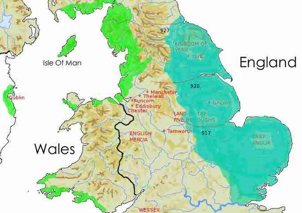
Mercia was to effectively collapse with the invasion of the Danes, initially as a series of plundering expeditions but with an increasing urge to settle. Alfred of Wessex found himself briefly confined to a few square miles of swamp but was able to restore his fortunes by a series of victories. His main advantage over the Danes appears to have been his systematic organisation and devlopment of defended "burghs" - towns which acted as a local strong-point but also supported the trade needed to maintain an effective military force. Some years of uneasy peace with the Danes followed in the late 880's. After another lull, in the autumn of 892 or 893, the Danes attacked again.
At this point Chester reappears in the historic record. An indication of the area's significance as a territorial salient is the near-convergence of the Anglo-Welsh border and the Anglo-Danelaw border, apparently leaving only the Dee, Gowy and Mersey in English hands at the end of the ninth century. The Danes briefly occupied the city, or more probably the Amphitheatre. Alfred himself, or perhaps one of his sons, personally saw them off. Around 900 Alfred's daughter, Æthelflæd, by now the Mecian "queen" extnded the burghal system northwards, repairing and extending the walls of Chester and establishing the cult of Werburgh in the city. The earlier historical interpretation of the burhs as there to simply resist the "Irish" Vikings does not square with the clear impression of the neighbouring Norse-dominated settlements in Wirral as independent and even relatively prosperous. If the Mercians troubled to build the burhs andcreate a network of associated estates in order to resist the Vikings, why did they permit Norse settlement in close proximity?
The border between Mercia and the Norse settlements can be characterised far more as grey than the black/white analogy more appropriate to the Anglo-Welsh frontier. Events conspired to cause the Mercians to renew their interest in the Dee and Mersey at around the same time in the early tenth century as the Irish-Sea Norse arrived. Changes in production and the trading economy, with the consequent reflection in urban and rural archaeology and the artefactual assemblage, were primarily brought about and fostered by the political and economic interests and conflicts of neighbouring regions. The active role taken by the Mercian and West Saxon monarchy in creating the burh and estate infrastructure during the tenth century was the most important development during the period AD 800-1100. The burhs of Chester and Rhuddlan rapidly acquired economic significance as markets and redistribution points for local produce, and a link to external trade. The change of status, from a Mercian periphery to a province of Anglo-Saxon England, completed the line of Anglo-Saxon resistance to Wales demonstrated by the line of burhs; Gloucester, Hereford, Shrewsbury and Chester; stretching from the Severn to the Dee Estuaries. The arrival of the military, naval and administrative apparatus of the West Saxon monarchy on the shores of the Irish Sea coincided with the establishment of Scandinavian settlement in the coastlands of north-west England, the Isle of Man and the eastern seaboard of Ireland. Far from coming into immediate and predictable polarised conflict, the Anglo-Saxon/Norse relationship grew into a complex and often lucrative combination of co-existence, exchange, cultural assimilation and only occasionally violence. The Scandinavian or Norse settlements of the Irish Sea should perhaps not be seen as mass-migrations but the arrival of small, aristocratically dominated groups which established distinct areas of settlement.
Huxley
- "HUXLEY, a village and a township in Waverton parish, Cheshire. The village stands near the Chester canal and the Chester and Crewe railway, 3½ miles WSW of Tarporley; and has a post office under Chester. The township comprises 1, 501 acres. Real property, £2, 441. Pop., 253. Houses, 49. Lower Huxley Hall belonged to the Clive family, and is a fine old moated mansion. Higher Huxley Hall belonged to the Savages, and passed to the Cholmondeley family. There is a New Connexion Methodist chapel." - John Marius Wilson's Imperial Gazetteer of England and Wales (1870-72)
Barnes suggests the name is either an OE pers.n. Huc , or hūc 'a river bend'. At Huxley the R. Gowy turns northward, but the change of direction is not so sudden as to form a remarkable topographical feature. However, the spellings indicate that this p.n. could be from OE husc , hucs , hux (gen.sg. -es , gen.pl. -a ), Middle English hux , "insult, ignominy, scorn, mockery, scoffing, a taunt". Huxley would mean "woodland or glade where ignominy is offered or suffered", alluding either to some social activity here, or to some inhospitable feature of the ground which made a mockery of inhabitation or cultivation.
On some early maps Huxley is one of the places where the Gowy divides in two: the other being further downstream near Picton. Here at Huxley, early maps (such as that in the Blaeu Atlas Maior 1662-5, Volume - "Cestria Comitatvs Palatinvs") show the Gowy branching into a path which follows the course of Golborne Brook and enters the Dee near Aldford. Some modern historians believe that during the Civil War the Battle of Rowton Heath, actually started at the bridge where the Whitchurch-Chester road crosses Golborne Brook. It might be that the impression that there was a substantial stream here dates back to at least the time of the Civil War. However the underlying geology does not suggest a connection with the Gowy, instead the alluvial deposits which indicate the bed of the river curve southward through Tattonhall and Newtown and extend as far as Harthill in the Peckforton hills. Borehole data along this alluvial deposit indicate that there is extensive ground-water which is under sufficient pressure that it will flow to the surface if a well is sunk and in places can overflow at some thousands of gallons an hour. If a spring were to tap this reservoir it would provide a much greater flow in Golborne Brook (making it a significant barrier other than at the bridge). Since the Civil War there has been significant water abstraction from the area so the decrease in flow of Golborne brook possibly mirrors that of the Gowy. This may explain why it was thought that the Gowy split. The issue of the "split" is explored further on the pages Backford and Maps.
2004 saw the discovery of the "Huxley Hoard" - 22 silver objects and some lead fragments dating back to the 10th Century, most likely to the period 900-910. The lead fragments suggest the hoard could have been buried either in a lead sheet or a lead-lined wooden box. The silver objects were bracelets and a silver ingot. All the bracelets in the hoard have been flattened so that they take up less space. The original owner seemed to be trying to reduce the size of the silver as much as possible to fit it in the original container. Bracelets of the type have been found in other hoards in the Northwest of England and North Wales, as well as in Norway. The most famous was the massive hoard of Viking silver discovered on the banks of the River Ribble at Cuerdale, Lancashire in 1840. They are a type believed to have been produced by Norse settlers in Dublin during the late 9th and early 10th centuries AD. Thus the hoard could be interpreted as bullion buried for safekeeping by Viking refugees who settled in Cheshire and Wirral after being expelled from Dublin by the Irish in 902 AD. Initially led by the Norwegian Viking Ingimund, it is believed they would have landed in their boats along the north Wirral coastline probably between what is now the lighthouse at Lingham (Old Norse lyng-holmr), Hoylake/Meols (Melr), West Kirby (vestri Kirkjubyr) and Thurstaston (Thorsteinn’s tun). There is some possible place name evidence for Viking settlement near the Gowy: Helsby may be derived from the Norse "Hjallr-by" meaning a village with a constructed platform.
- "A.D. 913 ... This year by permission of God, went Aethelfleda, Lady of Mercia, with all the Mercians, to Tamworth and built the borough there in the early summer, and afterwards, before Lammas, that at Stafford. Then afterwards in the next year, that at Eddisbury in the early summer and later in the same year, in the early autumn, that at Warwick, then afterwards in the next year, after Christmas that at Chirbury and that at Wearyg (Warburton), and in the same year before Christmas, that at Runkhorn (A.D. 915)."
Brook Hole
Here the Gowy crosses under the canal and heads off northwest. They will almost meet again much further along their courses, but for now their stories separate. The River Gowy is culverted under the footpath (the Eddisbury Way) which passes under the canal here, making it a three level aqueduct. This is not apparent when travelling over the aqueduct by boat or foot. The stone was quarried locally at the site to the north of the bridge shown on the 1874 OS map. The aqueduct is generally known as the Gowy Aqueduct although some references cite it as "Mill Farm Aqueduct", despite their being no "Mill Farm" nearby
Having left it's incised valley the river become far less noticable. In places across its northern extent the river becomes almost indiscernible in the landscape as it is managed, embanked and dispersed across a network of drains and cuts, particularly around Stamford Bridge and Plemstall.
Highter Huxley Mill
Here are the remains of a watermill: C17 or earlier origins, extended early C18, rewalled in brick C19. The construction is washed brick with some timber-framing on an ashlar red sandstone base, with a Welsh slate roof. The east face shows the setting for an undershot wheel, with a small light above and to right a weatherboarded loft jettied out over the stream. The south face of is of 2 storeys and 2 bays, with a small 2-light window and stable door under cambered brick head alongside. There is some crude timber framing to the rear. The interior has a large spur wheel inscribed "1811 T Littler" which drives 2 pairs of French stones upstairs. No other machinery but wooden framework and layout survive. Tithe maps have the mill in the ownership of Henry Cholmendeley but occupied by John Bate (which seems to support the theory that Bate were a family of millers). There is an extensive leat/millpond reaching back towards Brockholes which has effectively diverted the course of the river Gowy. The 1908 OS Map shows the weir at the source of the leat and the overflow for the canal to return water to the Gowy. As the overflow is located at a corner of the canal it is provided with a barrier to prevent mishaps.
As well as the mill the Cholmondeleys also owned Higher Huxley Hall.
Lower Huxley
Close to Lower Huxley Hall, there was a flour mill, shown as disused on the 1910 OS map. The Tithe maps appear to have the actual mill dam in the ownership of a John Robinson, and show the existence of a large millpond, but which was probably done away with when the river was straightened in the 1940s. The tithe maps also show what appears to be a leat feeding the mill.
Lower Huxley Hall dates from the late 15th century, with major additions and alterations in the 17th century. Huxley was at one time held by the Canons of St Werburgh Abbey, Chester, from whom it passed to the Benedictine Order, although it is uncertain which of their monastries controlled it. A small addition was made to the rear in the 19th century. It was originally a courtyard house, but only two wings remain. The house is designated by English Heritage as a Grade II* listed building. The house was originally the seat of the Clive family. John Tilston inherited the property upon the death of his elder brother Henry in 1613. Their father Ralph Tilston had purchased half of the Huxley estate from a relative Ralph Huxley in 1580. During the English Civil War the house was taken over by Colonel Thomas Croxton and the Parliamentary forces on September 5, 1644 and served as a base for the Siege of Chester.
In 1659 Croxton was in command of Chester Castle when The Booth Rising took place. The rebels entered the town and called upon him to surrender. He is said to have replied:
- "that as perfidiousness in him was detestable, so the castle which he kept for the parliament of England was disputable, and if they would have it they must fight for it, for the best blood that ran in his veins in defence thereof should be as sluices to fill up the castle trenches."
He held out for about three weeks, when he was relieved by General John Lambert shortly after the Battle of Winnington Bridge (19 August 1659). The garrison was then in some distress for want of food. On 17 Sept. the House of Commons voted Croxton a reward for his services. He continued irreconcilable to royalism after the Restoration, and in 1663 was arrested and secured in Chester Castle on a charge of plotting a general rebellion. He probably soon died there.
In 1810 Lower Huxley was described as being a farmhouse, and was still so in 1935. It is now a private residence.
Fulk Stapleford
- "STAPLEFORD (FOULK), a township in that part of the parish of TARVIN which is in the lower division of the hundred of BROXTON, county palatine of CHESTER, 5½ miles (W.) from Tarporley, containing 263 inhabitants.": Samuel Lewis A Topographical Dictionary of England (1831)
Foulk Stapleford was a township in Tarvin ancient parish, Broxton hundred, which became a civil parish in 1866.The rest of Tarvin parish, including Bruen Stapleford, was in Eddisbury Hundred. In Domesday, both the Staplefords were included in Stapleford in Dudestan (Broxton) Hundred, from which it appears that this manor was divided at the re-organization of the Cheshire hundreds.
Walk Mill
The Domesday Book, records a mill at or near the site of the Walk Mill. In 1219 a mill at Stapleford was leased to Madoc, son of Wicker Seis by William son of Henry de Stapleford, with an annual rent of one pair of gloves. In 1802 Walk Mill was leased by Randle Wilbraham to John Dutton, farmer and Thomas Howell, miller for a rent of 15 guineas. Land included in the tenancy was 1 acre, 2 roods, 11 poles of arable land – on condition that within three years they erected a new water corn mill. The present incarnation of Walk Mill, was built after 2006. The previous mill was demolished in 1960 having possibly been built in 1805 (1881 OS Map) to replace one dating from the 1660s. The present owners found that a mill had been located here when ploughing uncovered a buried millstone. A date stone engraved “RW 1668” was also found which now sits above the fire place in the millers kitchen. At the time of the Tithe maps the mill was owned by the Wilbrahams but tennanted by a Robert Phoenix.
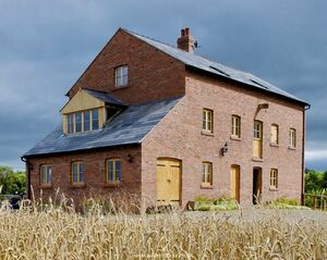
It is a working mill also open to the public. When grinding is to take place, a sluice gate is raised from the riverbed, thus diverting the water into the now short millrace, on to the 14-foot wheel and back to the river by the tailrace. The wheel and sluice gate are new constructions, but much of the internal machinery has been rescued from other mills in the country that have been converted to private houses. The "damsel" which feeds the grain to the grindstones is original and was found on site.
According to the 1910 OS map, the present course of the river past the mill was the original leat, with the river following a line to the east of its present course. The river line was altered in 1945 by Italian POWs and the old riverbed is now part of the strangely named "Waterless Brook": the brook is not waterless, but "Watley's Brook" may well have become "Waterless Brook". This now takes the overflow of the river when it floods. However, there may be a more complex answer to the origin of the name, as geological sections show at least one deeply buried valley in this area - possibly a glacial spillway now filled with gravel. These structures can carry quite a lot of water in the form of underground rivers and may account for some streams having a highly variable flow due to resurgence of these underground flows.
From its name the original mill was most likely a fulling mill. From the medieval period, the fulling of cloth often was undertaken in a water mill, known as a fulling mill, a walk mill, or a tuck mill, and in Wales, a pandy. In these, the cloth was beaten with wooden hammers, known as fulling stocks or fulling hammers. Fulling stocks were of two kinds, falling stocks (operating vertically) that were used only for scouring, and driving or hanging stocks. In both cases the machinery was operated by cams on the shaft of a waterwheel or on a tappet wheel, which lifted the hammer. Driving stocks were pivoted so that the foot (the head of the hammer) struck the cloth almost horizontally. The stock had a tub holding the liquor and cloth. This was somewhat rounded on the side away from the hammer, so that the cloth gradually turned, ensuring that all parts of it were milled evenly. However, the cloth was taken out about every two hours to undo plaits and wrinkles. The 'foot' was approximately triangular in shape, with notches to assist the turning of the cloth. Celia Fiennes, who visted Chester in 1698, described a fulling mill in Exeter:
- " ..its a pretty diversion to see it, a sort of huge notched timbers like great teeth, one would think it should injure the serges but it does not, the mills draws in with such a great violence that if one stands near it, and it catch a bit of your garments it would be ready to draw in the person even in a trice; when they are thus scoured they dry them in racks strained out, which are as thick set one by anotheras will permit the dresser to pass between, and huge large fields occupied this way.."
In Roman times, fulling was conducted by slaves working the cloth with their feet while ankle deep in tubs of human urine. Urine was so important to the fulling business that it was taxed. Stale urine, known as wash, was a source of ammonium salts and assisted in cleansing and whitening the cloth. By the medieval period, fuller's earth had been introduced for use in the process. This is a soft clay-like material occurring naturally as an impure hydrous aluminium silicate. It was used in conjunction with wash. More recently, soap has been used. The second function of fulling was to thicken cloth by matting the fibres together to give it strength and increase waterproofing (felting). This was vital in the case of woollens, made from carding wool, but not for worsted materials made from combing wool. After this stage, water was used to rinse out the foul-smelling liquor used during cleansing. Felting of wool occurs upon hammering or other mechanical agitation because the microscopic barbs on the surface of wool fibres hook together. Fulling was the first part of the cloth-making process to become mechanised, and records dating to 1185, indicate a fulling mill at Temple Newsham, West Yorkshire and another at Barton on Windrush, near Temple Guiting in Gloucestershire, both these mills set up by the Knight Templars. Following the fulling process, the cloth was attached is to a tentering frame in order to stretch it to the required size by setting the weave to a consistent dimension and tension, and it also acted as a way of evenly drying and bleaching the cloth in the sunlight. The tentering frame was a wooden framework, similar to a fence, consisting of a number of upright posts or rails set at intervals in a line, fixed to which, one above the other, were two long horizontal bars stretching from one end of the row to the other. Whilst the top bar was set, the lower one, set parallel to the upper one, was adjustable to suit the required width of the fulled cloth. Fixed all along the bars every three or four inches were tenterhooks, L-shaped iron hooks, pointed at both ends. The tenterhooks on the top bar were set so they pointed upwards, while those on the lower adjustable bar pointed downwards, this meant that after fixing the edge of the fulled cloth to the tenterhooks, the frames were adjustable to cope with the differing widths of broadcloths and narrow cloths.
Just upstream of the mill is what is probably the moated site of Foulk Stapleford manor which was created out of a 12th century division of the manor of Stapleford but the distinctive manorial name only became common usage after Fulk de Orby (Justice of Chester 1259-60) succeeded his father's holding in Stapleford in the mid 13th century. From the 13th century St Johns reputation was enhanced by the possession of an important relic, the so-called "Rood of Chester". It existed by 1256 or 1257, when Fulk of Orby provided a mark of silver annually for lights before it, and appears to have been enshrined in a golden cross-shaped reliquary adorned with an image. It was so greatly venerated both in the locality and much further afield that in the late 13th and early 14th century St. John's was known as the church of the Holy Cross.
The site passed through various hands before ceasing to be in use as a residence by the early 16th century. The site is bounded on the east by the old course of the River Gowy and on the west by the modern course of the Gowy - originally the extended leat to Walk Mill. The site includes a grassy platform measuring some 47-50m each way and standing c.0.3m above the neighbouring ground surface. This is clearly visible on LIDAR. There is a low inner bank running around the perimeter of the island and faint traces of surface scarps. A dry moat 18-20m wide x 1.2m deep surrounds the island and this is flanked by an outer bank up to 10m wide x 0.2m max. height.
Bruen Stapleford
- "STAPLEFORD (BRUEN), a township in that part of the parish of TARVIN which is in the second division of the hundred of EDDISBURY, county palatine of CHESTER, 4½ miles (W. N. W.) from Tarporley, containing 268. inhabitants. At Hargrave Stubbs, in this township, is a grammar school, founded by Sir Thomas Moulson, Bart., who endowed it with a rent-charge of £20 on certain lands then given by him for charitable uses, and now let for £155 per annum." - Samuel Lewis A Topographical Dictionary of England (1831)
Sir Thomas Moulson (sometimes spelled "Mowlson") (1582–1638), an alderman and member of the Grocers' Company, was a Sheriff of London in 1624 and Lord Mayor of London in 1634. He represented the City of London as a Member of Parliament in 1628. Sir Thomas was a native of Hargrave, Cheshire, and in 1627 built a combined chapel and school in the village which is now St Peter's Church, Hargrave. He also set up a trust to maintain the chapel and school. There is a local legend which says that Moulson, when a schoolboy from Hargrave, could not return home one night from Tarvin school because the Gowy was flooded and he spent the night sleeping in a haystack: next morning he vowed that if ever he became rich he would build a school at Hargrave,
Stapleford Mill
Ceased work by WWI and the machinery was removed during WWII. The building was demolished c 1950. John Bruen the puritan iconoclast maintained the poor of his parish by the produce of two mills in Stapleford, of which this was one. As Bruen is known to have kept sheep it is likely that the other mill was the Walk Mill, which was used for fulling. Since the mill became disused the course of the Gowy has been changed so that is diverted to follow a portion of the course of Guylane Brook and hence no longer passes the site of the mill. The road which crosses the Gowy just south of the site of the mill at "Ford Bridge" is now known as Guy Lane and is probably derived from the name of the river which was once forded at this point. The Tithe maps and the older OS maps show how the course of the river has changed over the years, apparently moving back and forth between the leat of the mill and a course some way to the west.
April 1st 1692 was the date of a pre-nuptial settlement between a John Bruen of Stapleford and Honor Winnington, daughter of Sir Francis Winnington, which included Walk Mill in Foulk Stapleford with lands and tenements. The situation is complicated by the fact that a further document mentions two mills in Huxley (DBW/M/M/E/1). 1801 saw mention of the mill in a further complex marriage settlement involving the Wilbrahams. At the time of the Tithe maps the mill was owned by the Wilbrahams but apparently operated by Joseph Howell, recently deceased. Howell, as noted above, also appears in connection with the Walk Mill.
A prehistoric settlement of six roundhouses has been excavated near Brook House Farm. This was discovered in 2001 when a new gas main was being laid. It was occupied from the Middle Bronze Age to the end of the Iron Age (approximately 1000 BC to 42 AD). The name "Stapleford" is possibly derived from a pillar marking a ford.
Hockenhull
- "HOCKENHULL, a township in that part of the parish of TARVIN which is in the second division of the hundred of EDDISBURY, county palatine of CHESTER, 5 miles (W. N. W.) from Tarporley, containing 38 inhabitants." - Samuel Lewis A Topographical Dictionary of England (1831)
Hockenhull Platts
Clicking on the walking man icon will reveal how much the course of the river hereabouts was altered by the improvement works carried out by POW's in WW2. Although the Hockenhull bridges are in England, they are not far from the Welsh border and it is likely that their name is derived from a combination of English and Welsh roots. "Platt" is an Old English word for "bridge" and is associated with "plank". "Hock" may come from the Welsh "hocan" which means to peddle or to sell abroad. "Hen" is Welsh for "old" and "hoel" (as in Hoole) means a paved way or road. It is therefore possible that Hockenhull Platts means "the bridges on the old peddlars' way". In the alternative the bridges may be named after a local family, or the family after the bridges, there are arguments all ways (the same is true of Platts).
In 1353 when Edward, the Black Prince, crossed the bridges, he ordered that 20 shillings should be spent on their repair. A reference to a bridge at Hockenhull appears in the will of one Ralph Rogers, a citizen of Chester who in 1539 made testamentary provision of 10 shillings for its repair. In the 17th century the surface of the road was disintegrating so badly that posts were set into the road to prevent the passage of carts, and it could be used only by pedestrians and horses. As noted above carts took a different route. Goods were carried by convoys of packhorses led by a driver (or jagger) walking in front. The pioneer female traveller Celia Fiennes crossed the bridges in 1698, as did Thomas Pennant in 1780. The present bridges probably date from the latter part of the 18th century, although they are frequently referred to as the "Roman Bridges". In 1824 Cheshire County Council proposed to divert the road from Nantwich to Chester and make it pass along Platts Lane, which would have led to the destruction of the bridges. However the land on which they stood belonged to the Marquess of Westminster, and he refused permission for the road to be diverted. Some thing similar must have happened around 1901, when the local newspapers contained letters complaining about the impending removal of the bridges:
- "HOCKENHULL PLATTS. — One of the most picturesque spots in Cheshire is that known by the name of Hockenhull Pii.tts, situated just beyond Cotton Abbotts and half a mile from Stapleford. It is visited by many during the summer months, and although the scenery is certainly very pretty, the three Roman bridges, one of which crosses the river Gowy, form the principal attraction to those who love to see relics of byegone ages. They present a quaint appearance, and a romantic history of byegone days could they unfold were they but human. It seems a pity, therefore, that these bridges, which are objects of such curiosity, have now to be pulled down For many years the road passing through Hackenhull Platts and running direct to Stapleford has not been used for vehicular traffic, but now it is stated the lane has to be widened and repaired for the convenience of market people and others who at present are obliged to go a roundabout way in order to reach Chester, &c. This will effect a public convenience, no doubt, but then the Platts will in consequence be robbed of their chief attraction, the Roman bridges. New bridges will, of course, be erected, but they will not be exactly Roman." (Chester Courant: 1st May 1901)
Fortunately they were again saved. Today (2020), Hockenhull Platts consists of three humpback bridges which are approached and connected by causeways. The bridges are constructed from tooled blocks of red sandstone. The parapets are plain and are surmounted by chamfered coping stones which are joined by iron ties. The carriageway is formed from a mixture of stone setts and cobbles.
At Duddon, the road passes the site of the "Headless Woman", a pub now gone. There are at least two different local legends about this. In the first the woman was called Dorothy and accidentally decapitated by her father while he was trying to save her from the Roundheads. In the other the woman is called Grace, and, during the Civil War, when the Parliamentarians were getting close, the Hockenhulls (a Royalist family) left Grace the maid in charge of their house (possibly on the site of Hockenhull Hall) and treasure. Despite torture, she refused to say where it was hidden and had her head taken off as a result: i.e. they chopped the head off the only person who could tell them where the treasure was. Of course, her ghost wanders round with her head in her hands, haunting the area to this very day. One local story is that Washington Irving stopped here while travelling by coach from Birminham to Chester and was intrigued as to why the village inn was called "The Headless Woman". Against the landlord’s advice, Irving insisted on staying the night at the inn and had a bed made up in the "haunted" attic room. He kept a vigil all night, but did not see the headless woman. He did, however, claim to have heard a woman sobbing in the night and, in the morning, found "a patch of blood" on the floor of the attic. Prompted by his experience in Cheshire, Irving spent several months researching headless ghost tales. He found that that their incidence was ubiquitous throughout the British Isles, as a consequence he incorporated the story into "The Legend of Sleepy Hollow". So could this be true? - Irving certainly began writing the tales that would appear in "The Sketch Book" shortly after moving to England for the family business, in 1815, and is known to have visited both Birmingham and Chester.
There used to be a headless woman figure standing in the pub car park many years ago: a ship's figurehead modified with a saw and some red paint. One day it disappeared - stolen. Now the pub has gone too, having been converted into residential use in 2018. There are a host of variants on the story some of which have Grace the maid haunting Hockenhull Platts rather than the pub. Hockenhull Hall is recorded as previously having a Pele tower with the possibility of the site having been moated.
Stamford Mill
Stamford Mill, just to the south of Stamford Bridge is now a private house, but in the 1836-51 tithe maps it was shown as a flourmill in the ownership of the Marquis of Westminster, tenanted by Joseph Rowe. Stamford Mill on the River Gowy is first recorded in a document of 1188 as "molendinum de Staneford". It was rebuilt in 1810 after being burnt down. A painting from 1892 shows that the mill had an enclosed undershot wheel. The mill wheel and its associated machinery were removed around 1900 when the building was converted into a house, but the remains are still visible, as is the mill pond. These are best seen from across the river. The mill is marked as such on the 1908 OS map. In 1965 two date stones from 1610 and 1790 were discovered during renovations.
The Roman Road from Chester to Northwich (Margary 7a) crossed the Gowy at Stamford Bridge (don't believe the hilarious place-name derivations given on the linked page: Christleton does not mean "whirlpool on top of a hill"). Codrington writes:
- "The Roman road from Chester to Northwich and Manchester, called Watling Street, was on the line of the present road for four miles to Stamford Bridge, and then along a highway with a parish boundary for another mile, pointing straight to Edisbury Hill (460′‑550′) in Delamere Forest. After an interval of a mile, a road with a parish boundary along it for three-quarters of a mile east of Salter's Brook takes up the line. Mr. Robson traced the road through Delamere Forest before it was effaced by deforesting operations. At the west of the forest he describes the ridge as being more or less distinctly marked for half-a‑mile, nine or ten yards across, with a well-marked crown, and shallow ditches and traces of mounds beyond them on each side. There was a thickness of 18 inches of solid gravel. Traces appeared after a mile and a half in the same course. At Edisbury Hill there is a slight turn, and the line is taken by a lane, and where that joins the road to Delamere railway-station the Roman road was cut through two feet beneath the surface in laying the Vyrnwy water-main. It is visible on the east of the road, and in about a mile and a half the Northwich road rejoins it for a short distance, and the ridge is traceable onwards on the north of the road to Sandiway, from which onwards the present road seems to follow very nearly the course of the Roman road on to Northwich, where remains have been found in several places." (Codrington, 1903)
The road shows clearly in LIDAR mapping. On what was once Stamford Heath. just south of Tarvin Road are the remains of a Roman Camp, possibly either an early "Marching Camp" or a practice camp. The bridges at Hockenhull are sometimes called the "Roman Bridges", even though the Roman Road runs well to the north of them. Around the camp are clear narks of medieval ploughing, gnerally known as "ridge and furrow", but known as "butt and rean" in Cheshire. Interestingly, these cut straight through a marl-pit showing them to be older than the pit. "Rean" is from the Old English "Ryne" - used elsewhere in England as an agricultural term for a drainage ditch and possibly having the same origin (in a linguistic sense) as "Rhine". The supposedly humble plow also illustrates the history of technology with two important improvements being the heavy wheeled plow (possibly introduced by the Vikings according to some theories) and, somewhat later, the horse-collar, which meant that plowing was no longer dependent on oxen or humans to draw the plow.
In the Middle Ages the Northwich-Chester section, diverted through Kelsall and Tarvin, was a saltway also known as 'Lynstrete', 'the road to the Lyme'. In the late 16th century it was regarded as the way not only to Manchester but to cross the Pennines. Its condition may have been poor, since by the late 17th century the preferred route to Manchester went instead through Frodsham, Warrington, and Salford. The road via Northwich and Altrincham was turnpiked in stages between 1753 and 1769 and thereafter the two routes were probably regarded as alternatives. In the 1370s the road to Manchester through Frodsham and Warrington left Chester by the Northgate and turned right along Bag Lane (later George Street), but later the route went from the Eastgate along Cow Lane, a road which in the 19th century was successively renamed Warrington Street and Frodsham Street. Beyond Flookersbrook bridge the original course was along the line later taken by Kilmorey Park, Newton Hollows, Mannings Lane, and the Street as far as Trafford Bridge, where it crossed the Gowy.
Barrow
- "BARROW, a parish in the second division, of the hundred of EDDISBURY, county palatine of CHESTER, 5 miles (E. N. E.) from Chester, comprising the townships of Great Barrow and Little Barrow, and containing 642 inhabitants, of which number, 393 are in the township of Great Barrow. The living is a rectory, in the archdeaconry and diocese of Chester, rated in the king's books at £19. 6. 5½., and in the patronage of the Marquis of Cholmondeley. The church is dedicated to St. Bartholomew. A school for poor children is endowed with about £6 per annum. A preceptory of the Knights Hospitallers, founded here in the reign of Henry II., vas valued, at the dissolution, at £107. 3. 8." Samuel Lewis A Topographical Dictionary of England (1831)
The reference to the Knights Hospitalars is a mistake: this is Barrow-on-Trent not Barrow in Cheshire, as mistakenly given both in the original and last editions of the Dugdale's "Monasticon".
Milton Brook which enters the Gowy to the north of Stamford Bridge also had a mill at Barrow and its course can be followed upstream to further mills at Tarvin, Duddon and Willington. Barrow Mill is shown on the 1831 Bryant map, is mentioned as the "molendinum de Barou" in 1154–60 (1329), as "molendinum de Barowe" in 1442 Cholmondeley deeds and as a "Water corn Mill called Barow-Mill" in 1710. Barrow mill was probably established by John, Constable of Chester 1178–90, cf. "molendinum …et alter molendinum quod pater meus Johannes postea fecit in aggere eiusdem Barwe 1190–1211".
Another branch of the Gowy, Barrow Brook, appears to have had mills at Swinfordmill (owned and run by John Cheers) and near Peel Hall at Ashton. Many attempts have been made to drain the land hereabuts over the centuries. By the early 14th century half a dozen dykes had been built towards Frodsham, but in the 1340's a major scheme to build a large sluice to avoid winter flooding failed when winter storm swept away the timbers. A wooden dugout boat, perhaps dating to the iron age was found near Stamford Bridge in the 1930's.
Plemstall
- "PLEMONSTALL, a parish comprising the townships of Hoole, Pickton, and Mickle-Trafford, in the lower division of the hundred of BROXTON, and the township of Bridge-Trafford, in the second division of the hundred of EDDISBURY, county palatine of CHESTER, 4¼ miles (N.E.) from Chester, and containing 710 inhabitants. The living is a vicarage, in the archdeaconry and diocese of Chester, rated in the king's books at £6. 13. 4., and in the patronage of the Earl of Bradford. The church, dedicated to St. Peter, stands in the town ship of Mickle-Trafford, a mile and a half north-east of the village of that name. There is a small endowed school, erected by subscription, more than a century ago. At Trafford, in this parish, a garrison was placed for the king, by Sir William Brereton, during the siege of Chester in the parliamentary war.": Samuel Lewis A Topographical Dictionary of England (1831)
Samuel Lewis is wrong when he says that a garrison was placed here for the king, as Brereton was on the side of Parliament and commanded their forces during the Siege of Chester.
There are said to be records of a church at Plemstall as far back as the 7th century, when the Gowy used to flood the surrounding land and the locality (barely elevated) was known as the "Isle of Chester". In the Late Saxon period the Gowy is likely to have been wider and tidal. In the north-western corner of Eddisbury Hundred, the settlements of Thornton-le-Moors and Ince (0ld Welsh ynys, island) would have been divided from the Wirral by tidal sands reaching up to 1.5 km inland. A legend, perhaps of the 5th or 6th century, tells of a shipwrecked fisherman who, on finding refuge here, built a church as an act of thanksgiving, dedicating it to St Peter the fisherman. It is not clear how the suggestion of an early church and a "hermitage" fit together. Also, there is a weak suggestion in Asser that Plegmund was more than a hermit when before he was selected by Alfred: Asser says that Alfred summoned four distinguished Mercian clerics and showered them with honours and entitlements in Wessex, "not counting those which Archbishop Plegmund and Bishop Werferth already possessed in Mercia". It ia also worth noting that Gervase of Canterbury does not actually call Plegmund a "hermit", but writes that he "for many years led an ermetic life" - which could simply mean he led an austere life.
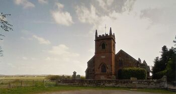
Plegmunds life and his supposed well are covered elsewhere on this site, but he may have had a far larger impact on local history than he has been credited with. Plegmund is a fascinating figure. He steps out of obscurity in Plemstall straight into a very tricky environment, and manages to safely navigate not only two perilous trips to Rome but also one very delicate political or military situation after another, seemingly with ease. While little is known about Plegmund prior to his appointment to the court of Alfred, there are hints that he was widely known prior to this and maybe even that he had some reputation as a missionary which stretched as far as continental Europe and even to Rome. The actual extent of Plegmund's influence on policy is hard to pin down, especially as regards events in and around Chester. Taking it to an extreme, he could have influenced Æthelflæd to re-fortify Chester and establish the cult of Werburgh (and thus bolster the Mercian state). He could have had a part in keeping the peace with her brother Edward the Elder (at least while she lived) and possibly influenced Edward to continue building a defensive line for Mercia north of Chester - and to continue the recovery of the lands occupied by the Danes on the eastern coastline. Plegmund could have influenced Æþelstān to be somewhat overly religious and to take up arms against the combined armies of Olaf III Guthfrithson (Viking King of Dublin), Constantine II (King of Scotland) and Owian (King of Strathclyde), who were subjected to a crushing defeat at the Battle of Brunanburh which confirmed England as an Anglo-Saxon kingdom.
Although the surrounding land has been drained, the church still stands in an isolated location. Once called "Plegmundeshamm" (which may be translated as "Plegmund's hemmed-in place in water meadows"), later Plemondstall, it is now Plemstall. There are some few remains of a 12th century church, but the present sandstone building of St Peter is mainly 15th century. The tower was added in 1826, replacing a wooden belfry. Most of the original glass has gone, but there are said to be fragments from the 14th century (they may possibly be slightly later). In a display case in the north aisle are (or were) a Breeches Bible of 1608, a King James Bible of 1611, a folio edition of the bible printed by Edward Whitchurche in 1549, a black letter bible of 1549 and a King James Bible of 1623. The strikingly macabre 14th century tomb of the Hurleston family is located at the rear of St. Peter's church. One noted incumbent in the latter part of the 18th century, was the Rev John Baldwin of Hoole. His son Thomas Baldwin, who was also ordained, took part in a famous balloon flight in 1786. He took off from Chester Castle. Another noted incumbent was the Rev. Joseph Hooker Toogood (rector 1907-46). Pevsner records the war memorial was carved by Toogood and in fact the industrious Toogood was responsible for improvements to the chancel screen, a new altar, the reredos and panelling for the sanctuary, the lectern, much of the north chapel and baptistry, a new cover for the font, the choirstalls and their canopy, figures for the sanctuary niches and an alms box.
Trafford Mill
The earliest documentary reference to the Trafford Mill is in the Cheshire Chamberlains' Accounts of 1302–03. Further documentary records of the mill are in 1464 in the records of the Troutbeck family and in the Land Tax returns between 1784 and 1832. The building was offered for lease in an October 1767 edition of the Chester Chronicle. It was described in that advertisement in the form it is in now as 'this new built corn mill' thus dating the building at around 1760, nearly 100 years older than previously thought. In 1851 Rupert Fernyhough was the Miller and his younger son, Frederick became the Miller in 1871. He died in 1893 and is buried alongside his father at Plemstall Church. In 1893 James Owen, a corn chandler, of Chester became tenant of the Mill and the last Miller, Mr Tourle started work at the age of 20 where he worked for the rest of his life. It was sold at the Shrewsbury Sale of 1917 at which time it consisted of a three-floor corn mill, including two undershot water wheels (one of which was out of repair), a drying kiln, a barn, a stable and a shippon. In 1952 it ceased to be a working mill and was taken over by the North West Water Authority (now United Utilities). It was in a derelict condition and in the 1970s it was re-roofed and other repairs were made. Further repairs were made in 1998. At this time the mill is still not open to the public in an official form. There have been numerous attempts to get charitable status set up for the mill in order to be able to make the mill a museum and add a visitor’s centre, but as yet these attempts have failed.
Mickle Trafford
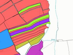
Mickle Trafford ward lies to the east of Chester city a short distance from Hoole along the Warrington road (A56) and is made up of the villages of Mickle Trafford, Bridge Trafford, Wimbolds Trafford, Picton, Picton Gorse, Hoole Village and Hoole Bank. Most of the ward lies outside the A55 by-pass, although the section around Hoole Hall Hotel lies between the A55 and the A41. Most of the ward remains rural, and the area closest to Chester lies in greenbelt land. Historically, Mickle Trafford was a key river crossing point, over the Gowy, for visitors to Chester. The village is noted for its annual "well-dressing" of Plegmund's Well in honour of St Plegmund - who was selected for the see of Canterbury in 890 by King Alfred the Great. There are a number of historic buildings within the ward, including Trafford Mill and the ancient church at Plemstall. The village has a very informative History Page.
Nearby, the "Gibbet Field" is named after two 18th century highway men who were hung there. James Brown and Thomas Price are often said to have been executed, on the 30th April 1796, for the murder and robbery of a mail boy. They remained there till 1820, when the pole was taken down, the place having been previously enclosed. In the skull of Price was found a robin’s nest (some say a wren). However the common account is not accurate. The 1796 publication An accurate statement of the trial...etc informs that the post boy was named Peter Yoxall and provides a less than helpful, and somewhat innacurate map as to where the gibbet can be found. It also includes a statment of Yoxall's evidence at the trial. Gibbeting started off as an unofficial practice which then became official with the Murder Act of 1752. This called for the bodies of convicted murderers to be either publicly gibbeted or given over to surgeons and anatomists for dissection. Women were never gibbeted, it would be nice to think that this was out of some kind of respect for the female body but the truth is that female murderers were so rare in comparison with men that their corpses were always claimed for dissection. Even the gibbeting of male criminals wasn’t a frequent occurrence – between the passing of the Act in 1752 and the end of the practice only 80 years later the bodies of 134 men were hung in chains somewhere in England, an average of roughly 1 or 2 a year. Surprisingly, a very similar gibbet still exists (it is in a museum at Warrington) and was also made for the robbery of a post-boy.
The Gowy often flooded at the Traffords and it is often said that both the Shrewsbury Arms and the Nag's Head provided facilities for travellers of the old coach road, and for the many foot travellers having to wait until the waters subsided from the floods. The problem with this tale is that while there was a public house marked on the tithe maps at the location of the Nag's Head, there was no building on the site of the Shrewsbury Arms, and so the story is possibly a fabrication. The account of the mail robbery mentions the Nag's Head several times and it is apparent from the narrative that there is no other inn close by. In 1648 a petition was heard about the repair of the bridge:
- "To the Justices assembled at the Quarter Sessions at Namptwich. The peticon of the Inhabitants of the parishes of ffrodsham, Ince, Thornton, Plimstow, Barrow and Sutton. Sheweth that whereas in the late warres one arch of Trafford bridge beinge beaten downe by the Cavelleers and the other two stone arches soe ruyned for want of seasonable repaire that they are ready to fall and must of necessity bee taken downe to the foundation or sufficiently repaired, the ruins of the arch havinge stopped the principall course of the water by reason whereof all the low grounds and meadowing for divers miles adjacent have for divers yeeres past binne utterly spoyled by flooding to the greate impoverishing of the neighborhoode and also detriment of the Cytty of Chester, having most of their hay from those parts, the highway also (beinge the greate roade from the North of this Kingdome to Chester) beinge somtymes by high water soe overflowed that it impossible without greate danger, th: cost of the repair whereof, according to the Judgment of workmen, will amount to one hundred markes at the least. May it please your worshipps that there may bee a le(v)y throughout the whole countie for the repair of the bridge."
Trafford Hall
The name Trafford is associated with the Trafford family at Bridge Trafford who played a significant part in the history of the area and are commemorated in Sr Peter's (Plemstall) Church, especially in some fragments of stained glass that survived the Puritan window-smashing. The male Trafford line died out in 1645 when Thomas Trafford was killed at the Battle of Naseby leaving a daughter Alice who married John Barnston of Churton (1630-61) to whom the significant estates went. The interest in the church at Plemstall would pass to the Hurlestons but again passed to the Barnstons when Trafford Barnston (1708-71) married (28 June 1756 at Holy Trinity, Chester), his step-mother's daughter, Elizabeth (d. c.1798), daughter and co-heir of John Hurlestone of Newton and Picton. Trafford Barnston inherited Churton Hall and Hapsford Hall from his father in 1753, but lived chiefly in Chester, where he built Forest House, Love Street, in 1769-70. He also had a house in Upper Brook St., Mayfair, London.
Mickle Trafford, Magna Trafford or Great Trafford after the Conquest belonged to the Fitzallan family. For the whole of the 14th Century, the Earl of Chester whose estate it formed part leased it to various people until taken over by the William Troutbeck in 1416. The Troutbeck line ran out in 1510 and the inheritance passed to the Talbots who became the Earls of Shrewsbury and continued to hold an interest until 1917. Bridge Trafford Hall (probably in use as a farm) is shown in early OS maps but current LIDAR shows no trace at all. Buildings are shown on the site in maps up to the 1950's, at some time after which the last remains of the house seem to have been cleared completely. The area then became a landfil site but has now been converted into the Gowy Woodland Park. nearby Wimbolds Trafford Hall still exists and is somewhat confusingly known as Trafford Hall.
Picton
Picton is a hamlet and former civil parish, now in the parish of Mickle Trafford and District. In 2001 it had a population of 58. Picton Hall and Picton Hall Farmhouse are designated by English Heritage as a Grade II listed building.
Modern references suggest the Picton is from an Old English personal name "Pica" and "tūn" (again Old English) meaning an enclosure; a farmstead; a village; or an estate. But older writers often suggest that the name-element "pica" is somehow derived from a fork in the river. On older maps (such as that of Robert Morden - image here) the Gowy is shown to split hereabouts, with one branch flowing into the Mersey and the other flowing into the Dee via the Bacford Gap - these forming the bounary of Wirral. The Gowy does indeed split near Picton, with one branch heading to the sea and the other feeding the long leat of Stanney Mill. Bryant's "Map of the county palatine of Chester from an actual survey made in the years 1829, 1830 & 1831" also appears to show a straight channel leading off the Gowy here (see below for map). Bryant also shows the "River Twine" which runs from the Gowy near Picton through the Stanney water mill and rejoins the Gowy as it approaches Stanlow. The leat of Stanney Mill appears to be mostly straight om modern maps but older maps show that the lead meandered and labels it as the River Twine. According to Ormerod (Vol 2, 1819, p.441):
- "Richard de Vernon gave the tithes of this vill to the abbey of St, Werburgh, before the charter of 1093, and Warvin Vernon, by a deed in the Chartulary, gave 4s issuing from the mill of Picton."
Given there is no mill at Picton, this may be a reference to the mill at Stanney which is fed by it's leat running from close to Picton and which the Abbey at Chester either owned or was entitled to a tithe from.
Downstream of Picton and the Traffords Quaternary geology, with Holocene aged estuarine deposits occupy the low ground along the coast inland as far as Helsby and alluvial sediments occur in the floodplain of the River Gowy. Dunham-on-the-Hill forms a bedrock ‘high’ where superficial deposits are absent and Sherwood Sandstone Group is exposed at the ground surface. Near Stoke (often "Stoak"), the Gowy is almost rejoined by the continuation of the Chester Canal to Elesmere Port. This has crossed the high ground of the Wirral by means of a fluvioglacial spillway: the Backford Gap, which has allowed the canal to avoid locks except at its ends. When the canal reaches the village of Stoak, it turns sharply west in order to keep within the boulder clay and avoid the alluvium of the River Gowy valley: the marl-pits are mostly if not wholly to the west of the canal. From the very beginning, the Wirral Line proved to be a great success carrying freight and passengers from Chester to the Mersey at Ellesmere Port from where they were taken across the estuary to Liverpool.
Picton lies on a greenway which is marked on older maps as a quite substantial track, and which can be followed on LIDAR into Upton. Picton Farm, once part of Picton Hall and has a large suite of former cheeserooms now converted. One contains pair of boilers with a cheese oven to the rear, with wooden doors and whey drainage patterns on the bottom stone shelf.
Stanney/Stoak
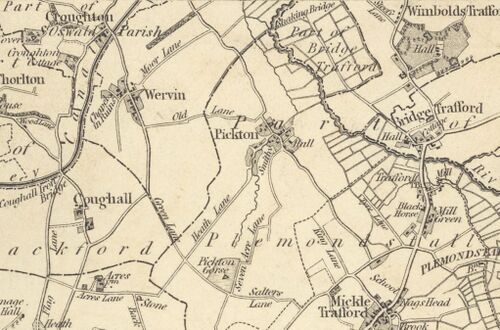
- "STOKE, a parish in the higher division of the hundred of WIRRALL, county palatine of CHESTER, comprising the townships of Great Stanney, Little Stanney, and Stoke, and part of that of Whitby, and containing 461 inhabitants,of which number, 129 are in the township of Stoke, 4¾ miles (N. by E.) from Chester. The living is a perpetual curacy, in the archdeaconry and diocese of Chester, endowed with £200 private benefaction, and £200 royal bounty, and in the patronage of Sir H. E. Bunbury, Bart. The church, which is the burial place of the Bunbury family, has a Norman doorway, some ancient wooden screen-work, and a small chapel attached to the south side of the chancel: it was partially rebuilt in 1827, and has received an addition of fifty five free sittings, the Incorporated Society for the enlargement of churches and chapels having granted £50 towards defraying the expense. A school, founded here about 1670, by Sir Thomas Bunbury, Bart., is endowed with the interest of £200.": Samuel Lewis - A Topographical Dictionary of England (1831)
- "STANNEY (GREAT), a township in the parish of STOKE, higher division of the hundred of WIRRAL, county palatine of CHESTER, 6¾ miles (N.) from Chester, containing 18 inhabitants. The Chester canal passes through this township, A court leet is occasionally held. Excellent marl, composed of alluvial matter, abounds here, and large trees have been dug up in the meadows.": Samuel Lewis - A Topographical Dictionary of England (1831)
A Saxon chapel was originally on the site of St Lawrence's Church, Stoak (which is normally not open). The church has the not-uncommon legend of the stones prepared for building being repeatedly removed by supernatural hands from the selected site to the present location - the same is said of Ince church across the River Gowy. Why this legend of moving stones should be so widespread is unknown and various theories have been put forward such as revolt by the local inhabitants against the placing of a church on a site of some special significance. There is nothing suggest this was the case at Stanney. Another possible explanation is that sometimes cut stones were found whose purpose, often as boundary stones, had been forgotten and the locals invented the explanation that these were church stones that had been moved through supernatural means: much the same applies to glacial "erratics" - large boulders of a non-local rock type.
Stanney was not mentioned in the Domesday Book but fragments of church architecture still present in the 19th century showed that a new church must have been built soon after the Norman conquest. Ormerod quotes sources from the 14th century which stated that at that time the church was "a sumptuous fabric of stone and wood, of great size, with four bells, but was then becoming ruinous". The present church dates from its rebuilding in 1827, undertaken by George Edgecombe (or Edgecumbe), and very little of the original work remains. It now has three bells (Clipbury, Holt) which date from 1615-42 and are believed to be the oldest in Wirral. Fortunately the Tudor nave roof of arch-brace and hammerbeam design was kept: it is an almost unique survival in the area. A further restoration was carried out in 1911–12. The clock is notable in that it only has one hand - it was made that way. The church contains several memorial panels by Randle Holme. The churchyard contains the grave of nine-year-old Nelson Burt, son of Albin R. Burt (of Hunter Street), drowned during the River Mersey hurricane of 1822. The church, and the grave of Nelson Burt, are mentioned in the song "The Unfortunate Gwatkin" by the band "Half Man Half Biscuit" on their 2014 album "Urge For Offal".
North of Stoak much of the landscape has been transformed by industry.
Stanney Mill and the River Twine
An early antiquarian paper entitled "The Mersey as known to the Romans" from the "Proceedings of the Literary & Philosophical Society of Liverpool" (1873) makes some comments on this mill, but makes some errors as regards other facts and so might not be entirely trustworthy. In so far as the paper can be understood it appears to suggest that the monks of Stanlow and those of Chester at times came to disputes over the uses of the water in the lower Gowy and especialy as to the amounts of water which should be diverted along the various courses. The closure of either this mill, or alternatively Thornton Mill is debated at length in Cheshire Farming - A report of the agriculture of Cheshire (1845) by William Palin of Stapleford Hall. Both of these mills have exceptionally long leats which divert the Gowy.
The Tithe maps show Rupert Fernihough being the tennant at "Little" Stanney Mill (which was owned by "Sir Henry, Edward Baronet Bunbury"). After the Dissolution, Great Stanney was acquired by the Warburton family but it was then sold by John Warbuburton (36 Henry VIII) to Henry Bunbury in 1544. Ormerod, writing initially in 1818 notes that from the time of Charles I, both Great and Little Stanney descended through the Bunbury family to Sir Thomas Charles Bunbury, whose heir the historian and soldier General Sir Henry Edward Bunbury (7th Baronet) sold them to the Dean and Chapter of Chester Cathedral.
Since the burning of The Hall in Hoole in the Civil War, the Bunburys had lived in the Old Hall at Stanney. However, as the 7th Bart notes, things changed in about 1724 when "merry Sir Harry" took up his abode in the small house, which was then christened "Rakes Hall". Its name, as Hanshall notes, recalls:
- "the bon vivants who frequented it, was jocosely called "Rake Hall" and still retains its nomenclature. On a pane of glass in the kitchen window, dated Dec 15, 1724, is recorded the names of the following visitants then present, viz. Sir Charles Bunbury, Sir R(obert) Grosvenor, Sir William Stanley, Sir Francis Poole, Amos Meredith, Colonel Francis Columbine, Edward Mainwaring, Thomas Glazeour, Sherrington Grosvenor, Seymour Cholmondeley, William Poole and Charles Bunbury, jun."
While these must just be a scattering of the wealthy in the area, there may be interesting associations. Several (including Poole) were from long-standing Catholic or Jacobite families. Henry Bunbury was dismissed from his office at the Irish Revenue in 1715, following a report from the Irish lords justices that they had found a letter to a Jacobite agent engaged in distributing a declaration of the Pretender’s, and a great number of seditious pamphlets, "superscribed and franked by him". Charles Cholmondely's name was included in a list of leading English Jacobites sent to the Stuart court in Rome, and Robert Grosvenor was rumoured to be Jacobite sympathiser. At least one (Colonel Francis Columbine) was an important Freemason. Of course, Rake Hall may also take its name from Rake Lane, on which it stands. "Rake" being a common name for a road in the area as used by the Vikings it is from the Old Norse "Rek", meaning "Lane".
Sir Henry Bunbury, son of the famous caricaturist, Henry William Bunbury and Catherine Horneck, was educated at Westminster, and served on active service in the army from 1795–1809, notably in the Anglo-Russian invasion of Holland in 1799, the Egyptian Campaign 1801, and the campaigns in the Mediterranean, where Bunbury served as Quartermaster-General. He particularly distinguished himself at the Battle of Maida in 1806. He served as Under-Secretary of State for War and the Colonies from 1809–16. He was promoted to the rank of Major-General and appointed a Knight Commander of the Order of the Bath (KCB) in 1815, and in the same year was responsible for informing Napoleon of his sentence of deportation to St Helena. He owned Rake Hall at nearby Stanney, but for centuries the Bunburys had lived at Stanney Old Hall - said to have been Wirral’s finest medieval house, in which an unusual feature was the Court Room - with four oak trees standing one at each corner,the branches forming the vaulting of the roof. Unfortunately, this is no longer to be seen: in 1820, while the owner was abroad, an over-zealous agent had the Hall pulled down, hoping to see a "fine modern house" in its place. The oak was sold for firewood, and legend recounts that the local smith found a hoard of gold coins, probably hidden during the Civil War, in one fine beam.
Another local legend depicts the people of Stanney as simpletons who were afraid of a duck which wandered the local lanes and terrified the inhabitants. To solve the problem the bold men of Stanney ganged up on the duck and caught it. It was then beheaded and buried. However, things then got worse, as the now ghostly duck continued to wander the lanes without its head. Apparently, this is the only known occurence of a spectral headless duck.
The water-courses leading to the mills of Stanney and Thornton diverge near Picton and it has been suggested that Picton actually takes its name from the fact that it is close to a "fork" in the river. Where the Gowy splits into the what is known from some maps as the River Twine and the "main" course of the Gowy.
Ormerod describes this area as particularly gloomy with Stoak being: "..a collection of of rugged and filthy hovels scattered around the church..", and Picton being "situated in a cold flat, clayey soil; in roads appearance and in inhabitants it may be safely said to present a complete picture of barbarism..". Ormerod saves his strongest words for Stanlow and says: "It is difficult to select a scene of more comfortless desolation than this cheerless marsh .... approached by one miserable trackway of mud".
To the Mersey
- "STANLOW-HOUSE, a liberty (extra-parochial), in the higher division of the hundred of WIRRALL, county palatine of CHESTER, 8 miles (N. by E.) from Chester, containing 16 inhabitants. An abbey of Cistercian monks was founded here, in 1178, by John Lacy, constable of Chester, which, on account of the inundations of the Mersey in 1296, was removed to Whalley in Lancashire, a cell being left at this place; some small remains of the conventual buildings are visible in a farm-house.": Samuel Lewis - A Topographical Dictionary of England (1831)
The lower reaches of the River Gowy near Stanlow in Cheshire are subject to periodic flooding from combinations of river water and high tides. The River Gowy flows through the Stanlow Manufacturing Complex, an extensive area of oil refineries and other industries adjacent to the Mersey Estuary. Flooding can occur in the Stanlow complex at times; the most recent events occurred during the 1990’s. Flooding of the industrial areas is a risk to the operation of the installations. It could lead to pollution of the floodwater with oil or other chemicals and this contaminated water entering the Mersey Estuary, an area of national and international importance for birds.
The lower basin of the River Gowy was semi-tidal and only became cultivable during the 19th Century following the construction of the railways and the Manchester Ship Canal, under which the Gowy is compelled to pass through a syphon. However, much of this land floods regularly to this day. Almost all of the lower river has flood-banks to reduce the frequency of flooding. There is also a tidal gate at Folly Gates which normally stays open to let the river flow out to the estuary, but closes during high tides to prevent tidal water flowing back up the river. There are two other tidal gates which regulate the flow out of the Thornton Brook and another tributary, Gale Brook.
Gowy Meadows Nature Reserve, which was originally donated by Shell and is managed by Cheshire Wildlife Trust, covers 166 hectare on the eastern bank of the Gowy floodplain, close to the river’s confluence with the River Mersey at Stanlow. Two-thirds of the site comprises rushy pasture on the floodplain itself, with the remaining third, along the eastern side, being on drier mineral ground. A network of straight open ditches drain the peaty soils of the former tidal marshes. Many small ponds are also scatted across the reserve. Almost 145 bird species have been recorded at Gowy Meadows, including great white egret, marsh harrier, rough legged buzzard and glossy ibis. The reserve is known for aquatic invertebrates including the lesser silver water beetle and is home to more than half of the dragonfly and butterfly species recorded across Cheshire, with banded demoiselles from late-May. The reserve also hosts around 68 species of hoverflies and over 224 moth species. Wheatear appear in the fields during spring migration and there's always the chance of a special spring visitor like a ring ouzel. Summer breeders may include reed and sedge warblers, with their scratchy calls rising from the ditches along with whitethroat in the hedgerows. When winter conditions are right, the wet meadows and ponds play host to wigeon and our smallest duck, the teal. Gadwall are a becoming a regular sight on the ponds with jack snipe a visitor along with green sandpipers and little egret. Infra-red cameras have also recorded otters along the River Gowy, and field signs such as spraints are sometimes recorded. Water voles are known to use the extensive ditch system on the reserve and latrines and feeding remains can be found dotted along the ditch banks and some of the more open pond edges.
Stanlow Abbey (or Stanlaw Abbey) was a Cistercian abbey situated on Stanlow Point, on the banks of the River Mersey in the Wirral Peninsula, Cheshire, England. The abbey was founded in 1178 by John fitz Richard as a daughter abbey of Combermere Abbey. After the death of his father in 1163 John inherited his rule of Halton Castle and the Office of the Constable of Chester, which he became the chief official of Hugh de Kevelioc, 5th Earl of Chester. After the death of Hugh in 1181 he served in the same capacity for his heir Ranulf de Blondeville, 6th Earl of Chester. In 1166 he paid a fee of 1,000 marks to obtain his mother's possessions. His mother, Albreda de Lisours, was a daughter and heiress of Robert de Lacy (d. 1193). His younger brother Roger fitz Richard was Lord of Warkworth Castle; another brother, Robert fitz Richard, was the prior of the Knights Hospitaller in England. During the rebellion against Henry II of England in 1173, John was a loyal supporter of the king. In early May 1181, when Hugh de Lacy, Lord of Meath lost the King's favor and was removed from office as Justiciar of Ireland, John was sent to Ireland together with Bishop Richard Peche of Coventry to take control of Dublin. Nevertheless, they supported Hugh before he left Ireland in the construction of many castles in Leinster. The following winter, John and Bishop Richard were recalled to England, while Hugh de Lacy returned to Ireland. On 3 September 1189, John took part in the coronation of Richard I of England. In March 1190, he left England to participate in the Third Crusade. He died during the siege of Acre.
Roger de Lacy, John de Lacy and Edmund de Lacy, respectively the 7th, 8th and 9th Barons of Halton, were buried at Stanlow. The de Lacy's were important royal advisors, soldiers and crusaders, although they seldom managed to get a decent burial, with the tombs of at least three being lost with the flooding of the abbey.
The abbey was in an exposed situation near the Mersey estuary and it suffered from a series of disasters. According to the Chronicles of St. Werburgh's Abbey in Chester, there were serious floods in 1279 at Stanlow then in 1287 a violent storm destroyed the the church tower. Two years later a fire destroyed much of the abbey and a second inundation flooded it to the depth of three feet. The monks appealed to the pope for the monastery to be moved to a better site and, with the consent of pope Nicholas IV and the agreement of Edward I and Henry de Lacy, the 10th Baron, they moved to Whalley Abbey near Clitheroe, Lancashire. This move took place in 1296. However a small cell of monks remained on the site until the Reformation, the site becoming a grange of Whalley Abbey. Henry de Lacy was buried in Old St Paul's Cathedral. His grave and monument were destroyed along with the cathedral in the Great Fire of London in 1666. Halton then passed to Thomas of Lancaster, by his marriage to Alice de Lacy, Countess of Lincoln, daughter and heiress of Henry de Lacy, 3rd Earl of Lincoln. Thomas took the "wrong" side against Edward II, was convicted of treason and sentenced to death. Because of their kinship and Lancaster's royal blood, the King commuted the sentence to "just" beheading, as opposed to being hung, drawn and beheaded. Soon after Thomas's death, miracles were reported at his tomb at Pontefract, and he became venerated as a martyr and saint. In 1327 the Commons petitioned Edward III to ask for his canonisation, and popular veneration continued until the reformation. He also did not rest easy in his grave: in 1942 it was reported by E. J. Rudsdale that some of Thomas's bones had been found in a box at Paskell's auctioneers in Colchester, Essex, having been removed from Pontefract Castle in 1885.
Stanlow remained a cell of Whalley Abbey until the Dissolution when it was acquired by Sir Richard Cotton. It was sold by his son, George Cotton, to Sir John Poole and passed through this family until the death of the Rev. Sir Henry Poole, baronet, in 1820, when the manor and estates were sold to the Marquess of Cholmondeley who sold them on to the Dean and Chapter of Chester Cathedral.
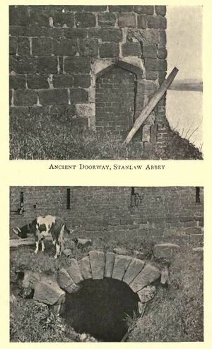
The abbey is located at the north-eastern end of Stanlow Point, a low-lying promontory projecting into the River Mersey and now severed from the mainland by the Manchester Ship Canal. The monument includes both upstanding and buried remains of the monastery and the grange which succeeded it. Because the monastery and grange buildings were later incorporated into now demolished post-medieval farm buildings, the exact interpretation of the upstanding remains is uncertain but they retain a range of architectural features which identify them with the core buildings of the monastery. These upstanding remains include a sandstone wall running east-west across the site; this is two courses thick and stands 1.5-2m high and was latterly used as part of the north wall of the farmhouse and adjacent buildings. At the western end of this wall is a re-used medieval doorway 1m wide. A second sandstone wall runs north-south across the site, slightly apart from the farmhouse and at an angle to it. This wall is up to 3m high and was latterly used as the west wall of farm outbuildings. Amongst other buried features, the monument includes a tunnel cut into sandstone and running west to east. This is lined with 4 courses of sandstone blocks and formed part of the main drain which led to the River Gowy. Some dressed sandstone from the monastery was re-used in the post-medieval farm buildings and is visible in the ruins of the outbuildings. There is a revetment wall on the eastern side of the promontory constructed of re-used sandstone. Antiquarian sources record that a circular rock-cut crypt containing lead coffins and bones was revealed by flooding, although the exact location of this is now unknown. They are described as follows:
- "scattered about are various stones, which have been carefully carved ,and four beautiful old circular columns now support the roof of a cow-house. One of the walls, in which is an ancient doorway, is still standing, and in the centre of the farm-yard is a subterranean passage, hewn out of the solid red sand-stone, passing under the buildings and emerging over 45 yards, close to where the Gowy falls into the Mersey. An other passage, which, however, the present writer did not succeed in finding, is said by Ormerod to have led to a small circular apartment, hewn also out of the solid rock, which was not discovered until a furious storm burst in upon it, and laid bare the chamber containing numerous bones and several leaden coffins. At the present day bones are still found when gardening operations are in progress, showing that Stanlaw was a favourite place of burial, and that a considerable God's acre was attached to the abbey."
The abbey ruins and the mouth of the Gowy are not accessable as they are in the midst of a huge refinery complex noted for the production of the contents of Hoole's Acid Tar Lagoon and the anti-knock agent tetra-ethyl lead. The lowest point on the Gowy which can be visited by car is where it crosses the A5117. It is possible to cycle or walk down Oil Sites Road to see the Gowy, or to take a train to Stanlow and Thornton which is the least used railway station in Cheshire, and in 2018/19 shared with Denton the position of least used station in Britain. Although it is theoretically accessible by foot, it involves a long walk from either Ellesmere Port, Ince or Elton and there are only three trains a day.
Conclusions: What the River Wrought
Each of the major rivers of Cheshire has been modified by the hand of man. The River Dee is the most regulated river in Europe. The Mersey has effectively become the Manchester Ship Canal. The Weaver was the home to an important part of the early industrial revolution. Each of these is conspicuous either for its water traffic or for the engineering works that have provided their crossings, be they bridges or tunnels.
The Gowy sits perhaps a little lost in the shadow of its sisters. It flows through no major town, and its impact is easy to overlook. The farmlands of its upper reaches made the Tollemaches rich though the river is seldom seen now that the waters have been drawn away to the Potteries. It flows inconspicuously through the valley that provides the railway and canal cutting which pierces the Sandstone Ridge and which is guarded by Beeston Castle. Heading towards the sea, its plain was home to the Cheshire gentry who fought out their battles in the Civil War often within families. Before its final fate in the depths of a refinery tank-farm it was the subject of a major fracking debate. At its mouth lie the scant and isolated ruins of an abbey where the de Lacy's tried so hard to be remembered. Allmost all of its many mills lie silent.
But look closer and the river is revealed. Three mills still turn and two grind corn, otters have returned and the "Roman" bridges have survived. The course of the Gowy can be walked in 2-3 days and each stretch of it has something of interest to find.
Related Pages
Other Cheshire Rivers
- River Dee Upper Reaches;
- River Dee Middle Reaches;
- River Dee Lower Reaches;
- River Dee Hilbre Island;
- River Weaver (see Vale Royal);
- River Mersey;
- Canalside;
- Canal and Boatyard;
- Water Supply;
- The Permo-Triassic Sandstones of west Cheshire and the Wirral: BGS;
- Glacial Britain;
Sources and Links
- Geodetective: a well-researched and well documented study of the River Gowy;
- The River Gowy: on CheshireTrove - another brilliant guide to this river;
- River Gowy on Wikipedia;
- The River Gowy: by David Ackerley;
- Craig Thornber: on THORNTON-LE-MOORS, STOAK & STANLOW ABBEY;
- AERIAL ARCHAEOLOGY AND THE EVIDENCE FOR MEDIEVAL FARMING IN WEST CHESHIRE;
- Landscape History Discoveries in the North West;
- The Gowy from Source to Sea: "One Man's Walk Along a Cheshire River Passing by Peckforton, Beeston, Bunbury, Hargrave, Huxley, Tarvin, Plemstall and Guilden Sutton" (2002) - out of print;


