Beeston Castle
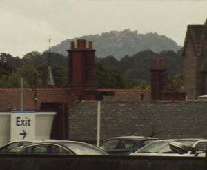
"All too obviously defending the county from England rather than Wales", Beeston Castle is familiar to anyone who has taken the Crewe-Chester railway or navigated along the nearby Shropshire Union Canal as an impressive ruin atop a steep and isolated rocky hill in the midst of the mid-Cheshire Sandstone Ridge. Leyland (as reported by Camden) records the remarkable prophecy that Beeston Castle will rise again to its former splendour and there is a common saying "that it should save all England on a day".
There is evidence for Neolithic, Bronze Age, Iron Age and (some minor) Roman activity on this site. The castle visible today was built in the 13th century with Civil War additions. Started in 1220 by Ranulf of Blundeville, the Earl of Chester and in medieval documents the castle is described as Castellum de Rupe, the Castle on the Rock. The building material consists of red sandstone. It was altered during the late 13th-early 14th centuries by Edward I. From the mid-fourteenth century the castle fell into disuse and by the 16th century it was ruined. It was neglected until the Civil War, when it changed hands twice between the Royalists and Parliamentarians. Partial repairs were undertaken in 1643 and it was partially demolished in 1646 by the Royalists.. The demolition of the castle sealed a large group of Civil War finds, among them fragments of a jack of plate armour, a collection of spurs, and a major group of clay pipes. Later in the seventeenth century the Outer Gateway was reoccupied for a short period. Many traces have been recorded of the nineteenth-century fair held annually on the hilltop. The gatehouse is mid to late 19th century with 20th century alterations and additions.
View
The steep walk to the castle's highest point, 359 feet (107 meters) above the Cheshire plain) is rewarded with what must be one of the finest and most dramatic views in the country - from the Welsh mountains in the west to the Pennines in the east. In very clear conditions it is just possible to make out Pendle Hill (fifty miles to the north). The dramatic location, on the cliff top of an isolated hill, is usually described as defensive, although such a position actually makes the castle very vulnerable to being besieged by a small force.
Link to panoramic view.
Pre-historic site
Evidence for early human activity on the site is provided by worked flint tools dating to the Neolithic period (3500–2000 BC). A neolithic flint arrowhead (found in 1916 by Sir George Windum on the SW slope of the castle and given to the then Duke of Westminster from whom it is reported to have been stolen in London) shows that people were visiting the site at early dates. There is also some evidence for early Bronze Age (c 2000–1500 BC) burial mounds and funerary material from the lower part of the crag, suggesting that it had ritual significance. Among the most significant finds are two copper-alloy socketed axes that had seemingly been deliberately buried beneath the earthwork bank. They almost certainly represent a votive offering, or were used for ritual purposes.
Archaeological excavations have revealed the remains of a Bronze Age community living on the Beeston crag from about 800BC. Evidence first came to light in 1978 when a socketed Bronze Age axe was discovered on the crag. Archaeological excavations have uncovered some evidence for bronze casting in the form of objects such as moulds and crucibles. In addition to the metal finds, numerous fragments of prehistoric pottery (which may have been used to transport salt) and post-holes were uncovered showing the site had a long history of occupation. The evidence of metalworking and salt transport can be taken to indicate long-distance trade.
Further excavations have discovered the remains of a late Bronze Age/Iron Age hill fort. These are hard to detect - being most evident on either side of the gatehouse to the outer bailey. During the early Iron Age (c 650–450 BC) the existing bank was enlarged and given an accompanying external ditch to create a large defended enclosure. In the later Iron Age (c 450 BC–AD 40) a substantial earthwork bank, strengthened with stone rubble and topped with a wooden palisade, was built. It is believed that some of the mediaeval walls are built using existing earthworks. The hill fort was probably abandoned by the beginning of the Roman period. Roman pottery has been recovered at the base of the hill, but there is little other evidence for Roman occupation.
The absence of occupation on the crag from the Roman period to the 13th century seems at odds with the otherwise long history of the site, but this ‘abandonment’ may be more apparent than real. Paleobotanical evidence suggests the regeneration of woodland on the crag in the Saxon period and it is worth speculating whether this woodland was connected with a place of pagan worship. Study of place names and field names might contribute information here.
Ranulf de Blondeville
There is no clear military reason why Ranulf should have built a castle at Beeston. However, in 1220, Ranulf had just returned from the fifth crusade and was not on the best terms with the then king, Henry III. It could well be that the castle was a political statement showing the king how powerful Ranulf was. Beeston therefore stands as an example of how castles on the English border with Wales should not automatically be interpreted as fortresses connected with frontier defence. The castle stands to the east of Chester, rather than in the west of the county, which was more vulnerable to Welsh incursions. Camden records that Leyland describes it as follows:
When Ranulph from Assyria return’ d with victorie,
As well the neighbour Nations to curbe and terrifie,
As for to fense his owne country, this famous Fort he rais’ d,
Whilom a stately thing, but now the pride thereof is raz’ d.
And yet though at this present time it be in meane estate,
With crackes and breaches much defac’ d, and foulie ruinate,
The day will come when it againe the head aloft shall heave,
If antient prophets I, my selfe a prophet, may believe.
Ranulf designed Beeston castle as two parts. On top of the crag he cut a great ditch through the rock to create the inner bailey, a relatively small enclosure which, with its walls, towers and gatehouse, and with precipitous cliffs on three sides, was the most secure part of the castle.
On the lower slopes he created the outer bailey whose walls and towers followed the contours of the ground and which had another massive gatehouse, fronted by a ditch, at its entrance. Ranulf's innovative design differed from most other castles of the day in that were dominated by a huge tower or 'keep' that acted as the main stronghold of the castle. Beeston had no keep, instead small towers projected from the walls which allowed defenders to fire across the faces of the walls. Another innovation was the provision of powerful gatehouses at each entrance designed to protect the most vulnerable parts of the castle and provide a refuge if the walls were breached. The design of the gatehouse has close affinities with that built by Ranulf’s powerful Welsh neighbour, Llywelyn the Great, Prince of Gwynedd (c 1173–1240), at Criccieth (Gwynedd) and with Castle Roche, near Dundalk (Ireland), and so is part of a group of structures attesting to changing trends in castle design. The defences built in the 1220s by Ranulf also belong to a period when the design of gatehouses became more complex, and the defences and domestic buildings began to be located in the outer ward.
Ranulf was heavily influenced by the defenses he encountered in Turkey/Syria during his time on Crusade. In particular the castle bears heavy resemblance to the fortress at Sahyoun (described as the most impregnable Crusader fortress and in name associated with the Hebrew root ṣiyyôn ("castle")). It is possible that the castle provided the inspiration for the fictional castle of Sir Bertilak in the late 14th-century Middle English poem Sir Gawain and the Green Knight. If so, this further underlines the importance of Beeston in the medieval period.
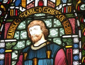
Ranulf died in 1232, long before the construction of Beeston was complete. His successor John Canmore inheirited Beeston, but John, too, died soon after (1237), and the castle passed to the crown. Henry III used Beeston as a garrison and prison during his wars in Wales. Even after this programme of works, Beeston probably never received a full suite of domestic buildings. Instead, all the accommodation and services were concentrated in the gatehouses and curtain-wall towers.
Edward II strengthened the defenses. Between 1301 and 1360, extensive alterations were made to Ranulf of Blundeville's original design for Beeston. Over a total of £109 2s 4½d was spent on works, indicating more than routine maintenance. Volume 59 of the Translations of the Lancashire and Cheshire Record Society (1910) records that the Master-mason in charge of all the masons working at the castle was one "Master Warin". Warin, was the family-name of the Mainwarings or ‘Mein-warins’ as the name was sometimes spelt in the Middle Ages. A "Roger de Meinwarin" witnessed Ranulf of Blundeville's instruction to his barons regarding the founding of Dieulacres abbey in 1214. (According to the Dieulacres chartulary, "Roger de Menilwarin" also gave the monks of Dieulacres “free common in his wood of Pevere (Peover)” and other valuable privileges). The Mainwarings derived their name from the River Guarenne or Varenne and the small town of that name near Arques in Normandy. The name was anglicized to Warenne or Warren, Warin, and later Waring (there are a great number of variant spellings). Main-waring means the house of the Warings (Peover) in Cheshire.
Richard II's treasure
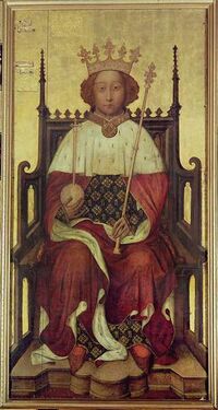
Local legend holds that Richard II hid his extensive Royal Treasure hereabouts before sailing to Ireland to quell an uprising in 1399. Richard never reclaimed his treasure as he was captured, upon his return, at Flint by Henry Bollingbrooke (Duke of Lancaster, and later Henry IV) and imprisoned at Chester Castle for a while in 1399. Many attempts have been made to find the "treasure" over the years and none of them have been successful. Stories have suggested that there are "secret" passageways leading from the well to a nearby farmhouse, a possible escape or re-supply route if the castle was under siege. Local legends place the treasure at the foot of the castle well (said to be around 365 feet deep - an impressive feat of mediaeval engineering) or in passages running off the well. There is a document from the 16th century which suggests that some of the priceless artifacts included a gold quadrant in a leather case, a white helmet of St George, white hart brooches, cups and jewellery.
Attempts to probe the well (including those using sophisticated electronic measuring devices) revealed at least 3 passages, but no treasure, though investigators conjectured that a fourth passage remains to be investigated. It was widely accepted in the Middle Ages that the gold was guarded by demons and that "anyone that goes down the well will be struck dumb or go mad". There are however many local caves and so it is just possible that a treasure is hidden in the vicinity: although most of the caves are the result of rather too recent quarying. It has been suggested that historical records show that Henry IV actually reclaimed gold from Beeston Castle during the c15th, and indeed Richard II did commonly hide treasure in castle wells. Over the last few decades the Cheshire water table has fallen dramatically and even the deep, historic, crag-top well at Beeston Castle is dry.
Civil War
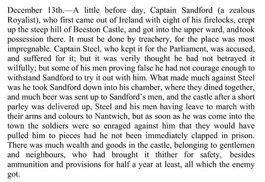
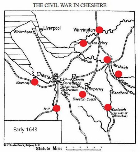
The castle was brought back into military use during the Civil War when Parliamentarians under Brereton seized the castle in February 1643 and made some repairs to the fortifications. In the early hours of 13 December 1643 a very small party of Royalists ("eight firelocks") under Captain Sandford took the castle. The most probably route into the castle was by a difficult climb at the east end of the north face from a point just below the northern opening of the great ditch.
The governor of the castle (a Captain Steel) was at the time in his lodgings in the lower ward and the attack cost him his life, for while he was allowed to march his garrison of 80 out with colours flying, the "War Council" at Nantwich decided he was a traitor and had him "shot to death" (on Tinkers Croft by Bunbury parish church). An alternative view of these events is that Steel actually let Sandford into the castle and thus he was justly shot.
What makes the story even more complicated is that when James Hall was preparing his "History of Nantwich" he discovered that the main account of it may have been a "fake". The diary of Edward Burghall, then the Puritan schoolmaster of Bunbury who supposedly records the fate of the unfortunate Captain Steel of Beeston Castle in 1643/4 had always been taken as a primary source. However parts of the supposed "diary" are a virtual copy of the diary of Thomas Malbon of Nantwich (actually written in 1651) and Edward Burghall (who died in poverty in 1665) is essentially a forger as regards parts of his supposed diary. See Hall's Memorials of the Civil War for a comparison between the two works.
A Royalist garrison remained in the castle until 15th November 1645 when, after a long siege, they were forced to surrender. The garrison had seen the defeat of the Royalists at nearby Rowton Moor at the end of September and Captain Vallet, Governor, and his 56 men were not only occupying a site of little benefit but were also starved out. By this stage the garrison had apparently been forced to eat any cat which strayed within their grasp. The victorious Parliamentarians found that:
- theire was neither meate, Ale nor Beere found in the Castle, save only a peece of Turkey pye, Twoe Bisketts, a lyve Peacock and a peahen.
The fall of Chester followed in February 1646 and (as Henry Vaughan wrote)...
- prsentlie afterwards command was gyven and warrants sente to thee sev'all p'ishes of Bunbury, Tarporley, Wrenbury and Acton and some other places and Townshipps neerest adoiyning fflor the pullinge downe and utter defacinge of Beeston Castle, wch before Whitsunweeke 1646 was p'formed. Onlie the Gatehouse in the lower warde, & pte of some Towers in the higher warde, weire lefte standinge wch scythens are pulled down & utterlie defaced.
After the Civil War
After the Civil War, between 1703-22 a George Walley was living in the outer gatehouse. Ownership of the castle eventually passed by marriage to Sir Thomas Mostyn (1651–c 1700), a Denbighshire gentlemen.
In the 18th century the site was quarried for rock, and the outer gatehouse was partly demolished to allow carts to come and go from the quarry site. Well after the Civil War the Buck Brothers engraving shows much more of the inner ward still standing than presently survives and so it might be assumed that stone was "robbed out" from the castle. Nevertheless, the crag increasingly became valued as a ruin, and the castle provided inspiration for Romantic artists and painters, including J. M. W. Turner. In 1840 the Peckforton estate (which included Beeston Castle) was bought by the landowner Lord Tollemache(1805–90), later 1st Lord Tollemache of Helmingham. As the estate lacked a suitable residence, in 1844 Tollemache commissioned the architect Anthony Salvin to build a Gothic mansion, Peckforton Castle, on the hillside to the south, as a "re-creation" (or sorts) of a castle of the time of Edward I. Beeston’s ruins were an integral part of Peckforton’s landscape and were intended to provide a ‘view’ and talking point for Tollemache and his guests. Much consolidation work took place during this period, including repairs to the outer curtain wall. Fir trees were planted in the outer ward to complement the estate planting around Peckforton.
The 19th century saw the castle develop as a tourist attraction, chiefly facilitated by the opening of the Chester to Crewe railway in 1846. Two years previously the castle had been the setting for the first Beeston festival, which became an annual two-day event, drawing thousands of people. The present castle ticket office and the stone wall around the base of the crag were built in 1846. The wall also acted as a boundary for the deer and the kangaroos that were, somewhat surprisingly, kept on the site. After 1945 the current Beeston Castle fête was established, and it continues to be held on every August Bank Holiday.
For some years after World War II, the fete was associated with the "Beeston Castle Hill Climb". It has been described as follows:
- Perhaps in those days, that was the biggest attraction for some folks. It was organised by the Nantwich Motor Cycle Club and drew riders from far and wide. A swath of bracken, several yards wide, was cut away up the side of the hill which faces Mr. Geoffrey Winward’s farm. The rider who could make his way without stopping, right to the top of the course, was the winner. As I recall it the rider’s feet were not allowed to touch the ground once he had set off, otherwise that was counted as his "distance". Derek ("Blaster") Bates, the well known demolition expert, gives a very amusing account (if somewhat Anglo-Saxon language) of his experiences of the "Hill Climb", for, to improve his chances, he reputedly fastened some home made rockets to his motor cycle. On taking off, his machine did exactly that!! - leaving him with some nasty leg burns.
Beeston was taken into state guardianship in 1959 and passed to English Heritage in 1984. The present concrete bridge leading to the inner ward was constructed in 1975 to improve access.
A Guide to the Beeston Site
An enterprising local land-owner has set up a "pay and display" near the castle. This has nothing to do with English Heritage. It is also possible to find parking by the roadside.
The entrance gates to Beeston look authentic, but they are Victorian additions, set at the base of the hill. This ticket office, which resembles the medieval inner gatehouse, and the stone wall around the base of the crag were built in 1846 by Lord Tollemache, then owner of Beeston. A little museum housed in a modern extension of the gatehouse retells the castle's story through a display of models based on archaeological surveys and also a selection of artefacts including flint arrow heads dating from the Neolithic period; bronze age axe heads; funeral urns; loom weights and lead shot dating from the end of the castle's active life.
From there, visitors have to walk up a fairly steep incline, through extremely impressive stone walls that encircle the site. The outer ward was defended by a masonry curtain wall with eight projecting D-shaped towers. Some are ruinous with only their ground plan remaining, whereas others are better preserved. These towers are believed to be located on the site of a much earlier Iron Age earthwork. Originally each tower had at least one upper storey above the level of the curtain-wall battlements. The tall square tower next to the outer gatehouse was probably built in the late 14th or early 15th century, but its purpose is uncertain. In a hollow diagonally opposite the tower is one of the castle wells. The outer gatehouse was the entrance to the medieval castle. The outer and inner gatehouses at Beeston were probably the first parts of the castle to be built by Ranulf, Earl of Chester, in the 1220s. The outer gatehouse was probably twice the height of the surviving remains. From outside, the most obvious features are the two rounded towers that originally framed the entrance passage.
A trail leads up an open hillside to the castle itself. At the end of the track leading up the crag, a great rock-cut ditch, dating to the 1220s, separates the outer ward from the inner ward. In the 13th century the ditch was crossed by a bridge, probably made of wood and supported in part by a pillar of rock. This pillar was left in place when the rest of the ditch was quarried and can still be seen beneath the present bridge (built in the 1970s). The large jumble of masonry beneath the bridge is all that is left of a causeway built when the inner ward entrance was remodelled in 1303–4. A modern footbridge crosses the ditch and leads through a large gateway into the castle courtyard. The inner gatehouse, probably the first structure of the castle to be built, was the most important building at the castle. It probably provided accommodation for the constable, who managed the castle on behalf of the lord or king. Two towers enclosing the entrance passage contained ground-floor chambers, with a single room for the constable’s accommodation at first-floor level extending across the length of the building. The supports for the wooden floor can be seen in both towers. The inner ward curtain wall survives to its full height to the east of the inner gatehouse, where five battlements survive. Beneath the parapet are six square holes for the wooden beams of a hording – a defensive gallery from which missiles could be dropped onto attackers in the ditch below. No evidence has been found for any major buildings such as a great hall or kitchens in the inner ward. Its interior is rocky and uneven, suggesting that the castle was never finished.
Most of the castle remains inside the courtyard are ruinous, though the well cut straight down into the rock is impressive and probably one of the deepest wells of any castle in England, was first recorded in the 1230s, indicating that it is contemporary with the earliest phase of building.
The castle sits in 40 acres of woodland park which includes miles of paths. The woodland trail takes visitors on a circular route through the woodland around the base of the cliff. The route moves into the pinewood forest which dates back to the 1850s and from which the castle becomes visible. The path then emerges near the ‘Robin Hood Cave’ – a location used by movie stars Patrick Bergen and Uma Thurman in their 1992 movie. It is believed that the "caves" were created during stone quarrying in 18th Century. They are also known as "Beresford's Caves" (according to the 2007 guidebook) "supposedly named after a local inhabitant who made a living from quarrying sandstone. The stone was so soft that it could be easily crushed and and the resulting sand was used as an early form of industrial sandblasting for cleaning the hulls of canal boats".
In 2012 a pair of lesser horseshoe bats were discovered during a hibernation check by the Cheshire Bat Group in these extensive (and now barred-off) caves that run beneath Ettiley Hill, immediately below Beeston Crag. The species was last recorded in Cheshire in 1948. There are also a large number of common and soprano pipistrelles as well as somersaulting Natterer’s bats.
Pets are welcome on the castle grounds, provided they are on a lead. A variety of Cheshire birds can be seen, including owls, sparrow hawks, buzzards, kestrels, wrens, woodpeckers and more. The café offers outdoor seating and serves a wide range of hot and cold drinks as well as snacks. Among the café’s specialties are bacon sandwiches. Picnics are also possible - in addition to convenient grassy areas, there are also picnic tables available.
There are reports of "supernatural" events: staff at Beeston Castle have reported seeing a shadowy figure standing by the inner ward gates, lights flickering on and off and hearing knocking on the walls. Visitors have also reported strange events from the caves - claiming to have seen light in their depths and a woman on a rocking chair barring them entry!
At the time of writing (2018) visitors have complained about the cost of parking and the entry charge. A few people have had the problem that they have paid for parking and then found that the castle was closed: given that, it may be worth checking that they are open before visiting. Also, given that a major part of any visit is the view, it is worth checking on the weather to avoid what some might consider an expensive dissappointment.
Related Pages
- Cheshire Castles: the string of defensive castles alon the English/Welsh border;
- Civil War: Beeston was an important fortress in the siege of Chester;
- Ranulf de Blondeville: Earl of Chester and founder of the Norman castle;
- Gowy: rises nearby and flows off to Liverpool bay - a short river with a lot of history;
- Royal Treasure: Richrd II's treasure and Beeston;
- Battle of Hoole Heath: more on the Civil War;
Sources and Links
- Beeston Castle unofficial website;
- History of Beeston Castle: English Heritage;
- Beeston Castle listed building record;
- English Heritage - History of Beeston Castle;
- Beeston Castle on Wikipedia;
- Beeston Castle at CastleFortsBattles;
- Beeston Castle at CheshireLive;
- Beeston Castle at Britain Express;
- Beeston Castle, Cheshire: Excavations by Laurence Keen & Peter Hough, 1968-85;
- Megalithic Portal Beeston Castle - Hillfort in England in Cheshire;
- Beeston in context J Chester Archaeol Soc, new ser 81, 2006, 65–82;
- Mid Cheshire Ridge Geology;
- Geology and Warfare - Examples of the Influence of Terrain and Geologists on Military Operations;
- The Sandstone Ridge;
- Beeston Castle at Discovering Britain;
- Gatehouse - very good for links;
- Nooks and Corners of Lancashire and Cheshire;
- The Antiquities of England and Wales Displayed by Henry Boswell (1795) contains a fair description of the Castle - and can be downloaded as a free "e-book";
- Redefining the Significance of Beeston Castle, Cheshire ;
- ‘Gateways to Power: The Castles of Ranulf III of Chester and Llywelyn the Great of Gwynedd’;
- Hall's Memorials of the Civil War;


