Hoole
Overview
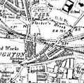
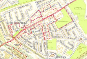
Hoole is one of the largest neighbourhoods in Chester. Situated roughly a mile north-east of the city centre, Hoole starts from the Hoole Railway Bridge and runs all the way up Hoole Road (A56) to the Hoole Hall roundabout, where the M56 motorway starts.
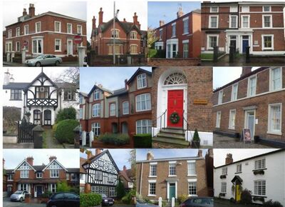
It is a popular residential neighbourhood. Much of the current housing stock consists of Victorian terraces of houses and villas, and semi-detached houses dating from the 1930s. In the 1960s and 1970s, Hoole declined into genteel decay. Some of the larger properties were divided into bedsits and small flats to provide housing for students and the unemployed. Since the mid-1990s, the area has once again become desirable. The large Victorian villas are being restored to their original purpose as family homes. One reason for Hoole's popularity is its proximity to Chester Station - ideal for commuters.
Hoole has a thriving History and Heritage Society - whose website is well worth exploring and provides much more detail than is provided here. Local news can be found in the Chester Chronicle.
A Brief History
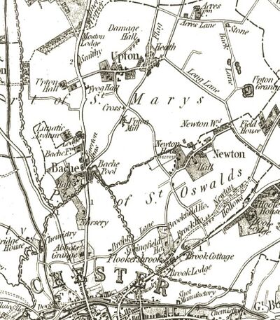
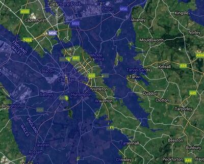
In terms of geology Hoole sits on a low sandstone ridge which extends from Chester Zoo, through Upton to Hoole, and then on through Boughton, Christleton and Rowton to Beeston Castle. Northwest of Chester, between Moston and Backford, the ridge is cut through by a glacial melt-water channel which the canal to Ellesmere Port conveniently uses to avoid any need for locks: a good example of geology causing geography and geography influencing Human activities. The Chester canal follows the line of this ridge south-east to gain altitude and reach the long pound (a stretch of canal without locks) south-east of the City. The rock is overlain with a bed of sand and on the slopes of the low ridge this sand is covered with a layer of boulder-clay. In places the sand bears water - and on the edges of the impervious clay cap-layer springs may form. The free-draining sandy soil on the top of the ridge gives rise to "heath" formation and there are many examples of "Heath" place-names along the ridge, especially on the windward side. There are also a statistical excess of "ton" place-names along the ridge, indicating how the underlying geology influenced the pattern of settlement by the Anglo-Saxons.
The ancient village of Hoole dates back to at least 1119, when it was first recorded in the records of the Chartulary of the Abbey of St. Werburgh. It remained a separate entity until 1954, when it was incorporated into the City of Chester.
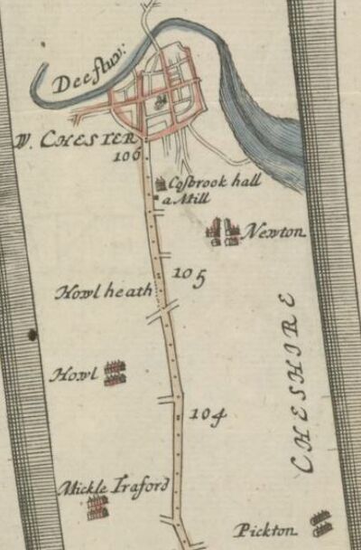
Hoole lies on the Roman road which leaves Chester via Frodsham Street and Brook Street, continuing through Flookersbrook into Newton Hollows, which still exists as a sunken pathway and connected with Mannings Lane before the construction of the now disused railway. Mannings Lane then continues the line through Hoole Bank, and it becomes known as "The Street" (very clear in early ariel photographs) in Mickle Trafford, a "Street-Ford" name which frequently denotes a Roman road. The name "Hoole" is thought to mean 'at the Hollows' (or hole) and most likely refers to the 'hollow way' formed by the road. The modern Hoole Road follows a parallel course. "Hoel" means a "paved way or road" in Welsh, and this could be the origin of its name. There are Roman remains in Hoole in the form of a "marching camp" next to Hoole Hall in "Burrows Field". A further, possible Medieval trackway, runs right past the site of this camp and could be the origin of Hoole Lane.
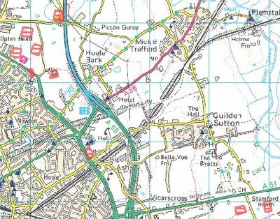
Flookersbrook is where cattle were watered on their way to the market in the city and for many years was the boundary of the City of Chester. A local cattle market was held at the "Ermine" upto the end of the 19th Century.
- History of Hoole Bridge - fascinating stuff!;
Plegmund
Historically, Hoole was in in the parish of Plemonstall, the "place of Plegmunds well" which can still be seen today. Little is known of the early life of Plegmund except that he was of Mercian descent. He was Archbishop of Canterbury in the years 890-923.
A later tradition, dating 300 years after his death, stated that Plegmund lived as a hermit at Plemstall in Cheshire. His reputation as a scholar attracted the attention of King Alfred the Great, who was trying to revive scholarship. Some time before 887, Alfred summoned Plegmund to his court. There he worked with three other scholars, Wærferth, Bishop of Worcester, Æthelstan and Wærwulf in working on translating Pope Gregory the Great's treatise "Pastoral Care" into Old English.
The bounds of Hoole Heath were described in 1339 as extending from:
- "the yate called Chester yatem nygh Flokersbroke, and so folloyng Wysnaysich nere a cet’eyne place wher a grange of the p’sons of the Church of Plemondestow sometime being…neare Hogheshey a’ynst Pykton Dale unto Saltesway, which is the Kyng’s Highway ner Chest’r…and so flooyng….unto Sasse Diche, and so unto the town of Newton…" (cited in Hanshall 1817)
It is quite difficult to translate that into modern English! - it seems to suggest the boundaries ran from Flookersbrook at Boughton out towards Plemstall, over towards Picton and then then back down Newton Hollows. What this means is that most of Hoole as it is today appears to fall within the bounds of "Hoole Heath".
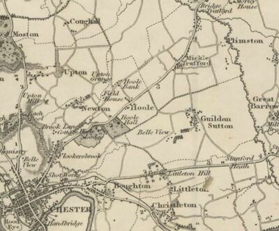
Some of the lands in Hoole passed into the possession of the church. There exists evidence in the form of a quitclaim by Robert, son of Herbert de Hoole of a transfer of land to Simon the Abbot and the Abbey of St Werbergh (1284-1288). This may be the origin of the name "Bishopsfield" on some maps, and "Bishops Ditch" as a name used for a part of Flookersbrook in the past.
The Valley of Demons
Early tourists were somewhat disparaging: in De Laude Cestrie ('Of the Praise of Chester') written around 1195 by Lucian the Monk in the cloisters of Chester Abbey, we read:

- Hec cum ita sint, ut dicamus pauca que restant: intendat Cestriae habitator, exeunti portam orientalem, qualiter ei trinus uiarum trames aperitur et pulcra super locorum uocabulis, que se offerunt, consideracio inuenitur; nec solum pulcra, set etiam iocunda. Nam progressus paululum a ciuitate si directus incedit, statim a fronte uenientem locus excipit, quem nominant Villam Christi; si uero flectit ad dexteram alter locus, quem uocant incole, Veterem Vadum; si autem uertitur ad sinistram, uenitur ad locum, quem de latibulis insidiantium, recte dicunt Vallem Demonum.
- "The native of Chester remembers how three roads branch off outside Eastgate and how beautiful and pleasing are the names of the places to which they lead. The road straight in front leads to Christ's Town (Christleton), that on the right to the Old Ford (Aldford) but if it turns to the left it comes to a place which they rightly call the Valley of Demons (Hoole) with reference to the hiding places of those who lie in wait... the wanderer... is despoiled by thieves and robbers" ---Lucien the Monk
Lucian the Monk at the Abbey of Chester (now the Cathedral has the distinction of being one of the first ever writers of a "guidebook" to anywhere in England outside of London. There are earlier descriptions of York and Durham. However he is sometimes short on detail - we cannot be sure which road junction he is referring to in his description reproduced above - is this outside the Eastgate at the branch of Frodsham/Foregate/St John streets? or the junction at Boughton? This not a simple puzzle, in the 1370s, after Lucien was writing, one source holds that the road to Hoole left Chester by the Northgate and turned right along Bag Lane (later George Street) ot St Annes Street, and only later did the route go from the Eastgate. An alternative source refers to the removal of a gate from the Kaleyards to what is now Frodsham Street in 1323. The road was realigned through the villages of Hoole and Mickle Trafford when it was turnpiked as far as the existing turnpike at Warrington in 1786 (it was disturnpiked in two parts in 1870 and 1883). Also, prior to the construction of the Groves, it would not have been possible to get from Eastgate to the Old Dee Bridge without re-entering the city. If Lucien is referring to Boughton, then he does not mention the old Roman road which was in use at his time as an important saltway from Northwich. It it probable that in describing road geography outside Eastgate, as in other places, Lucien distorts geography into allegory.

The fear of robbery probably stemed from the fact that Hoole Heath had been granted by the Earl's of Chester as a sanctuary for criminals who had fled to the Palatine county of Chester. Hugh of Avranches established three "asyla" in Cheshire. These were at Hoole Heath near Chester, Overmarsh near Farndon and Rud Heath near Middlewich. These were places to which a felon from any place in the country (or Wales) could flee and seek the protection of the Earl. The sanctuary at Hoole Heath may well be the reason for the bad reputation of Newton Hollows. Hemingway describes them as follows:
- These sanctuaries were the source of much emolument to the earls, who received fines from all such persons when they came to reside under their protection a heriot at their death and in case of their dying without issue claimed their goods and chattels.
Thus we see that the tale of criminals being free if they escaped the "hue and cry" and reached Chester is only partly true. Much later, in the times of Edward II, they were described as follows:
- By an inquisition taken before Hugh de Audelith Justice of Chester on Sunday after the feast of St Peter ad Vincula it was found That a certain large piece of Waste called Overmarsh was in ancient times ordained for strangers of what country soever and assigned to such as came to the peace of the Earl of Chester or to his aid resorting there to form dwellings but without building any fixed houses by the means of nails or pins save only booths and tents to live in.
In in the reign of Edward III:
- The jury declare upon their oaths that the Moor which is called Rudheath was formerly a waste place very anciently assigned and set apart by some of the old Earls of Chester for the reception not of their own subjects but of all fugitive strangers coming to the aid of the Earl's peace either from England or from any other countries And there is an inquisition of the same tenor relative to the other of Hoole Heath.
Earl Hugh is also supposed to be the origin of a rule that during fairs held in the city no felon could be arrested except for crimes committed at the fair. The beginning and end of the fairs was therefore indicated by the suspension and removal of a glove on the south side of St Peter's church (see Gloverstone).
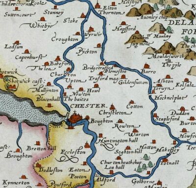
Some later visitors to Hoole were hardly more complementary, as can be seen from the following two reviews:
- Chester Beer Project: The Beehive (now shut);
- Chester Beer Project: The Flookersbrook (now changed hands);];
Saint Anne's Lakes
St Annes Lakes were located roughly where the enclosed wooded areas near the northern end of Hoole railway bridge now lie (they also gives rise to the name of the proposed "St Anne's House" development, and before that to St Anne's street which runs from near Northgate towards Hoole), and was the site of a shrine errected for the convenience of superstitious travelers about to pass through what in medieval times was known as the "Valley of the Demons" (modern day Hoole) and especially Newton Hollows. Some believe that the statue was a re-used work from Roman Chester, whereas others believe that it was not a figure but a cross errected by the "Guild or Fraternity of St. Anne", which had close links with the vicars of St Johns, and was apparently founded in 1361 and refounded in 1393.
Their property included property in Hoole:
- "Possessions of the Fraternity of Saint Anne in the City of Chester." (First Account.) "Rents and farms in the City " Saynt Anne's House with houses, gardens, ftc., demised 12 Feb. 1 Edw. iv. for the term of 100 years. Foregate Strete. Cowlane. Seynt Johns Lane. Estgate Strete. Castell Lane. Iremonger Rowe. Northgate Strete. Parsons Lane. Watergate Streete." The messuages and tenements here mentioned are entered as leased to divers persons for terms of years, at various dates from the reign of Edw. iv." - "Rentes and farms in divers towns called Felde Renttes " Newton. Hole near Chester. Annes Heye near Seynt Annes Crosse" ("Hole" is "Hoole")
The Fraternity of St Anne was so much feared as a wealthy agency supporting ‘superstitious uses’ that in the last year of Henry VIII and the first year of Edward VI two Acts were passed which suppressed all such fraternities, and, conveniently, appropriated their property to the Crown. The Fraternity of St Anne was dissolved in 1547 and their building in Grosvenor Park was purchased by Sir Hugh Cholmondeley and converted into his town house (destroyed in the Civil War).
Together with Mickle Trafford a component of the FitzAlan earls of Arundel's manor of Dunham on the Hill, Hoole descended through the Troutbecks, who purchased it in the early 15th century, and thence by marriage c. 1510 to Sir John Talbot, ancestor of the Talbot earls of Shrewsbury. The earls held Hoole Lodge, then considered to be the ancient manor house, in the early 19th century, and were lords of the manor until the 1930s, although they had ceased to be significant landowners by the 1920s.
In the 13th and 14th centuries the Hoole or Holes family, which included a city sheriff in the 1280s, were mesne lords of the manor and probably resident, though by the late 14th century they had a mansion instead near Chester castle. They are not heard of after the mid 15th century. By the 1450s the Bunbury family of Stanney resided at Hoole Hall, but the house was destroyed in the siege of Chester and the Bunburys sold their Hoole estate in 1757.
The land at Flookersbrook was held by the Massey family of Kelsall prior to 1450 and later passed to the Bruens of Tarvin and the Sneyds before being bought by Sir Lawrence Smith of Hough, 1516–82 (1st MP for Chester 1545). He built the first Flookersbrook Hall, slightly to the north of the present Hall, which remained in that family until just after the Civil War, although the Hall itself was burned down during the Civil War as part of a "scorched-earth" policy by the defenders of Chester. The hall had been rebuilt by 1686 when Roger Whitley recorded dining there in his diary:
- "November 30. Tuesday, I went to Chester with Mainwaring in the coach to meete the Bishop; the rest went on horseback; we met the Bishop at Flooke Brooke; brought him to the Palace; stayd ½ houer with him; went back to Flooke Brook; there was Hurleston, his sonne, Griffith, Minshall, Mainwaring, my sonne, Swetnam, Morgan &c. dined there, parted about 5; went to the Sunne; there we found G.Mainwaring, Edwards, Lloyd, Murrey, Golborne, Ravenscroft; we parted at 10; I lay at Doctor Angells."
Saint Annes lakes were a watering place for cattle and horses, but dissappeared rather quickly at the end of the 19th Century and were replaced by a single drinking trough. The condition of this trough was the subject of much debate. As discussed in local council meetings and reported in the Chester Courant of 12th January 1898:
- The second resolution alluded to section 28 of the Flookersbrook Im- provement Act, 1876. This section said that such power (meaning the power invested in the trustees) should be exercised subject to the condition that ample provision should always be made and maintained by the Trustees for watering horses and cattle at the large pit next the Ermine Inn by means of the streams and waters running into and supplying the said pit. In the plans deposited at the time of the Act the superficial area of the pit was 22,100 feet. This had been reduced to 3,600 feet, and now it had come down to the very modest area of 11 feet. The Act said that ample provision should be made and maintained by the Trustees, and if they considered that the reduction he had mentioned was in accordance with the Act- well he did not. He had seen forty head of cattle drinking out of the pit when it was there, but ever since the present trough had been placed in its position, he could honestly say he had never seen a cow or a horse drinking from it. He had only seen one animal touch it, and that was a dog, who had got into it bodily. (Laughter).. ..Mr. BRADLEY, in seconding, said he thought the matter deserved their serious consideration. He had seen Mr. Brown's man emptying the trough, and the man had almost seemed to collapse during the process. The offal and the refuse he had seen taken out had disgusted him. It would knock a man down at a hundred yards. (Laughter). The supply was useless, and people dare not let their horses and cattle drink at it. It was the talk of the county, and the next thing they would be having would be an epidemic of typhoid.
One theory is that the "Flookersbrook Improvement Act" from 1876 was intended to correct the problems caused by years of a cattle market at the Ermine - what had been a set of elegant lakes had become a watering place for cattle and trod into a stinking morass of cow dung and mud. "Mr Brown" was a member of the Brown family of "Brown's of Chester" in Eastgate Street who had held the mayorality - he didn't want a problem on his doorstep. With Hoole being outside of the City, and the land management being entangled in the complex case of the trustees of John Lightfoot (died 1832), Brown had to find a solution. Just why the cattle market (run by the Pickerings) at the Ermine was so popular remains unclear, although it may have something to do with taxes and by-laws being avoided by holding it there.
Hoole and the Civil War
Hemingway writes how Flookersbrook Hall was burned down on Sunday, November 12th, 1643 by the Royalist garrison of Chester:
- "The day following Mr Whitby's mansion, Bache hall and Flookersbrook hall - Sir Thomas Smith's - were also burnt down lest they might afford lodgements to enemies from another quarter."
During the Battle of Rowton Moor, 24 September 1645, at Hoole Heath, Charles Gerard was attacked by about half of the units of the besieging Parliamentarian army under Colonel Lothian. Thus engaged, Gerard was unable either to attack Michael Jones or support Marmaduke Langdale at Rowton Moor. The Royalist troops heading towards Chester to rejoin with the King later ran into the ongoing fight between Charles Gerard and Lothian at Hoole and even more troops were sent out from Chester to assist. In the confused fighting which followed "as much dispersed as the greatest rout could produce...", Lord Bernard Stewart was killed. It was this last stage of the battle that King Charles watched from the Phoenix Tower.
The battle might well have been called "The battle of the four heaths", as the heathlands along the low ridge provided the hedgerow-free space for cavalry to be active.
Francis Earl of Shrewsbury
Hanshall explains how the township of Mickle Trafford was passed from the Earls of Chester to the Fitzalan's and then to the Troutbeck's from which it passed through an heiress named Margaret to the Talbot's and hence to the Earls of Shrewsbury. This is covered in more detail on the page relating to St Mary on the Hill).
In 1666/7 there was an end to the protracted dispute between, Francis Talbot, the Earl of Shrewsbury and the Mayor and Citizens of Chester. This dispute had gone on since at least 1652 and concerned whether the citizens of Chester had grazing rights on land in Hoole north of Flookersbrook. We find the resolution of this in an agreement (ZA/B/2/156) dated 20th August 1666:
- "Certain proposals were read which had been agreed upon on June 21st last between William Davenport, gent., on behalf of Francis Earl of Shrewsbury, and Thomas Willcocke, Alderman, on behalf of the Mayor and Citizens of Chester, for ending all differences between the Earl and the City. By these proposals the Mayor and Citizens should have the herbage and pasture of that part of Hoole Rake and St. Ann's Rake which had been agreed upon by the said referees. All other persons were to be excluded, except those who lived "within that compasse" and had rights of common there. This area was to be fenced and severed at the charge of the City. The Earl was to allow 20s. at first, but afterwards it should be preserved at the sole charge of the City. At the time of ratifying this agreement the Mayor and Citizens should pay £200 to the Earl for the toll of the Bridgegate, the presentation of the Sergeant thereof and all other profits from the same, and for the costs recovered at law. The Earl should have the "Intacke" on Hoole Rake called "Traffords Intacke" for him and his heirs for ever with freedom to inclose and improve. The Earl should still be owner of the soil to Flookersbrooke, and all offenders and breakers up of soil should be presented and fined at his court as formerly. The Earl should grant liberty to break the soil there only to Citizens and to such as the Mayor should approve. The Assembly unanimously approved the proposals, except the provision about the "Intacks". As it lay within the limits intended to be apportioned to the City, it was thought most convenient that the Citizens should enjoy it with the rest of the commons there."
"Intacke", derived from the Old Norse inntak, was an improvement to land carried out by a few members of the community, by which they brought into use land which was normally unused.
Francis Talbot was a Captain in the royalist armies during the English Civil War and fought at the Battle of Worcester in 1651. Following the royalist defeat there he fled abroad to Europe but returned to England before February 1653/54, the month he succeeded to his father's earldom, when he petitioned the Lord Protector, Oliver Cromwell, to pardon him for all offences against Parliament. He was suspected of complicity in the unsuccessful royalist rising by Sir George Booth in August 1659 in the period between Cromwell's death and the restoration of King Charles II in 1660. Booth mustered five hundred supporters at Warrington in Lancashire and advanced to a rendezvous with Cheshire insurgents at Rowton Heath near Chester. The following day, sympathisers opened the city gates and Booth's rebels occupied Chester. The commander of the Chester garrison Captain Croxton withdrew into Chester Castle with his men and refused to surrender. Lacking artillery, the rebels could do nothing to threaten them. Booth issued a series of proclamations claiming that the insurgents had taken arms to defend the freedom of Parliament. No explicit reference was made to King Charles. Leaving forces to blockade Chester Castle, Booth set off for Manchester with around 4,000 men, intending to make his way to York which, it was supposed, would also surrender to him. The revolt eventually failed when Booth was defeated near Northwich.
Shrewsbury was readily employed in Charles' court. He bore the Second Sword at the king's coronation in 1661, and in the same year was made Lord Housekeeper of Hampton Court and Treasurer and Receiver-General of Ireland. However, he would not prosper for long after settling matters in Hoole.
After his first wife and two young sons had died, Shrewsbury (who had succeeded to his father's titles in 1654) married the "notorious" Lady Anna Maria Brudenell, a daughter of the 2nd Earl of Cardigan, on 10 January 1658. She was twenty years his junior and as for "notorious" we can infer we can infer something more than "a bit of a flirt". On 16 January 1668, he duelled with one of his wife's (several) lovers, George Villiers, 2nd Duke of Buckingham, and was mortally wounded, dying two months later. He was buried at the parish church of Albrighton in Shropshire. Villiers was the son of the "evil counselor" whom Sir Richard of the Grosvenors had identified. Samuel Pepys wrote of the incident:
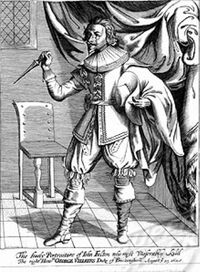
- from the whole house the discourse of the duell yesterday between the Duke of Buckingham, Holmes, and one Jenkins, on one side, and my Lord of Shrewsbury, Sir John Talbot, and one Bernard Howard, on the other side: and all about my Lady Shrewsbury, who is a whore, and is at this time, and hath for a great while been, a whore to the Duke of Buckingham. And so her husband challenged him, and they met yesterday in a close near Barne-Elmes, and there fought: and my Lord Shrewsbury is run through the body, from the right breast through the shoulder: and Sir John Talbot all along up one of his armes; and Jenkins killed upon the place, and the rest all, in a little measure, wounded. This will make the world think that the King hath good councillors about him, when the Duke of Buckingham, the greatest man about him, is a fellow of no more sobriety than to fight about a whore. ... it is said that my Lord Shrewsbury's case is to be feared, that he may die too; and that may make it much the worse for the Duke of Buckingham: and I shall not be much sorry for it, that we may have some sober man come in his room to assist in the Government.
His wife is said to have disguised herself as a page and held Villiers' horse during the duel and afterwards slept with him while he wore the blood-stained shirt he had been wearing when he wounded her husband. Perhaps in order to entertain his mistress in private, Villiers, in 1666 acquired an estate at Cliveden on the Thames .. the same estate where the Profumo Affair erupted.
Villiers also made a contribution to the English language in his satirical play The Rehearsal, 1672. Where he coins a well-used phrase:
- "Now, Criticks, do your worst, that here are met; For, like a Rook, I have hedg'd in my Bet."
Dragoons in Hoole
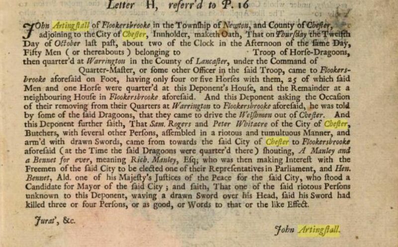
1732 saw a certain amount of unrest in Chester centered around the Mayoral elections - sporadic disorders culminated in a clash in Bridge Street in early October between a Whig mob (allegedly reinforced with disguised soldiers, revenue officers, and Liverpool sailors) and Tory supporters who included Welsh miners. The latter came off worse, and the Whigs, suspecting that Tory aldermen were admitting more freemen after dark, broke into and wrecked the Pentice. The mayor called for dragoons from Warrington to help restore order and appointed c. 270 special constables. Fifty dragoons arrived on foot and according to "a letter from a freeman of the city of Chester to his friend in London" (text here) were loadged in Hoole, with 25 of them quartered at the Ermine (then in the hands of a John Artingstall) and the remainder at a neighbouring house in Flookersbrook.
Kilmorey
There are several streets in Hoole named after the Earl of Kilmorey and places associated with him. The connection to Hoole is through the Hurlestons. Their coat of arms is known from the end of the first reign of King Henry VI of England (c.1460) during whose reign they built Hurlston Hall in Lancashire. According to Foster’s Feudal Coats of Arms, "William Hurleton" bore "four ermine spots in cross". It is depicted (here) as number 6 in Berry's Enclyclopedia Heraldica (volume 3). It almost certainly gave its name to the Ermine.
The Hurleton's of Harleton near Scarisbrick in Lancashire have the same arms. The first mention of Harleton after Domesday is a charter of about the year 1190 by which Robert, son of Ulf de Hurleton, gave to the abbey of Cockersand two acres of his land in Harleton. It appears that they had moved to Cheshire by 1584 (the date of the first burial at Plemstall) possibly due to the marriage of Thomas Hurlton/Hurleston to Elizabeth (1508-1602), daughter of Adam Birkenhead of Huxley. The family purchased the manor of Picton, before c. 1600. According to Ormerod the Hurlestons are said to have increased their estates by the purchase of the adjoining manors of Newton and Wervin as well as the somewhat more distant Edenshaw from Sir Richard Cotton - he having "extorted" them from the dean of Chester.

The Hurlestons are best known from the rather spooky tomb in the graveyard of St Peter, Plemstall. The full inscription of the plaque behind the tomb is given from Ormerod, (see: History of Cheshire p 438), 1819, with the exfoliated parts in brackets:
- "In this vault lies the body of Elizabeth, wife of Charles Hurleston, of Newton esq., youngest daughter and coheir of Thomas Lander, of Newhall, in the County of Lancaster, esq., by Elizabeth, daughter of Edward Downes, of Shrigley, in the county of Chester. esq.) (She was beautiful) in her Person, Distinct in her Behaviour, Dutiful Daughter in her Observance, And had the (.........) long night, A Happy Mother She dyed the 19th of November 17(27), aged 32."
The plaque is surmounted by a heraldic shield which also displays the "four ermine spots in cross". Thus, the "spooky" tomb in Plemstall is the last resting place of Elizabeth (nee Lander), first wife of Charles Hurleston (Sheriff of Chester Nov 1726-Dec 1727) and she was pregnant at the time of her death in 1727. Some have suggested that the fact that the female skeleton is holding an arrow pointing towards her womb suggests the death of an unborn child, but the tomb-chest has been variously dated as 14th Century to c.1670. If the c.1670 date is correct, the carvings may have been made at the time of the deaths of John Hurleston (died Oct 29, 1669) and his wife Anne (died Oct 12, 1669).
Charles remarried but there were no surviving issue from either marriage. Had Elizabeth survived and borne a son it is possible that the male line of the Hurleston's might not have failed. However, following the death of Charles Hurleston in 1734, the last male heir, his estates were partitioned between his three surviving nieces: Anne (1710-86), Mary (1711-63) and Elizabeth (1713-35) who were the daughters of his deceased brother John (1685-1720).
John Needham 10th Viscount Kilmorey (1711-91), was born in Jan 1711 and in July 1737 appointed a colonel of a company of Grenadiers in the 2nd Foot Guards, but resigned Nov 1748. He married Anne (1710-1786), the daughter and co-heir of John Hurleston, of Newton, Cheshire, and widow of Peter Shakerley, on 11th Jan 1738. They had a daughter Mary and three sons: Thomas, died unmarried 1773; Robert, his successor, and Francis, successor to his brother Robert. Anne died on 9 Aug 1786 while John died five years later on 29 May 1791 and was buried at Adderley.
Anne Hurleston's marriage to John Needham meant that her estates in Newton and nearby, which she had inherited from her childless uncle, passed to her husband and then to son, Francis Needham, who was to become the 1st Earl of Kilmorey. Kilmorey entered the British Army in 1762 and served in the American War of Independence, where he was taken prisoner at the Siege of Yorktown in 1781. He also fought in the French Revolutionary Wars but is best remembered for his role during the Irish Rebellion of 1798. He was in overall command at the Battle of Arklow and commanded one of the five columns at the Battle of Vinegar Hill. In 1804, he was appointed Colonel of the 5th Royal Veteran Battalion. He was promoted to colonel for life of the 86th Foot in 1810 and to general in 1812. Francis was succeeded by his elder surviving son, Francis who thus rather unexpectedly became an Earl and a land-owner in Hoole. Anne Hurleston's 4th great grand-daughter was (apparently) Margaret Hilda Roberts, better knowm as Baroness Thatcher.
Ormerod gives the arms of the Hurleston's as having a crest which is an ermine, but his only evidence for this is a memorial at St Peter, Plemstall, which had been destroyed although he has a description of it from Harl MSS 2151.
Hanshall on Hoole
Following his description of how Mickle Trafford pass down through the Fitzalans and the Troutbecks, J. H. Hanshall in his "The History of the County Palatine of Chester" (1817) describes Hoole as follows:
- HOOLE Is vested in the Earls of Shrewsbury in the same line of descent as the preceding township. Hoole Heath was one of the sanctuaries for appointed by the Earls within the Palatinate:- From an Inq 13th Edw III, its privileges are thus noticed: Six citizens of Chester, and six men selected from inhabitants of the county, state, that they had the boundaries of Hole Heath, and they find it to been holden of the Earl of Chester, and his time out of mind; and that in time of war in Wales, all lawful men of the Earl of Chester and all men living in peace of our Sovereign Lord the of England and the said Earl of Chester, were wont have refuge and receipt on Hole Heath "w they goods, necessaryes, and beasts, by an yer and one daye; and that the comynaltie of the cittee of Cest of and of tyme out of mynde ought to have comyn upon Hole Heath to they r beasts in all tyme of yeare and saye also that the mearcs and bondes Hole Hethe do begyn from the yate called Chest nygh Flokersbroke and so folloyng Flokersbroke to Wysnaysich and so folloyng Wysnaysich nere cet eyne place wher a grange of the p sons of the of Plemondestow sometime beyng and so neare that Robt of Whitmore sometyme dyd breke and so folloyng neare Houghshey aynst Pykton Dale unto Saltesway whych is the Kyng's Highway ner Chestr to lede the hooste of our sovreyn Lord the Kyng in tyme of warre unto Shotwyk Ford and so folloyng beyond Saltesway unto Sasse Diche and so unto the town of Newton and unto the yate of Robert the sonne of Cislie Newton whyche sometyme was called the Shepe Yate for whyche yate the said Robert gave money to the Kep r of the Towne of Hole for the tyme beynge and so folloyinge from the s yate by the Old Heyes of Newton unto Flokersbroke." This Inquisition complains that the Abbot of Chester the Whitmores, Bruchulls &c had made inclosures on Hole Heath to the gret hurt and gret exheredition of the easement of the hole citie of Chestr. Hoole is pleasantly situated on a gentle elevation. The Bunburys of Stanney had an estate here before the reign of Henry VI and the seat of their descendants, Hoole Hall, was destroyed during the siege of Chester. In 1757 this property was purchased by the Rev J Baldwin who assumed the name of Rigby. In 1800 it was sold to the Rev Dr Peploe Ward whose son is the present proprietor. There is a handsome brick house with stone facings built by the Rev J Baldwin which was sold together with the land immediately surrounding it to Mrs Fairfax from whom it was purchased by John Oliver Esq. It has recently become the property of Charles Sedgwick Esq. Hoole House built in 1760 is the property of the Rev James Ward who has assumed the name of Hamilton in compliance with the will of his uncle Chas Hamilton Esq It is now tenanted by the Lady of Lieut Gen Sir John Delves Broughton Bart sister of Sir John Grey Egerton Bart of Oulton Park. Hoole Lodge is held by lease from the Earl of Shrewsbury by the proprietor of the last mentioned estate. There are several other pleasant houses in the township.
Sir John Delves Broughton was the eldest son of Sir Thomas Broughton, 6th Baronet, by his first wife Mary (née Wicker). He served in the British Army and achieved the rank of General in 1830. He married Elizabeth, daughter of Philip Egerton, in 1792 - other sources have Elizabeth as coming from the Panton's of Plas Gwyn in Anglesey. They had no children and lived apart after about 1814. Broughton died in August 1847, aged 77, and was succeeded in the baronetcy by his younger brother, Henry. Lady Broughton died in January 1857.
Hoole Hall, Hoole Cottage and Hoole House
Early documentation states that the original Hoole Hall was first occupied by John de Hoole, the Lord of Hoole. Further documentation suggests that Rev Sir William Bunbury purchased the hall in the 14th Century and the family owned it for the next 400 years. During the English Civil War (1642-1647) the hall was burnt to the ground by parliamentarian troops as they advanced upon Chester. Daniel Lysons writes, in his Magna Britannia (1810):
- "The township of Hoole lies two miles NE from Chester; the manor was at an early period in a family of that name afterwards in the Troutbecks from whom it descended with several other Cheshire manors to the present Earl of Shrewsbury. Hoole Lodge the manor house is occupied by Charles Hamilton Esq. Hoole old hall now a farm house is said to have been the abbot of Chester's grange: it is certain that the abbot had an estate here which he purchased of John de Hoole Lord of Hoole in the reign of Edward II but it may be observed that Hoole old hall, now the property of Dr Peploe Ward, was bought off Sir William Bunbury whose ancestor David de Bunbury purchased off the Calveleys certain lands which had been the property of John de Hoole above mentioned. Webb in his Itinerary written in the year 1662 speaks of the pleasant and sweet seat of Sir Henry Bunbury at Hoole. There are also in this township two modern mansions called Hoole Hall and Hoole House the former is the property and residence of Mr John Oliver the latter is the property of Mr Hamilton and in the occupation of Brigadier General Broughton."
2nd baronet Henry Bunbury's first surviving son another Henry Bunbury was the MP for Chester. The Epsom Derby would have been called the Epsom Bunbury if a later Bunbury (Charles) had not lost the toss of a coin to name the race with the Earl Derby. Hanshall states that Henry Bunbury was:
- "..an active loyalist, and had his estates sequestrated by the Republicans for five years, during which period he was closely imprisoned at Nantwich. He was allowed as sustenance only a fifth of the produce of his lands, and when he was set at liberty a fine of £2,200 was levied upon them. His entire loss was about £10,000, exclusive of his Hall at Hoole, near Chester, which was destroyed during the siege of that city."
The 7th Bart added that not only had his mansion house been 'pillaged and burned to the ground ... by the Parliamentary forces when they were besieging Chester in 1645' but his estates were also 'ravaged'. Platt's History and Antiquities of Nantwich states that he had ten children at this time. The 7th Bart also writes:
- "The old hall at Stanney had been neglected during the many years whilst the head of the family resided at Hoole. It was dilapidated and parts seem to have been pulled down. Such as it now was, however, it became of necessity the dwelling-place of the impoverished Henry Bunbury, after his release from prison."
The family appear to have lived at Stanney thereafter.
Hoole House
Hoole House has vanished under modern housing, having been demolished in 1972 and replaced by sheltered accomodation flats also known as Hoole House. In the early 1800s, Lady Broughton transformed her new home with its extensive kitchen and formal gardens. Very late in his life, Thomas Harrison designed a large conservatory, a camellia house and a geranium house. Between 1826 and 1834, Lady Broughton designed and constructed an Alpine garden occupying over an acre of ground - based on the landscape of the Savoy Alps (where "Mont Blanc" is). John Claudius Loudon visited in 1831 and was very impressed; commenting in his "Villa Gardener" that the garden was 'one of the most remarkable specimens of the kind in England:
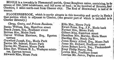
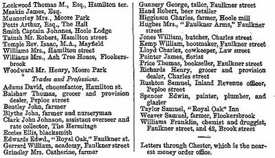
- "The design of the rockwork was taken from a small model representing the mountains of Savoy, with the valley of Chamouni: it has been the work of many years to complete it, the difficulty being to make it stand against the weather. Rain washed away the soil, and frost swelled the stones: several times the main wall failed from the weight put upon it. The walls and the foundation are built of the red sandstone of the country; and the other materials have been collected from various quarters, chiefly from Wales; but it is now so generally covered with creeping and alpine plants, that it all mingles together in one mass. The outline, however, is carefully preserved; and the part of the model that represents "La Mer de Glace" it worked with grey limestone, quartz, and spar. It has no cells for plants: the spaces are filled up with broken fragments of white marble, to look like snow; and the spar is intended for the glacier. On the small scale of our engravings, and without the aid of colour, it is altogether impossible to give an adequate idea of the singularity and beauty of this rocky boundary; and we may add that it is equally impossible to create anything like it by mere mechanical means."
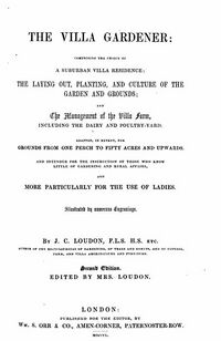
Loudon's description only appeared in 1838, as Lady Broughton initially denied him permission to publish anything. In the "Villa Gardener" (free e-book) Loudon describes how Beeston Castle can be seen in the distance:
- "General observations: Hoole is situated about two miles from the of Chester on the road to Liverpool. The extent of the place is twenty and thirty acres and it is arranged as a farm a lawn a and a flower and rock garden; the latter being one of the remarkable specimens of the kind in England. The surface of the ground at Hoole is flat and soil a rich loam. In the extreme distance in one direction are seen Welsh mountains, in another the Peckforton Hills and Beeston Castle."
The "Vale of Chamouni" and particularly the famous "Mer de Glace" an early tourist attraction on the "Grand Tour" of Europe, were written about by the Romantic poets Samuel Taylor Coleridge and Percy Bysshe Shelley as well as by Mary Shelley in her "History of a six weeks tour" (full text). Coleridge never visited Chamouni, but partly based his "Hymn Before Sunrise" on the descriptions of others, including William Wordsworth who had been there. Shelley's poem on the place was composed between 22 July and 29 August 1816 during Shelley's actual journey to the Chamouni Valley, and intended to reflect the scenery through which he travelled. The best description of the three is that of Mary Godwin who ran away with Shelley (she was aged 16) in 1814 and visited the area in 1814 and 1816. 1816 was known as the 'Year Without a Summer' because of low temperatures in the Northern Hemisphere, the result of the Mount Tambora volcanic eruption in Indonesia. The sulfur from this eruption reflected the sun's rays and caused severe global cooling, catastrophic in some locations. Kept indoors by the poor weather Mary Shelley drafted both her travelogue and the novel "Frankenstein".
After Lady Broughton's death in 1857 the lease for Hoole House and its gardens and parkland was passed to Martha Panton (married to Rev. William Peplow Hamilton of Hoole, after whom Panton Street and Panton Place are named). During the 18th century the Panton family engaged in lead and silver mining in the Bagillt area of Flintshire and amassed considerable wealth and property. Paul Panton (1727-1797) of Bagillt, Flintshire, and Plas Gwyn, Anglesey, was a descendant of the Panton family of Coleshill, Flintshire. He was a barrister, antiquary, and industrialist, who developed lead and coal mines, mainly in the Holywell area. He married, Jane Jones, heiress of the Plas Gwyn estate in 1756. His son and heir was Paul Panton (1758-1822) junior. On his death unmarried, much of the estate passed to his brother Jones Panton, and subsequently to his nephew, Jones Panton the younger (1761-1837), whose eldest daughter and heiress Mary married (as his second wife) Charles Crespigny Vivian, 2nd Baron Vivian, in 1841.
In 1837, Martha, already married to William Peploe Hamilton had been involved in a notable "forged will" case. This concerned the will of her wealthy father Jones Panton (d.1837) who was in the habit of changing his will frequently, especially towards the end of his life, at which time there must have been considerable doubt as to where his wealth would end up. Jones Panton had as his eldest son another Jones (1789-1830, predeceasing his father) whose daughter Mary Elizabeth Panton (1825-1907) married the 2nd Baron Vivian. Jones also had two other daughters, the youngest of which was Lauretta Maria who had married a solicitor, Thomas Williams. It was Williams who was accused of forging a will and codicils to benefit his wife.
Hoole House passed back to the Hamilton family upon Martha's own death in 1883. One of the Hamiltons living at Hoole House (Claud Hamilton Vivian - the son of Charles and Mary) sold some of the land to local builder Henry Sumpter in 1890, after whom Sumpter's Pathway is named. The remaining land was sold to Mrs Potts of Hoole Hall (see below). Shortly before the Second World War a large part of the parkland was purchased by Hoole UDC from the then owner, William Paul, to build what later became Maple, Pine and Cedar Groves. Vivian Terrace, Willow Crescent and Grove, Chestnut Close, Ashwood, Aspen Way, Alder Grove, Hoole Gardens and Hornbeam Close are among the many streets that derive their names from Hoole House and its gardens. After WW2 new housing estates were built on more of the land that had belonged to house and the house itself eventually became flats in 1954. In 1972 the house was in a state of delipidation and it was demolished, being replaced with housing for the elderly named Hoole House.
A Hoole House Gallery
(click on images to enlarge)
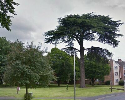
The only remnants of Hoole House which may be left include the fine stand of mature trees to the east of Hoole Road just before Hoole Hall roundabout including an impressive Cedar of Lebanon (Cedrus Libani) which Lady Boughton could have planted. However it is possible that Lady Broughton left another relic in Hoole. Tithe maps show that she also rented "lawn fields" extending to the southeast (as well as several other fields). At some point (after 1875, by which time Lady Boughton had long since died) a row of trees was planted, down the edge of what still might have been "lawns", possibly to screen the view of Chester Station, the Leadworks, Boughton and the Workhouse while leaving open the views towards Beeston and the Peckforton Hills, and possibly also the Welsh hills. These trees appear to have strongly influenced the layout of Linden Grove and Pine Grove. This was not the only botanical activity hereabouts. In the 19th century Chester became a centre for market gardening, plant nurseries, and seed merchants (see Industrial Revolution). As early as 1837 Chester market gardens were supplying Liverpool, and the coming of the railways allowed some Chester firms to expand greatly. The trade increased in importance right up to 1914 and maintained its position until the 1930s. The city's location at the geographical centre of the British Isles, together with its good rail connexions and mild climate, made it an ideal place to serve the national market. The Royal Agricultural Show was held at Hoole in 1893. As reported far and wide:
- "THE ROYAL AGRICULTURAL SOCIETY'S SHOW AT CHESTER. The fifty-fourth Annual Exhibition of the Royal Agricultural ."Society of England was opened in the City of Chester on Monday, June 19, the machinery yard having, as usual, been opened for the judging of the implements on the preceding Saturday. The show-ground, in the suburb of Hoole—which was outside the city proper—about a mile to the north of the general railway station, covered an area of nearly one hundred acres, and was admirably laid out." (Times of India)
The agricultural show. which used part of the grounds of Hoole House, was attended by the then Prince of Wales (and so also Earl of Chester) later Edward VII. This visit may have influenced John Douglas in his choice of biblical quotation for the carving of the King he used a few years later at Shoemakers Row in Northgate Street.
Hoole Hall: Balloons
Ormerod, writing in the early 19th century, noted that ‘the site of Hoole Hall on this estate is still marked by strong stone foundations, adjacent to the village of Hoole, near the second mile stone on the Frodsham road’ (1882, 813).
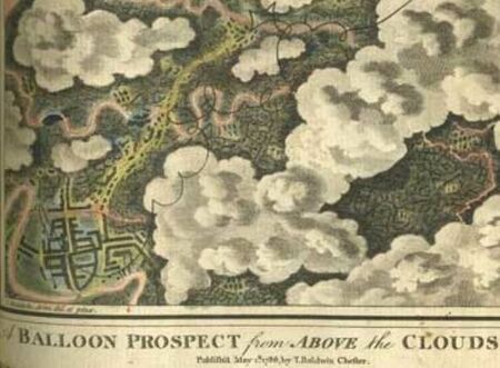
The present Hoole Hall was built c.1760 for Rev John Baldwin with extension and some alterations for the Hamilton family. He had purchased the estate in 1757 from Bunbury family. His son Thomas Baldwin (1742-1804, or "Baldwyn"), a clergyman, tried, in 1783 after resigning from his position as a Huntingdon curate, to fund the construction of a balloon by subscription, but was unable to raise enough money. A display of Thomas' exploits, which included his design for a "grand naval air balloon" from 1784, was until recently still found at Hoole Hall.
Baldwin's luck was to change when Vincenzo Lunardi, the "dare-devil Italian balloonist", visited Chester in 1785. On Friday, 2nd September the Chester Chronicle reported:
- "Mr Lunardi presents his respectful complements to the public with thanks for the favours that he has already received and begs leave to inform them that he has resigned his place in his balloon to T.B. esq a Gentleman of Chester"
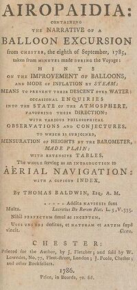
"T.B." was Thomas Baldwin. However his flight came about, Baldwin then wrote a highly detailed and lengthy account of the voyage, with the impressive title: Airopaidia: Containing the Narrative of a Balloon Excursion from Chester, the Eighth of September, 1785, taken from Minutes made during the Voyage: Hints on the Improvement of Balloons, and Mode of Inflation by Steam: Means to Prevent their Descent over Water: Occasional Enquiries into the State of the Atmosphere, etc. The Whole Serving as an Introduction to Aerial Navigation: with a Copious Index. Baldwin wrote:
- "On Thursday the 8th of September 1785, at 9 in the Morning was first fired one of the Cannons (a six-pounder) from the Castle-yard to inform the City and Neighbourhood that the necessary Preparations were making to inflate the Balloon."

He started with the release of a smaller balloon of his own as a sounding device, making it quite clear that he had almost beaten the French to it with his own earlier work:
- "At 10 o'Clock the process began with the inflation of an airistatic Globe eighteen feet in Circumference of Silk Tiffany made the latter End of the Year 1783 and decorated with Painting, Mottoes and Devices: in the Performance of which little Work, Mr Baldwin was the Sole Projector, Architect, Workman and Chymyst .. It was intended to serve as a sort of Pioneer, to delineate the Track of the Great Balloon. It fell at some Miles Distant, tis said unfortunately on a Hedge and was presently torn to Pieces by the Eagerness and Avarice of the Pursuers who expected and undeservedly obtained the Reward promised in the letter appended to it."
Further details of Baldwin's exploits can be found on the page for Chester Castle. In the 19th Century, the Hoole Hall acquired a floating staircase and a spacious Conservatory, now grade II listed.
During the 19th and 20th Cents the Hall saw many changes in residents and at some point during the 19th Century, one of them housed a family of monkeys in the Conservatory.
Hoole Hall: Botany
Arthur Potts bought Hoole Hall in about 1857 and he and his family lived here for the next 55 years. The second son of Henry Potts, of Glan-yr-Afon, Denbighshire, he was born on the 23rd of June, 1814. Watergate House was built in 1820 as a town house for Henry Potts who was Clerk of the Peace for the County of Cheshire. It was designed by Thomas Harrison. In 1907 Watergate House became the headquarters of Western Command. The Potts family country house at Glan-yr-Afon was also built by Harrison), and produced one of the first riders to win the Grand Liverpool Steeplechase (a fore-runner of the "National") on "The Duke" - Arthur's elder brother, another Henry. Arthur was apprenticed to Mather, Dixon and Co, of Liverpool, where he was a contemporary of W. B. Buddicom, and other engineers afterwards destined to rise to note in connection with the establishment of the railway system. Some tine after completing his apprenticeship, Potts joined John Jones at the Viaduct Foundry, near Newton-le-Willows, which had a very prosperous career. Jones and Potts employed about eight hundred men, and for several years were fully employed in making locomotive-engines for various railways, notably the Caledonian Railway. In 1852, offers were made by the London and North Western Railway Co. for the purchase of the Viaduct Works (without the machinery), and that company ultimately acquired the property, when Mr. Potts retired from business with an ample fortune. Thereafter, until his death on the 4th of April, 1888, Mr. Potts lived at Hoole Hall, and amused himself in horticultural pursuits, growing orchids; he also had a love for Alpine plants, and had collected a good many. The following orchid is named after Hoole:
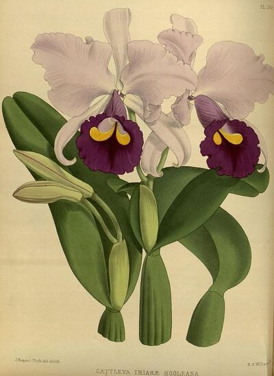
- CATTLEYA TRIANAE HOOLEANA - This lovely variety was first flowered by the late A Potts Esq, Hoole Hall, Chester. The flowers are about five inches in diameter; sepals pale rosy purple; petals deeper tint of same colour; lip rosy magenta on the upper side; anterior portion deep magenta purple; throat marked with a pair of curved cone shaped blotches of a rich orange yellow colour.
On the east side of the transept of the Cathedral is a stained window given in 1890 by Mrs. Elizabeth Potts, of Hoole Hall, in memory of her father and her husband. Elizabeth was born in 1829 in Chester. She was the only child of William Wardell a very wealthy banker and a partner in Dixon's "Old Bank" in Eastgate Street. Wardell was the mayor of Chester in 1840 and advanced the boney and a collection of books to start the Mechanic's Institute library in St John Street. When he died in 1864 she inherited around £80,000. She had a strong interest in gardening and won many prizes for her flowers. She died in 1911 and her daughter Edith who had married Reverend Oswald Pryor Wardell Yarburgh in 1889 inherited the property. Her husband died in 1913 and Edith lived at Hoole Hall with her daughter Hilda until 1924 when she sold it to Sir Alexander Maguire. As nored above, the Potts also have a connection with Watergate Street and lived at Watergate House where another Eliza Potts (1809-1873) was a noted botanist - in 2019 her portrait by William Owen Harling (1813-1879) was purchased by the Grosvenor Museum, which also holds her botanical collection.
Alexander Maguire born in 1876, was the son of match manufacturer J. T. Maguire of Liverpool. Alexander was educated at Waterloo College in Liverpool. In 1898, J. T. Maguire and his four sons – Alexander, David, Richard and Robert - left the Diamond Match Company of America to form Maguire, Miller & Co. In the 1900s Maguire worked on the White Phosphorus Prohibition Act of 1908, for which he was knighted in the 1917 Birthday Honours. In 1919, with the death of two of his brothers and the retirement of another, he took over the directorship of the company and formed Maguire, Paterson and Palmer. In 1945, Maguire stayed in Upper Carlisle Road, Eastbourne. There he was treated by society doctor John Bodkin Adams, the suspected serial killer. According to Olwen Williams, Maguire's nurse, Adams plied the patient with whisky despite him being "an inebriate". Maguire soon moved back to London, where he died 18 months later from "chronic alcoholism". Alexander had sold Hoole Hall in 1929 to Charles Edward Holmes.
The last family residing were the Holmes family who stayed until the British Army took over the property for Western Command in 1940. Charles Edward Holmes was born in 1875 in Tipton, Staffordshire. His father Edward was a railway pointman and Charles became a solicitor. He was the Secretary of Garden City Tenants Ltd which was a building society founded to raise capital for worker’s housing. In 1902 he married Rose Hannah Barnett, the daughter of Samuel Barnett who owned the Barnett Brickworks in Tividale. The couple had four children. After the second world war the Hall was passed over to British Telecommunications for offices, which subsequently stood empty for many years. The complete site was sold at auction on 30th June 1982 to Wolverhampton & Dudley Breweries who after nearly 2 years were granted planning permission to turn the grand hall into a Hotel, Bar and Bistro.
Hoole Cottage
Described by an estate agent as follows: "one of the three original houses that comprised Hoole, these being Hoole Hall, Hoole House and Hoole Cottage itself. Built originally in 1680 and formerly owned by the Earl of Shrewsbury, then onto the Grosvenor Estate and then into private hands thereafter".
Hoole Bank House
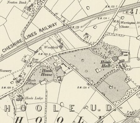
On 15 August 1914, Mr George W Hayes offered Hoole Bank House to the Red Cross as a hospital for wounded soldiers and sailors, paying the expenses for its conversion, even before the first major involvement of British troops in France on 23 August 1914. This is described in some detail on the Hoole History & Heritage Society website under Hoole Hospitals 1914-1919. The house had a maze according to the early OS maps. If the OS map is accurate, the maze is of a non-standard pattern - one cannot reach the center by the normal "trick" of following a single wall.
Hoole Lodge
Hoole Lodge was the home of the Rev James Ward who assumed the name of Hamilton in compliance with the will of his uncle Chas Hamilton Esq. Hoole Lodge was owned by the Earl of Shrewsbury and was reputedly Hoole's manor house. For over 50 years the Hamilton family lived there, at the same time renting their newly built Hoole House to Lady Eliza Broughton. When she died in January 1857 the family moved into Hoole House; as a result Hoole Lodge was available when an official residence was being sought for Cheshire's first Chief Constable.
Cpt Johnes Smith was its first occupant, the 1861 Census recording his wife and four children, his mother-in-law and eight members of staff living there. A coachman was employed for the journey into Seller Street, the location of the County Police Headquarters. A later residen was the Chief Constable and historian Fenwick.
The house has long since been demolished.
Rose Cottage
Also shown on early maps, Rose Cottage still exists. It is an early 19th century house in painted brick, with a grey slate roof over two storeys and is double-fronted. It has Gothick details, particularly in the windows which have some of which have Y-tracery to each light in Tudor-arched openings with hoodmoulds and lable-stops.
Brook Lodge
Robert L. Jones, station manager at Chester Station and resident of Hoole lived in the same house, Brook Lodge, that had been occupied by John Broster, printer and writer of guidebooks on Chester. The house has since been demolished. Jones is associated with the electrical regulation of clocks and invented a system used for the Liverpool-Holyhead telegraph line through Hilbre Island and used elsewhere. Surprisingly, both Jones and the Pickerings have connections with the first transatlantic cable. Jones' invention (see: Time) was in part instrumental in the development of waterproof cables and the Pickerings were involved in the development of the transatlantic cable. When the Transatlantic Cable was established (with the assistance of Thomas Brassey), Liverpool cotton broker John Rew saw the possibilities inherent in the idea of the simultaneous deal. By using the cable, he could get quotations from the Cotton Belt in the USA and buy the cotton at almost a moment's notice. He could then "hedge his bet" by a complex set of contracts. The cable which enabled him to do this was in part funded and greatly supported by Charles W. H. Pickering. He was the husband of Elizabeth Walker, who was the daughter of Thomas Walker of Flookersbrook and his wife Katherine Lightfoot. Pickering was present when the first official Transatlantic Telegraph message was transmitted. It was to be the message from Queen Victoria to the US president but Charles Pickering made a change and just before the Queen's message on August 5, 1858. The story of Pickering's message is reported by his son (in his memoirs) who wrote:
- "The message from Queen Victoria to the president was handed to the telegraph operator, a Mr. St. John .. The telegraph operator told me later that my father put his hand on Mr. St. John’s shoulder and told him to stop. My father told him there was a message to be sent before the queen’s telegram."
Pickering sent: "Glory to God in the highest, on earth peace, good will towards men" - which is still recorded as the first official cable across the Altantic. The use of the cable to "hedge" bets on prices is somewhat ironic given that the phrase was coined by the man who slew the same Earl of Shrewsbury who once owned Flookersbrook.
Tithe Maps of Hoole
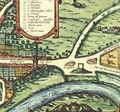
Cheshire Archives and Local Studies has made the "Tithe Maps" (circa 1836) from Cheshire available online, together with side by side modern and older OS maps for comparison purposes. Below is an illustrated example of how to use the Tithe Maps to explore a relic of the Medaeval in Hoole: - the Tithe Maps can be a lot of fun. The story starts with the Braun and Hogenberg map of 1561. On that map (to the right) can be seen the bottom end of Hoole Lane coming down to the then location of the gallows at St Giles Cemetery. Gallows, such as these were traditionally placed at an important crossroads near the boundary of a city or township. We know that Newton Hollows and its extension along the street was a road leading to Roman Chester, and the same can be said of the road (Tarvin Road) through Stamford Bridge and Littleton: so what of Hoole Lane? Or, as it was named on the Lavaux Map (1745) - "St Ann's Rake". "Rake" is an old Norse word meaning "lane", apparently dating back to the settlement of the Wirral peninsula by Vikings in the 10th century (see: Dark Ages). A lease (ZCHD/10/28) to Thomas Kelsall dated 18th August 1708 also refers to it:
- "..lease for 99 years from 1 to 2 Herbage and pasture of two pieces of land called Hool Rake and St. Ann's Rake in Hool, with liberty to inclose Hool Rake provided no inclosure extends further eastward than the Ash Tree in the hedge row of Sir John Werden's further field adjoining Hool Rake and so the cart way through the Rake is left. 2 to keep premises and the highways through them in repair. 2 may terminate lease at end of period of 21 years if he gives 6 months notice"
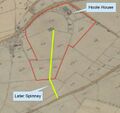
From that starting point the interesting thing is to follow Hoole Lane as it heads north-east. Early OS maps show Hoole Lane crossing the railway to the east of Chester Station then crossing Flookersbrook, After Hoole Lane passes the site of the former Workhouse it runs very straight, crossing the outer ring road to become Guilden Sutton Lane. At this point the line being traced passes along the edge of the remains of a Roman "marching camp". There appears to be a curve where it crosses the railway, but careful inspection of the maps reveals a separate track which follows the original line: this is visible on views from the air as a line of trees and this pleasant "Green Lane" can still be walked today (wellies suggested). The line of trees continies to Station Lane and crosses it about a third of the way from Guilden Sutton to Mickle Trafford. It then continues on to the River Gowy as an alignment of field boundaries - Bryant's 1831 map of Cheshire shows a road or track along part of this boundary. Apart from a single bend this is a remarkably straight line. In fact it follows very old township boundaries - or rather perhaps these boundaries (including that of Barrow) follow a very old track. Looking overall at the Tithe Maps at a larger scale there are few township boundaries near Chester that actually follow a more or less straight line for as long as "Hoole Lane" and its extension to the River Gowy. The Tithe maps also show how the Gowy has changed through time, with the original meandering course made much straighter. Where the line followed ends there are a couple of particularly sharp meanders and this could (possibly, but not certainly) have indicated a potential crossing point towards Barrow.
Now for the interesting bit. If we go to the Tithe Maps and look at the land ownership just as this straight line reaches the River Gowy we find different land ownership in long and narrow strips aligned with the "track"/"boundary", as it reaches the river. These can be little else than a relic of the "open field system" - the most visible characteristic of the open-field system was that the arable land belonging to a manor was divided into many long narrow furlongs for cultivation. The fields of cultivated land were unfenced, hence the name open-field system. Each tenant of the manor cultivated several strips of land scattered around the manor. The benefit was that everyone got a share of good and less good land. So Hoole Lane leads us from the place of execution on the Braun and Hogenberg map of 1561 to a relic of strip-farming on the banks of the Gowy.
Hoole Lane from Braun and Hogenberg
Lower Hoole Lane crossing Flookersbrook
Benchmarks
Hoole contains a significant "Benchmark" on the Daresbury to Wrexham line of the second geodetic levelling, England & Wales, which was levelled between March 1920 and July 1920. The surveyors report states that the mark is on the gate pillar, at the entrance to The Limes, on Hoole Road. This "flush bracket" was levelled with a height of 78.8060 feet [24.0201 metres] above mean sea level (Newlyn datum). This flush bracket was also used during the Third geodetic levelling, England & Wales, when it was included on the Oswestry to Daresbury levelling line. There is only one problem: the pillars, together with this benchmark have been destroyed. The next mark in the line has survived, on the side of the Town Hall facing Princes Street, but may have been moved during repairs. The previous marks at Hoole Old Hall, and Trafford Bridge (over the Gowy) have both been destroyed, with the next surviving mark at Horn's Mill Bridge over Peck Mill Brook.
Hoole becomes respectable
Ashby place represents the rural housing that once stood in the area and formed a driveway to Springfield House - which still exists on Springfield Drive. Infill development of large detatched houses later took place around the edges. The 19thC Hoole Road became lined with early Victorian grand terraces and semi-detached houses. Hoole's population grew from 177 people in 1801 such that there were c. 5,900 in the smaller Hoole urban district during the period 1911–31. Early development around what are now Hamilton Street and Westminster Road consisted of good quality housing for the moderately prosperous middle-classes. Later development of terraced housing for the "working classes" was also of reasonable quality. Some lower quality terraced housing once existed, for example in Law Street (built 1890's), but this relatively small amount of housing at the bottom end of the market was demolished in the 1960's.
As a general rule, in the triangle formed by Hoole Road, Lightfoot Street and Hamilton Street/Crawfords Walk, the later housing units (up to about 1914) are progressively smaller and more terraced than the older ones built in the previous century. Also, the generaly quality and quantity of embellishment around doors, windows, along the eaves and even on chimneystacks also reduces. In cheaper building dense, glossy Ruabon brick is not used, with cheaper brick being used instead.
Hemingway writing in 1831 describes it as follows (listing a lot of people he probably knew and hoped would buy his book!):
- ..the lovely hamlet of Flookersbrook abounding with neatly built modern dwellings to which if the epithet of splendid be inappropriate the claim of elegance and comfort is justly due to each of which is appended richly cultivated garden ground. Here are the comfortable residences of Major Cotton the Rev John Thorpe, Mr John Williamson, Mr Cross, Mr Lightfoot, Mr T Walker, Alderman Broater, Mr Humble &c &c. It is hardly possible to pass this approach to the city without being reminded of the villas in the neighbourhood of the metropolis - the width of the road the respectable and good looking tavern called the Ermine - the pool of water in front of an excellent footpath on the north side of the road over hung with willow trees and the clean and rural appearance of the neighbouring cottages all all have ever contributed to fix an impression upon my mind such as I have just stated.
Hemingway seems to have been wrong about the Ermine, as the following advertisment appeared in the Chester Chronicle a year later:
- TO BE SOLD BY AUCTION at the Sherrifs writ, By MR. JOHN BROWN, on Monday next the 16th and Wednesday the 18th April, THE whole of the Household Goods, and Furniture, Brewing Vessels, Stock in the Cellars, &c. &c. the property of Mr. George Hogg; comprising several sets of bedsteads, with moreen and chintz hangings, capital feather beds and bedding, (most of them new within the last twelve months), mahogany chests of drawers, and chamber furniture, parlour carpets, mahogany chairs, dining tables, with D ends, several painted dining tables, eight days clock, a quantity of casks and brewing utensils, also the barr fittings. Likewise, a few barrels of ale, a sow with eight young pigs, and two fat pigs. A number of wood hurdles, a quantity of Potatoes, some horses geers, sacks, tools, a quantity of timber, and a variety of articles. The sale to begin each day at eleven o’clock. Chester, April 10th, 1832"
The "last throw" of the canal builders before the railway arrived came in 1833 when plans were submitted for a canal from Hoole Lane lock (near the Leadworks/Shotworks) to Birkenhead, via Hoole and Upton and thence along the line of what is now the Chester-Birkenhead railway. This canal would have been at a higher level than the Chester-Ellesmere Port canal and would have presumably crossed the Backford Gap via a viaduct as the railway does today. The Civil Engineer on the proposal, James Gilbert, seems to have proposed several canal schemes between c1820-1840 but none were ever built.
From 1841 to 1871 Chester enjoyed thirty economic boom years. The main evidence for this is the extent of migration to the city and population growth, but prosperity was also reflected in a large rise in the number of businesses and in the amount of rebuilding in the city centre. The arrival of the railways reasserted Chester's importance for transport and consolidated its function as a service centre for the region. A limited growth in manufacturing further diversified the economy. In choosing their route through the City, and given the main imperative of creating efficient communication with Ireland through the new port of Holyhead, the railway avoided the City Centre, locating the station in an outlying area of marshy land known as Flookersbrook after the stream that ran through it. The land was occupied only by market gardens and a single row of cottages. Subsequently other competing companies sought to redress this deficiency by proposing a new line to terminate beside the Cathedral in the Kaleyards. Their thwarted ambitions were represented by a line truncated at the now closed Northgate Station (opened 1875), again located on the periphery of the city above the tunnels of those lines leaving the General Station. Between the two stations lay groupings of engine and goods sheds for the many independent railway companies and the railway colony of Newtown. Indeed, given the slope of the land from the site of Northgate Station down to the Kaleyards, it is difficult to see how the railway could have reached its intended terminus without either a prodigious viaduct or the destruction of the Phoenix Tower.
Samuel Lewis in 1848 described Hoole as follows:
- "HOOLE, a township, in the parish of Plemonstall, union of Great Boughton, Lower division of the hundred of Broxton, S. division of the county of Chester, 2½ miles (N. E.) from Chester; containing 294 inhabitants. It comprises 745 acres, of a sandy soil. The tithes have been commuted for £80 payable to the rector, and £22 to the Marquess of Westminster. Various plots of land here, belonging to the Rev. Mr. Hamilton, of Hoole Lodge, and others, have been laid out for building purposes, such as the erection of villas, &c., by Mr. Rampling, architect, of Liverpool; and some of the plots have been sold at the rate of 5s. the square yard, or £1210 per acre; while, before the introduction of railways, the price was not more than about £150 an acre."

By 1870, Hoole had grown somewhat and John Marius Wilson's Imperial Gazetteer of England and Wales described Hoole thus:
- "HOOLE, a village and a township in Plemonstall parish, Cheshire. The village stands near the Chester and Manchester railway, 2¼ miles NNE of Chester; and has a constabulary office, a lecture hall and reading room, and a national school.-The township comprises 743 acres. Real property, £6, 144. Pop. in 1851, 427; in 1861, 1, 596. Houses, 314. The increase of pop. was caused by proximity to Chester r. station. The landowners are the Earl of Shrewsbury, W. Brittain, Esq., and Mrs. Hamilton. Hoole Heath was allotted to the chiefs from Wales and elsewhere who went to Hugh Lupus' standard. A church was built in 1868."
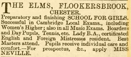
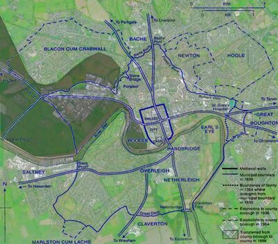
In 1864 the Hoole District Board was set up. This was largely occupied in the building of drains, paving of streets and general health matters. In 1894 this became the Hoole Urban District Council with first elections the following year. The Town Hall of the UDC was originally in Westminster Road and later removed to a large Victorian House and former girl's school, "The Elms" Hoole, which was demolished in the 1970's to become the site of a local medical practice, and in 2017 the site of a CO-OP supermarket. In 1880 Chester Town Council decided to appiy to Parliament for the extension of tho city boundary, to include the whole district of the Hoole local Board. Hoole remained a separate urban district in Cheshire until 1954 when it was made part of the County Borough of Chester. Even from the 1900's minutes of the Hoole UDC show that unification with the city of Chester was an almost constant subject of debate and difference of opinion. The main concern being the effect on rates. As the ancient boundary of Chester was defined by Flookersbrook, this placed it less than half a mile from the City center. Hoole UDC supervised the Police and Fire Brigade - the fire siren being a conspicuous object on the roof of the "The Elms"
In 1873, a new Chester Union Workhouse was erected at Hoole at a cost of about £30,000. The design for the buildings was opened to competition and the winning plans were submitted by W Perkin and Sons. The new workhouse had a large T-shaped main building facing to the east, with a separate infirmary to its west and a school to the south. After the opening of the new workhouse, the old Roodee workhouse site was used as a confectinary works by the Cheshire Preserving Company. The Roodee Workhouse building was demolished in the early 1900s. Following the opening of the new general wing at the West Cheshire Hospital in January 1983, the City Hospital, which the Hoole Workhouse had then become, ceased to be a general hospital, and specialised in geriatric cases. The hospital closed in 1991 when it was demolished. The pillars which supported the gates to the entrance drive to the Workhouse remain today, as does the Chapel of the utterly confusing St James the Less.
Hoole Expands
The rapid growth of "workers housing" in Hoole was not without its problems. In 1905 the Chester Courant reported (8th Feb):
- Dr. Butt presented his annual report of the health of the district. He said there had been 93 deaths in an estimated population of 4,948, being a percentage of 18.7 per thousand. That was considerably higher than the average for the last ten years, the increase being entirely due to the abnormal high infantile mortality, 36 infants under one year having died. The number of cases of phthisis had declined. Births numbered 191, an increase of 40 compared with 1903, betng equal to a rate of 38.6. That was considerably higher than the average for the last ten years. Of the births 93 were males, and 98 females. During the year there had been 30 infectious easts, two of which were in the Chester Union. In the Workhouse there had been 94 deaths a population of 468, or 200.8 per thousand. Ten births had been registered in the Workhouse during the year.
Although Chester's population doubled between 1841 and 1911, its social character changed little. The city was polarized between a middle- and upper-class population whose income came from land, agriculture, trade, and, increasingly, inherited wealth, and a working class employed in declining manufactures or in unskilled and casual jobs in the service sector. The distinctive economic base meant that Chester lacked both a significant class of industrial capitalists and a sizeable skilled working class employed in modern industries. The City council had difficulty in finding land for development within the borough boundaries, and sometimes had to buy sites for housing in the surrounding rural districts. In such areas the cost of roads, electricity, sewerage, and other services laid on by the borough could not be recovered because the rates went to the county.
Hoole and the Railway Footbridge
In 2014, two members of The Hoole History & Heritage Society discovered a fascinating document at the National Archives in Kew that (supposedly) led to a major development in Hoole (the Hoole Railway Footbridge) in the late nineteenth century. The 1889 Memorial is a plea for better links between Chester Station and the northern suburbs, with an appended list of signatories with addresses. But who instigated it? One might think the very first of the signatories: however careful inspection of the document reveals that may not be the case and illustrates nicely a few points about historical document research. For more see: Hoole Railway Footbridge.
Hoole after 1900
A sad event in Hoole is comemorated by one of the graves in Overleigh Cemetery which bears the words:
- "In loving memory of George Goodfellow, aged 11 years and Henry Berry, aged 8 years who were drowned by falling through the Ice trying to save a fellow playmate at Hoole on January 17th 1905. This memorial has been erected to perpetuate their memory by sympathising friends and playmates"
The story of the grave and its restoration can be found here.
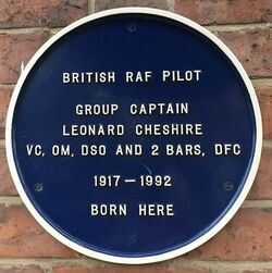
Hoole's economy can perhaps be considered as stalled during the first half of the 20th Century. The small size of a county borough such as Chester could lead to organizational inefficiency and a tendency to reactive, short-term decision making. The City sufferred a constant shortge of money during the first half of the 20th Century. This meant that there was little to be spent on preserving the City's past and parts of The Rows (especaiily in Watergate Street) fell into serious disrepair. Chester could perhaps have increased its revenues more if it had been able to extend its boundaries to include those areas of the surrounding rural districts, including Hoole, which had become suburbs and for which the county borough provided most of the services. They included both council and private estates, many of whose residents worked in Deeside or Ellesmere Port. Attempts at widening its boundaries, however, usually encountered strong opposition from Cheshire county council. In 1932 the City council planned a large extension into both Cheshire and Flintshire, but dropped the proposal when it became clear that a parliamentary Bill would be vigorously contested by Cheshire county council and that the government would not allow the borough to extend across the Welsh border. In 1936, however, the county agreed to surrender Blacon, the built-up part of Newton, and a part of Hoole which included the City Hospital and much of the railway station. It was not until 1954 that the rest of Hoole urban district was added to the City. The 1938 OS map shows that Park Drive, Pine, Maple and Cedar Grove had been constucted by that time. In the late 1950's a large council estate was constructed to the north of Hoole and cheap semi-detached housing in Pipers Lane was built as a fringe between council housing to the west and the bypass (A41) on the east.
In 1917 Leonard Cheshire was born in Hoole Road (in the building which is now the "BaBa" Hotel). Cheshire did not take part in the "Dam Busters" raid but took over command of 617 "Dam Busters" squadron later in the war, and was the official British observer of the nuclear bombing of Nagasaki flying in the support B-29 "Big Stink". He is one of the few people awarded a VC not for a single incident but due to cumulative action throughout the war. Cheshire dedicated the rest of his life to supporting disabled people, combining this with lecturing on conflict resolution. In 1948, he founded The Cheshire Foundation Homes for the Sick, which, in 1976, became the Leonard Cheshire Foundation, now styled Leonard Cheshire, which continues his work to support disabled people globally. On 5 April 1959, in Bombay's Catholic Cathedral, he married Sue Ryder, also the founder of a charity. Former Pink Floyd member Roger Waters once described Cheshire as "the only true Christian I've ever met."

In the 1920's shops were scattered through Hoole rather than being localised in Faulkner Street, which was mostly residential, and contained little more than a newsagent, two butchers and a cake shop. Faulkner Street is named after Mary Faulkner, wife of local developer Charles Hamilton. However all the corners in Walker Street (named after John Lightfoot Walker - owner of the Lion Brewery in Pepper Street) were built as shops and remained so at that date. By the 1950's shops were beginning to congregate in Faulkner Street.
A faded relic of WW2 can be found at the corner of Waverley Terrace and Ermine Road, where "EWS" can be just maked out in large yellow letters. This indicates the location of an "Emergency Water Supply". There are two more of these in Chester, one at the south end of Brook Street and another, as metal signage, in Northgate Street on the frontage of the "Coach House".
Hoole has a remarkable "Acid Tar Lagoon". The lagoon arose as a result of over 62000 tonnes of liquid acid tar waste from benzole refining being poured into the excavated clay pit of a brickworks until 1967. Benzole is a noxious coal-tar derivative. The waste was produced by a company called Lobitos (nothing to do with the tyre company), which was taken over (1962) by Burmah-Castrol Company, now part of BP Anaco. The sludge deposited into the pit consisted of a mixture of tar-like hydrocarbons. which included spent bentonite (a clay) and absorbed heavy oil, sulphuric acid and other oily substances. The acid tar waste arrived warm in a semi-fluid state, and therefore was simply poured into the pit - hence it must have come from a local refinery. There are plenty of photo's of Lobitos Benzole rail tankers on train-spotter sites from Ellesmere Port and Stanlow. In addition to the acid tar waste, several chemical drums were also fly-tipped into the sludge. However, nothing is known about the origins, contents or amounts contained within these drums. In 2000 the contents of the pit were 44 % sulphuric acid, 42 % oil residues, 8 % sulphated oil residues and 6 % water. The surface of the sludge tends to be covered with a layer of rainwater. It was fenced-off in 1999, but there are seepages outside of the fence. Various strategies for remediation have been considered, but none implemented. Curiously, and seemingly by co-incidence the Barnett family of Hoole Hall, were the owners of "Rattlechain Lagoon" in Tividale (West Midland) later used as a phosphorous waste dump and another seriously contaminated site.
Modern Hoole
On 24th October 1996, one of Chester's worst fires ever engulfed Pickford's storage warehouse and led to the destruction of much of Lightfoot Street. Pickford's was never rebuilt after the Lightfoot Street Fire and the site is presently occupied by a development of flats named Thomas Brassey Close after the railway engineer. On 2nd December 2010. The Chester Enterprise Center burned down in the second Lightfoot Street Fire. The cause of the fire was evidently a heater left on overnight. Lightfoot Street is named after John Lightfoot (licensee of the Ermine, Flookersbrook, from 1818 to 1820). According to some evidence, he died (12th March 1832) leaving everything to his son, but was not aware that his son had pre-deceased him by a few days. The consequent litigation dragged on for years, complicated by the fact that Lightfoot had sold land on which much of Flookersbrook had been built. When the matter was finally settled, many years later, the original deeds of the houses in Halkyn Road and nearby record a huge number of signatures to put the matter to bed. The "Flookersbrook Improvement Act" of 1876 related to:
- "Such of the lands situate in the townships of Newton and Hoole and county of Chester, comprising in the whole two acres two roods and three perches or thereabouts, bounded as follows; ...and on the north-west in part by property belonging or reputed to belong to the said Earl of Kilmorey, on the other part by property belonging or reputed to belong to the trustees of the will of the late John Lightfoot, in other part by property belonging or reputed to belong to the trustees of the settlement made on the marriage of the late Maria Broadbent, in other part by a certain street or occupation road...
On 17 July 2009 sixteen flats on Hoole Lane were destroyed following an explosion on the first floor. More than thirty firefighters tackled the resulting fire at the two-storey building in Wharton Court.
Hoole has its problems. CWaC's policity on "no drugs/alcohol in the city center" has pushed the issue into the suburbs. Dog fouling is also a major issue. You can report it "on line" but don't expect it to be cleared-up quickly. Despite CWaC going on at length about the hazards of dog excrement, they are not swift to deal with it. Parking in Hoole is also an issue due to its proximity to Chester Station and the reluctance of some people to pay for parking. In residential streets like the late 19thC. Halkyn Road many residents have taken to flagging over their front gardens to provide for off-street parking: unfortunately, that only makes the parking problem worse for everyone else.
Listed Buildings in Hoole
- Poplar House, Flookersbrook: a late 18thCent house in Flemish Bond brick, with an ornate radial bar fanlight over the door.
- 1 Derby Place/37 Hoole Road:
- 3-5 Derby Place:
- 4-6 Derby Place:
- 7-11 Derby Place:
- 51-53 Hoole Road:
- Former Westminster Road School and Schoolhouse:
- 13-17 Hamilton Street:
- 19-21 Hamilton Street:
- 23-25 Hamilton Street:
- 27-29 Hamilton Street:
- 41-43 Hamilton Street:
- Church of All Saints:
- 102A Hoole Road:
- Rose Cottage, Mannings Lane:
- Hoole Hall:
- Pinfold, Oak Lane, off Warrington Road:
Related Pages
- Plegmund: Alfred's archbishop and the story of his well;
- Flookersbrook: the former boundary of Chester, when Hoole was in Cheshire;
- Hoole Railway Footbridge: an interesting insight into Victorian society;
- Time: Robert Lewis Jones, Hoole resident, and his contribution to timekeeping;
- Baldwin: Intrepid Hoole balloonist but largely forgotten today;
- Brown: a branch of the store-owning family donated the clock at the parish church and were noted for electoral corruption;
- Newton Hollows: a medieval sunken road with its own legend of a hell-hound;
- Workhouse: including the one in Hoole;
- Battle of Hoole Heath;
Sources and Links
- Place names around Hoole: from the EPNS;
- "A virtual Stroll" on Hoole - a very extensive site with much history and many photographs. ;
- Chester Walls on the Ermine I suspect Mr Howe is not a regular...;
- Hoole Local History Society - the site is regularly updated. Incredible detail.;
- "Tithe Maps" of Hoole - a fascinating look at 19th Century Hoole;
- Hoole in newspapers around 1900 - incomplete, but it is free;
- The Flookersbrook Improvement Act - full text;
- Hoole on Wikipedia;
- Hoole on Genuki;
- Streetlife.com provides a local "chat" facility for Hoole residents;
- Hoole on "openstreetmap";
- Daily satellite image (NB sometimes it is cloudy!);
- All the other maps of Hoole you might ever want;
- More Maps;
- Old images of Hoole (from when the roads were empty);
- HooleRoundabout local magazine, mostly adverts but with good historical articles;
- Flookersbrook blog;
- Thomas Walker of Flookersbrook and the inter-marrying of the land-owners who gave many of the street names to Hoole;
- Roman remains in Hoole - marching camps built for practice;
- Hoole Road character study - what the local council thinks is good or bad in the conservation area;
- The lost Gardens of Hoole - perhaps why so many streets are named after trees;
- Geology of Chester (especially Hoole);
- The Bunburys;
- more on the Bunburys;
- Henry Bunbury: post mortem inquisition;
