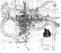
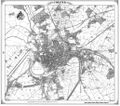
Mutlow and StockdaIes Map
Features
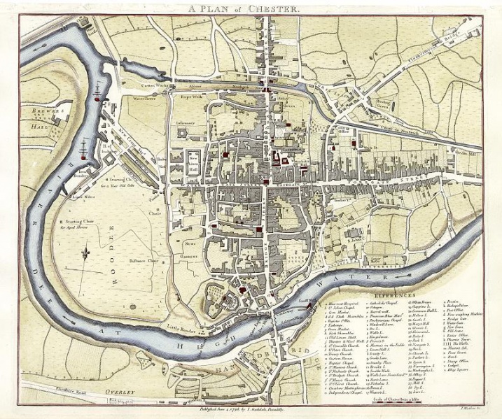
One surprising feature of the map is how small Chester was in 1795 and how much open space was left within the City Walls.
Some points to note are:
- The River Dee had been diverted from its original course, making a right-angle turn at the "Cheese Docks";
- The Canal has been built and the Basin is present, although there is as yet no extension to Ellesmere Port (see Canal and Boatyard);
- The shot-tower at the Leadworks has not yet been constructed, although the "Steam Mill" (1786) on the opposite bank of the canal has;
- The "Bowling Green" behind what was once the "Bowling Green" pub in Brook Street is marked on the map - having been in use since the 16th century. This bowling green regularly used until recently, the pub having become the "Catholic Club". The Church sold some of the land off in 2001, when a residential development (retirement homes) was built on its site. However the bowling green still survives, although used less frequently;
- The Infirmary has been built as has the Linenhall, both to the north of Watergate Street;
History
This map was engraved by J.Mutlow, published by John Stockdale in 1795. John Stockdale was born in Caldbeck, Cumberland, the son of Priscilla Stockdale (1726–1789) and, Joseph Stockdale. He is believed to have been raised as a blacksmith, like his father, and then to have become valet to John Astley of Dukinfield, Cheshire. He married Mary Ridgway, a native of Roe Cross, Mottram-in-Longdendale, Cheshire, and sister to James Ridgway, a well-known publisher of Piccadilly, London. He had met Mary in the Dukinfield Moravian chapel.
Stockdale moved to London about 1780 and worked as a porter to publisher John Almon, near to the premises of his brother in law. When Almon retired from business in favour of John Debrett, Stockdale opened a book shop in competition and, "being a man of natural parts, he soon became conspicuous in business in spite of much eccentricity of conduct and great coarseness of manners". Both Stockdale's and Debrett's premises became meeting places for the political classes, Debrett's being frequented by the Whigs and Stockdale's by the supporters of William Pitt. John Adams, one of the Founding Fathers of the United States lodged with Stockdale for two months during 1783.
Stockdales son, John Joeseph, was the publisher of the notorious Memoirs of Harriette Wilson (1826) which attracted a crowd ten deep outside his shop. Before publication, Stockdale and Wilson wrote to all those lovers and clients named in the book, including Arthur Wellesley, 1st Duke of Wellington and Henry Brougham, 1st Baron Brougham and Vaux, offering them the opportunity to be excluded from the work in exchange for a cash payment. Wellington famously responded with, "Publish and be damned".
Sources and Links
A gallery of Old Maps of Chester
Braun and Hogenberg (1581)
Smith Map (c.1588)
John Speed (c.1610)
Hollar's Map (1660's)
Lavaux Map (1745)
Hunter Map (1789)
Mutlow and StockdaIes Map (1795)
Coles Map (c.1804)
John Webb Map (1833)
Hugh Roberts (1858)
