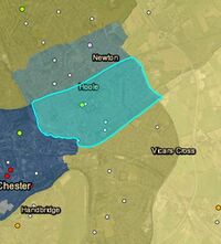
Parishes
"Ancient Parishes" of Chester are the group of parishes that existed roughly within the period of 1200–1800. Initially, the ancient parishes had only an ecclesiastical function, but reforms initiated by King Henry VIII, and developed by Queen Elizabeth, meant that the Vestry Committees of the parishes became responsible for some aspects of civil administration e.g. the new Poor Relief Law, and, for a time, maintaining the highways which passed through the parish boundaries. This role was expanded by later legislation and led them to acquire various secular functions that eventually led to a split between the ecclesiastical parishes and the purely civil parishes that exist today. However, for a long period of history the smallest administrative units of society were the parish, the township and the manor. This article looks, as an example, at the township of Hoole in the parish of Plemstall but much the same analysis can be done for any rural parish or ex-rural parish.
- "PLEMONSTALL, a parish comprising the townships of Hoole, Pickton, and Mickle-Trafford, in the lower division of the hundred of BROXTON, and the township of Bridge-Trafford, in the second division of the hundred of EDDISBURY, county palatine of CHESTER, 4¼ miles (N.E.) from Chester, and containing 710 inhabitants. The living is a vicarage, in the archdeaconry and diocese of Chester, rated in the king's books at £6. 13. 4., and in the patronage of the Earl of Bradford. The church, dedicated to St. Peter, stands in the township of Mickle-Trafford, a mile and a half north-east of the village of that name. There is a small endowed school, erected by subscription, more than a century ago. At Trafford, in this parish, a garrison was placed for the king, by Sir William Brereton, during the siege of Chester in the parliamentary war." - From Samuel Lewis A Topographical Dictionary of England (1831)
One thing to note is that the bounaries of a parish often change over time. After 1800 the movement of people into larger towns and cities, and the general growth of populations led to an increase in the number of "parish" churches and the establishment of "Conventional Districts" (see note at end below). In adition, it is not unknown for parishes to have been combined in the past. Nowadays, the parish system is often viewed as antiquated and the parish registers seen as relics of the past, but the parish administration, especially outside of cities, played a key part in "local government" and infrastructure (especially roads) for many hundreds of years.
History
The word "parish" which is the English equivalent of the Latin "parochia" and the Greek "paroikia", has been used by the Church since its very early days to denote a primary organisational unit. At first, during the spread of christianity in the later Roman empire, this would have been located in a city and would have defined a community rather than a geography. By the opening of the 4th century, christianity was spreading to the countryside, which was quite literally inhabited by "pagans". Minsters were established as centers of ministry, but in early times there were no parish boundaries as such - the religious community was too thinly spread and many preists and preaches would be itinerant. The minsters were sometimes staffed by monks living under a rule or secular clerks leading a semi-community life. Village churches were few and far between before the ninth century and very little is known about their organisation. They are believed to have spread rapidly between c.950 and c.1150, and while in some parts of the country there was a tendency towards "one township, one church" this was not so clear in the north and west. The majority of "Ancient Parish" churches in England originated as the personal property of (predominantly lay) patrons; who had the right to appoint and dismiss the parish priest, to receive an entrance fee on appointment, and to charge an annual rent thereafter.
Each such ecclesiastical parish was administered by a parish priest, specifically Rector, Vicar or Perpetual Curate depending on if the original set up of the rectory had become lay or disappropriated meaning its medieval rectorial property rights had been sold or bestowed on another body such as an abbey. The legal right to appoint or recommend a parish priest is called an advowson, and its possessor is known as a patron. Each such right in each parish was mainly first held by the lord of the principal manor. The creation of an advowson was a secondary development arising from the process of creating parishes across England in the 11th and 12th centuries, with their associated parish churches. A major impetus to this development was the legal exaction of agricultural tithes specific to the support of churches and their clergy; landowners needed to establish parish churches on their lands in order to retain tithe income within their estates and prevent it being spent or dispersed elesewhere, and to this purpose sought to raise former field churches to parish church status. This was generally performed by a lord of a manor by rebuilding a church within the boundary of his manor, or within that of a newly subinfeudated manor, and then transferring proprietary rights of certain individual named fields, mills or messuages (i.e. houses on the manor which earned rents) to establish a glebe, land from which the parish church could benefit directy.
The lord of the manor, having incurred a very great expense in building the church and parsonage and having suffered a loss of income due to his donation of property to the glebe, quite reasonably insisted on the right to select the individual who would act as parish priest, from which office he could soon not be ejected by the lord until the priest's death. The bishop, without whose consecration the new church would have no religious and spiritual stature, in turn demanded the right of confirmation of the appointment. Thus from the earliest time the advowson was "appurtenant to" the manor, that is to say it appertained to the manor and was exercisable by the lord. The advowson, being real property could be "alienated" (i.e. disposed of) by sale or gift of the patron, but with special licence from the overlord as was required for the alienation of the manor itself.

By various reforms almost all these rights were extinguished for lay patrons, who were able only to retain the residual power to nominate the rector to a benefice, and many lay notables thereupon gave up parish churches into the ownership of religious houses, which were less inhibited by canon law from extracting fees and rents from rectors. Initially it had not been unusual for religious houses in possession of rectories also to assume the capability to collect tithe and glebe income for themselves, but this practice was banned by the decrees of the Lateran Council of 1215. The abbeys and monasteries soon found a way around this, by purchasing advowsons, waiting for the incumbent to die and presenting themselves as a "legal person" for the role of rector. Such a rector had the advantage of never dying.
Thus, in the pre-Reformation church, a rector a cleric (or a "legal person") whose revenue was usually, at least partially, appropriated by a larger organisation (such as an abbey). This was in contrast to a vicar, who functioned as a "vicarious" assistant and representative of for example the abbey and was alloted some of the smaller tithes. The monasteries did very well out of this until Henry VIII.
Parishes are grouped into deaneries under a rural dean who is one of the parish priests, either a rector or a vicar of one of the parishes, and then the rural deaneries form the archdeaconries, which roughly acquaint to counties under an archdeacon, and then the various archdeaconries form the diocese under the bishop. The parish system was linked to the ecclesiastical courts to which the churchwardens would have made presentments. The basic court for the archdeaconry is the archdeacon’s court, which was the lowest court of probate for the people living within parishes of that archdeaconry. Above this is the bishop’s commissary court, which covers just one archdeaconry within the diocese, and the more normal bishop’s consistory court where wills could be proved, covering the whole of the diocese, such as the one that can still be seen at the Cathedral. Above the diocesan courts, are the prerogative courts, the Prerogative Court of Canterbury and the Prerogative Court of York, the Prerogative Court of Canterbury being the more senior of the two. This was the hierarchy of the ecclesiastical courts, which were the courts for probate up until 1858.
Tithes
Tithes are first mentioned in a constitutional decree, made in a synod held A.D. 786. Upon their first introduction, though every man was obliged to pay tithes in general, he might give them to whatever priests he pleased, or he might pay them into the hands of the bishop. In time, the tithes of a parish became the legal property of the person who held the office of rector. The rector did not have to be an ordained man — it might well be a college, bishop, a nobleman, or even a female. The rector was simply the one who received the ‘greater’ tithes, 10% of the cereal crops grown in the parish, (which might be as much as 75% of the total tithes), in compensation for the freehold (land) used by the church. The tithes were not the property of his vicar, who is not an office-holder but an employee, remunerated by a stipend, i.e. a salary, payable by his employer the rector.
Tithes were paid for every thing that yields an annual increase, such as corn, hay, hops, fruit, wood, cattle with calves, horses with foals, poultry, and the like, and for eggs, wool or milk and suchlike; but not for any thing that is of the "substance of the earth", or is not of annual increase, such as stone, lime, and the like; nor were they payable for creatures that are of a wild nature, such as deer and hawks. Personal industry resulted in tithes, as of manual occupations, trades, corn-milling, fisheries, and the like; and of these the tenth part of the clear gains and profits was due. Tithes were not intended entirely for the personal benefit of the rector, but were supposed to also provide some support for the poorer parishioners. They were also intended to cover the upkeep of the chancel of the church (but not the nave or anything else west of it).
In the Reformation of the 16th century, the Dissolution of the Monasteries led to the transfer of much monastic property back to laymen, and with the properties passed the advowsons which the monasteries had held: thus creating a large group of lay patrons (impropriators) who were entitled to collect the tithes. These lay purchasers of the tithing rights could not themselves fulfil the spiritual obligations of a parochial cure, and nor was it considered proper that they appoint stipendiary priests for the function, as the canons had done. Instead lay purchasers of appropriated tithes, were required in these instances both to nominate a clergyman to the diocesan bishop to serve the cure, and also to provide a fixed stipend of appropriate annual value to support the new perpetual curacy. In practice, most of the nominated incumbents to the new perpetual curacies were the canons or stipendiaries who had been serving those cures before the dissolution.
In 1603, there were an estimated 3849 livings in the hands of lay impropriators out of a total of 9284. Termed ecclesiastical pluralism some parish priests held more than one parish living (benefice), traditionally placing a possibly temporary curate in charge of those where they did not reside.
A rector received direct payment of both the greater and lesser tithes of his parish, whilst a vicar received only the lesser tithes (the greater tithes going to the lay holder, or impropriator, of the living). A curate received neither greater nor lesser tithes, but only a small stipend in return for his duties. Perpetual curates (the title was abolished in 1868, after which they became vicars) tended to have a lower social status, and were often quite poorly remunerated with the "living" sometimes being described as "a starving". Any distinct status that perpetual curates had in law was abolished in 1968. The traditional titles of rector and vicar continue in English use today, although the roles and the conditions of employment of the two titles are now essentially the same. Which of the titles is held by the parish priest is largely historical, some parishes having a rector and others a vicar. Owing to the origins of the terms, parishes with a rector are often of more notable historical importance or prominence than parishes with a vicar.
The amount of tithe generated by a parish varied according to it’s size and agricultural practices and this resulted in massive disparities in clerical incomes, indeed in 1704 a special fund – Queen Anne’s Bounty - had to be set up to help poor clergy. It was found that just under a half of all clergymen earned eighty pounds a year or less, whilst others earned thousands of pounds. Considering the average agricultural wage in the early 1800’s was about £25 per year this was still generous. The bounty was originally funded by the annates monies: "first fruits" (the first year's income of a cleric newly appointed to a benefice) and "tenths" – a tenth of the income in subsequent years traditionally paid by English clergy to the pope until the Reformation, and thereafter to the Crown.
By the early 19th century tithe payment in kind seemed a very out-of-date practice, while payment of tithes per se became unpopular, against a background of industrialisation, religious dissent and agricultural depression. The 1836 Tithe Commutation Act required tithes in kind to be converted to more convenient monetary payments called the tithe rent-charge. The Tithe Survey was established to find out which areas were subject to tithes, who owned them, how much was payable and to whom. The first task of the Tithe Commissioners appointed to oversee the administration of the Act was to discover to what extent commutation had already taken place. Enquiries were directed to every parish or township listed in the census returns. The results of these enquiries are in the tithe files, which cover the whole of England and Wales, and not only those places where tithes remained uncommuted by 1836. For parishes where tithes were still being paid in kind, the land had to be surveyed and valued, to arrive at total parish rent-charge figures, and to calculate each individual landowner’s liability to pay tithe. Assistant tithe commissioners travelled to these parishes to hold meetings with parishioners about valuations, and to settle the terms of the commutation of their tithes. During the process the Tithe Maps were generated.
Thus, the tithe maps represent the end of the era of tithes-in-kind, but not the end of tithes in the form of a rent-charge. They are very useful documents and at the time they were produced represented one of the most systematic surveys since Domesday.
Chester Parishes
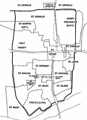
For the City of Chester, and some detached portions the nine ancient parishes were: Holy Trinity (inc. the Blacon part of Blacon cum Crabwall), St Bridget, St Johns, St Martin, St Mary on the Hill (inc Claverton, Little Mollington, Marlston cum Lache, Moston, Gloverstone and greater part of Upton.), St Michael, St Olave, St Oswald (inc. Bache, Croughton, Great Boughton, Iddinshall, Newton by Chester, Wervin, the Crabwall part of Blacon cum Crabwall, part of Upton, and the islands of Hilbre and Little Eye in the Dee Estuary) and St Peter. St John had no townships which were dependent upon this parish, but it did contain 16 fields that were part of Hoole. St Oswald had a chapelry of Bruera which included Churton Heath, Huntington, Lea Newbold and Saighton. Chester Castle was extra-parochial, as was Little St John which in 1778 contained Bluecoat Hospital, Northgate Gaol, and six almshouses. Other places not in an ancient parish included Spital Boughton and the Cathedral precincts. See the links below for information on how the intra-mural parishes of Chester developed over time.
Chester's "nine" medieval parishes were not mapped until 1833, but there is no reason to suppose that the boundaries as then defined were substantially different from those of 1200, by which date all the churches were in existence. The parishes of St. Michael, St. Olave, and St. Peter lay within the medieval walls, and St. Martin's almost entirely so. St. Bridget's was partly extramural but confined to the liberties. Holy Trinity and St. John's extended beyond the liberties, and St. Mary's and St. Oswald's far beyond them. The partly extramural detached portion of St. Martin's parish in the Crofts may originally have been the parish of a tenth church, St Chad's, which had disappeared before the Reformation. Of course the picture is not as clear-cut as when described briefly: the chapel of St. Thomas the Martyr without Northgate, was the site of the Abbey’s Leet Court for its tenants, and did not achieve parish status until 1871 while St. Oswald’s was a late Saxon chapel within the Abbey, from which it was not distinguished by name until the later 13th century, or by territory until 1509, at which date St. Oswald’s became a parish, and the Abbey precinct an extra parochial area.
The evolution of the parishes in Chester and the final shape of their boundaries have been plausibly explained as the successive subdivision of territories attached to the two oldest foundations, St. Oswald's and St. John's, as new churches were established from the 10th century onwards (see links below). Some of the city parishes had extramural portions with St Oswald's including townships in three different "hundreds". One complication in Chester was the presence of two large religious institutions: the college of St Werburgh (later the abbey and later still the Cathedral) and St Johns which had briefly been a cathedral in Norman times. Both these institutions were at times linked to wealthy benefactors.
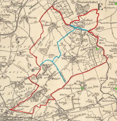
As an example of a rural parish this article considers the ancient parish of Plemstall. This comprises the townships of Hoole, Mickle-Trafford, Bridge-Trafford and Picton. The original church at Plemstall was built in the 12th century but the present building dates mostly from the 15th century. Inscriptions in the church show that there were restorations in 1684, 1711, 1802–03 and 1819. Further information on the church and its environs can be found in the article on Plegmund.
The Hundreds were the earliest known geographic divisions of Cheshire for administrative, military and judicial purposes. They were introduced in Cheshire some time before the Norman conquest. Similar divisions of land are known as wapentake, herred (Danish) with related twrms being used in other Scandinavian/Germanic countries and cantref (Welsh). The origin of the word is obscure and it may once have been the land needed to support a hundred households - something dependent both on how good the land was and the size or living-standard of households. It could also have been the land needed to provide 100 warriors in time of war. A recent theory, which does seem to be supported by evidence, is that the hundreds arose during the establishment of Mercian christianity. Higham has shown that eight of the 10 hundreds in 1086 were based on pairings of the great parishes of the early minster churches, and that in many instances there is evidence of a royal grant of land to the relevant churches. This implies that the hundreds were the product of a degree of coherent planning long before the Conquest, and as is the case elsewhere there is a growing body of evidence to suggest that some may conform with Romano-British land divisions.
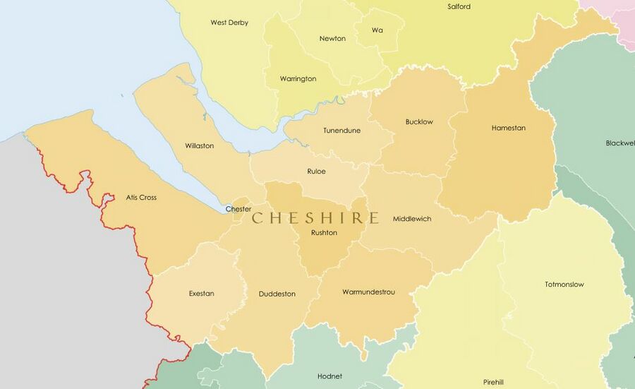
Both the number and names of the hundreds changed over time by a processes of land being lost from Cheshire, and merging or disaggregation of remaining hundreds. The Ancient parishes of Cheshire were usually wholly within a specific hundred, although a few of the extramural ones (such as Plemstall) were divided between at least two hundreds: Picton and Mickle Trafford being in Willaston Hundred and Bridge Trafford being in Ruloe/Roelau. It is reasonable to assume that parishes in two or more hundreds predate the existence of hundreds. Over the years the initial hundreds consolidated to just seven with losses to Wales and changed names: Broxton (most of Dudestan and part of Willaston), Bucklow (Bochelau and Tunendune), Eddisbury (Riseton and Roelau), Macclesfield (Hamestan), Nantwich (Warmundestrou), Northwich (Middlewich) and Wirral (Willaston). The date at which this process happened is not clear: These newer names are reported to be all in use by 1259 to 1260. Plemstall was still split (mostly along the Gowy) between the Broxton Hundred (Picton and Mickle Trafford) and the Eddisbury Hundred (Bridge Trafford}.
It is often said that the boundaries of rural ancient parishes reflect those of Anglo-Saxon manors as they were at some time before the Norman Conquest. This is true to some extent, but a parish might comprise several townshops and manors such that only a portion of the manor boundary became a parish boundary. Clearly this is not true of urban parishes, as in Chester where the interlocking of the intra-mural parish boundaries can be quite complex on a very small scale. In Cheshire and some other northern counties the number of townships per ancient parish is often three or more which is somewhat higher than in the south of the country where the average is usually less than two. No single explanation suffices to provide for this difference but it may be something to do with the influence of the Celtic as opposed to the Roman tradition in the early church. Apart from in the old diocese of Lichfield and that of St Asaph the large, multi-township parish appears to be restricted to the province of York. Cheshire has some parishes with a very large number of townships, including Great Budworth (35), Prestbury (c.32) and Malpas (24).
Beating the bounds
"Beating the bounds" was a formal perambulation of the parish boundaries on Ascension Day or during Rogation week. Knowledge of the limits of each parish needed to be handed down so that such matters as liability to contribute to the repair of the church or the right to be buried within the churchyard were not disputed. The relevant jurisdiction was that of the ecclesiastical courts. The priest of the parish with the churchwardens and the parochial officials headed a crowd of boys who beat the parish boundary markers with green boughs, usually birch or willow. Sometimes the boys were whipped or violently bumped on the boundary stones to make them remember. The object of taking boys along is supposed to ensure that witnesses to the boundaries should survive as long as possible. In England, the custom dates from Anglo-Saxon times, as it is mentioned in laws of Alfred the Great and Æthelstan. It is thought that it may have been derived from the Roman Terminalia, a festival celebrated on March 1st or February 23 in honour of Terminus, the god of landmarks, to whom cakes and wine were offered while sports and dancing took place at the boundaries. In 1540 the Mayor of Chester revived the custom, which had apparently been abandonned in the time of the Black Prince, but it is a very irregular occurrance and has taken place less than thirty times since revived.
Beating the bounds of Chester as a whole started and ended at some fixed spot, possibly in the south-east at "Claverton ford" on the Dee, near Heronbridge. It isn't known where the start and finish would have been for Hoole, but for Christleton it was "The Old Glass House" on Christleton Road. The present day Glasshouse has boundary stones set on two sides of the building showing that it sits astride the boundary between Boughton (Chester) and Christleton.
Charters and other documents can provide much detailed information on parish boundaries but one useful starting point is often the Domesday survey, which is widely available in English translation online. The other useful source are the Tithe maps.
For the parish of Plemstall we can rapidly learn the following:
Mickle-Trafford
- "MICKLE-TRAFFORD, a township in the parish of Plemonstall, lower division of the hundred of Broxton, county Chester, 3½ miles from Chester, its post town, and 2 S. of Dunham." - The National Gazetteer of Great Britain and Ireland (1868)
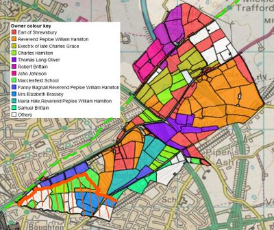
Mickle-Trafford is mentioned in Domesday (1086) as belonging to the Hundred of Willaston and in the lordship of Hugh of Avranches, Earl of Chester. It had a recorded population of 8 households comprising 4 villagers, 2 smallholders and 2 slaves. There were 6 ploughlands with 2 lord's plough teams and 1 men's plough teams. There is no mention of any pasture or meadow. It had previously belonged to Ording of Trafford. It had a value of 2 pounds in 1086 reduced from 5 pounds in 1066. The Tithe Maps for Mickle Trafford are lacking in detail as most of the land was in the ownership of the Earl of Shrewsbury and hardly any detail was provided in the Tithe Map survey of 1839.
From this we already see that the Normans were meticulous in their surveying and record-keeping, that the population of townships were small by today's standards, that slavery existed, and that the Conquest was associated with a significant loss of productivity. On the last point, several explanations have been put forward. These include: general economic turmoil associated with the change of government, loss of "working men" as war casualties or devastation by the Normans in the process of taking control. The Norman Conquest took time and there were several revolts. From 1069 to 1070 William ordered multiple villages in the north of England to be destroyed and the people deprived of their livelihoods. He ordered crops, houses and herds of animals to be burnt and destroyed. Chester was a particular center of revolt and was dealt with harshly: before 1066 there were 431 houses which paid tax (implying a population of at least 2,400), by 1107 there were only 226 houses, the scale of the loss, making it certain that major catastrophe had taken place.
Bridge Trafford
- "BRIDGE-TRAFFORD, a township in the parish of Plemonstall, second division of the hundred of Eddisbury, in the county palatine of Chester, 4 miles to the N.E. of Chester. Morley Hall was a seat of the Trafford family." - The National Gazetteer of Great Britain and Ireland (1868)
Bridge-Trafford is mentioned in Domesday as being in the Hundred of Roelua. It had a recorded population of 7 households in 1086, although details are only given as "1 smallholder, 4 slaves, 1 female slave, 1 men" and that there is ploughland for one lords team and one acre of meadow. The Tenant-in-chief in 1086 was the canons of Chester St Werburgh, who appear to held it since before the conquest, possibly charging a toll on the bridge. The annual value to its lord was 8 shillings in 1086 up from 5 shillings in 1066. By the date of the Tithe Maps survey (1840) the land was all in the hands of Roger Harry Barnston (having come to the Barnstons via the Hurlestons of Newton Hall), but no details of land use were provided.
A general observation here is that the cannons of St Werburgh were tennants or land-holders prior to the Norman Conquest. While Hugh of Avranches founded the Abbey which would later become the Cathedral in c.1092 - only after the Domesday survey - the cult of Werburgh had existed in Chester at least since Æthelflæd establish a burgh at Chester around 907.
Picton

- "PICKTON, a township in the parish of Plemonstall, lower division of Broxton hundred, county Chester, 4¾ miles N.E. of Chester, and 3 S.W. of Mullington," - The National Gazetteer of Great Britain and Ireland (1868)
Picton in Domesday was the land of Richard of Vernon and had six households comprising 3 smallholders, 2 other population and 1 "riders". The ploughland consited of 3 ploughlands with 1 lord's plough team and 1 men's plough team. There was a meadow of 0.5 acres. It had previously belonged to Toki of Picton. Picton was also in the Hundred of Willaston. It had a value of 1 pound in 1086; 5 shillings when acquired by the 1086 owner, reduced from 2 pounds in 1066. Toki, in contrast to the other pre-conquest land-holders in the parish of Plemstall also seems to have held land in Elton, Guilden Sutton, Hooton, Manley, and Norton. The lands were distrubuted after the Conquest as follows:
- to William fitzNigel: Norton;
- to Earl Hugh: Manley and Elton;
- to Richard of Vernon: Hooton and Picton; and
- to Robert fitzHugh: Guilden Sutton.
Picton appears to have had a mill. Hanshall writes that Richard Vernon gave the tithes of the township of Picton to Chester Abbey before 1093 and notes that Ormerod wrote of Picton:
- "in roads, appearance and inhabitants [it] may be safely said to present a complete picture of barbarism".
A later Richard de Vernon, was possessed of the manor of Picton but joined the Percys in their revolt against Henry IV, and as a consequence gets a part in Shakespeare's Henry IV, part one. He was captured at Shrewsbury and Vernon, together with the earl of Worcester and another leading Cheshire lord, Sir Richard Venables, was executed and their body parts distributed through the kingdom. From the Vernons, Picton descended to the Savages and then to the Hurlestons. By the date of the Tithe Map survey (1839) much of the land was in the hands of the Leche family, having come to them via the Hurlestons of Newton Hall.
An observation worth making at this point is that Toki (or Tochi) appears to be a Scandinavian name and is either a short form of a name such as Þórkell or possibly a pet-form of name such as Þór- "the god’s name Þórr" with the addition of the suffix -ki. The presence of Vikings in Chester and nearby is discussed elsewhere on this site.
For the parish of Plemstall, as in many other places, the three manors mentioned above only represent a part of a more complex picture on a local level. The estate of Flookersbrook, for example, lay partly in Newton and partly in Hoole. Parts of that estate went to the church whereas other parts were held by the Massey family of Kelsall, and existed before 1450. They later passed to the Bruens of Tarvin and then the Sneyds, before being bought after 1538 by Sir Laurence Smith of Hough (d. 1582). Flookersbrook Hall, still held by the Smiths but then at lease, was destroyed in the Civil War and the estate was later sold to the Anderson family before being broken up in the 18th century. Many such examples of complexity are to be found if any specific parish/township is examined in detail.
Hoole
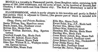
- "HOOLE, a township in the parish of Plemonstall, lower division of the hundred of Broxton, county Chester, 24 miles N. of Chester. It is situated on the high road from Chester to Frodsham. It was allotted to the Welsh chiefs who came to Hugh Lupus's standard." - The National Gazetteer of Great Britain and Ireland (1868)
Hoole is not mentioned in Domesday (1086) which records manors and not settlements or parishes. The settlement was first mentioned in the Register of the Abbey of Saint Werburgh in 1119. The place-name is often said to derive from the Old English word "hol" and is believed to mean "at the hollow" (or hole), possibly referring to the "hollow way" formed by a Roman roadway. Part of this survives as Newton Hollows.
An alternative theory is that it could have the same source as the "Hoole" found in the name of Much Hoole in Lancashire, which derives from the Old English "hulu": a shed or hovel, or a husk or pod. Much Hoole was recorded as Hull in 1204, Hole in 1212 and Hoole in 1508, Magna Hole was recorded in 1235, Much Hole in 1260 and Grett Wholle in 1551. While the latter derivation is the less likely for Chester, it is just possible that Hoole did not exist before Earl Hugh (d.1101) established one of his three asyla for fugitives and the name came to be used for the "shanty town" which sprang up. These have been described (by Gower as cited in Hemingway) as:
- "in ancient times ordained for strangers of what country soever, and assigned to such as came to the peace of the Earl of Chester, or to his aid; resorting there to form dwellings, but without building any fixed houses, by the means of nails or pins, save only booths and tents to live in."
Gower (1800) takes his information from an inquisition taken before Hugh de Audelith, Justice of Chester, on Sunday after the feast of St. Peter ad Vincula. While this is discussing the place of refuge at Overmarsh (near Farndon) it is possible the same stipulation would apply to Hoole. The Ancrene Wisse "Guide for Anchoresses", a prose masterpiece of an unknown thirteenth-century friar from Herefordshire or Shropshire, cited the scriptural direction to one who is “fairest among women” to feed her “kids beside the shepherds’ tents” (Song of Solomon 1:7). The last phrase he rendered as "bi heordmonne hulen of ris & of leaues" ("by herdsmens huts of boughs and leaves"). The sense of hulen is "shelters", made of whatever came to hand. The provision for Hoole Heath was also that:
- "that in time of war in Wales, all lawful men of the earl of Chester.. ..were wont to have refuge and receipt on Hoole Heath with their goods, necessaries, and beasts, for a year and a day"
The implication being that these were fugitives from the Welsh wars who had sided with the Normans and could flee across the Dee fords to Shotwick, where Earl Hugh constructed a castle in about 1093 to defend the fords. The route was utilised by both Henry III (1245) and later Edward I (in 1278 and 1284) in their respective military campaigns. The ford was used by Celia Fiennes in 1698 and last navigated at the very end of the 18th century before slipping into disuse, but its course was recorded one of Mackay's 1732 chart. It also appears on John Boydell's 1777 map. The route dates back long before the Normans and was possibly established as an early route for the transport of salt avoiding both the treacherous swamps at Saltney and the taxes and tolls of Chester.
The Cheshire hamlet (absent from modern maps) of Hull "huts, sheds" (Hulle in 1283), near Appleton, south of Warrington may derive from the same linguistics source.
Although not mentioned in Domesday: Hoole, together with Mickle Trafford was a component of the FitzAlan earls of Arundel's manor of Dunham on the Hill. As with many other places its later ownership has some complexity. On the death of Thomas FitzAlan during the Agincourt campaign in 1415 it descended with the latter through the Troutbecks, of whom William had become chamberlain of Chester in 1412 and later purchased parts of the parish, and thence by the marriage of Margaret Troutbeck c. 1510 to Sir John Talbot, ancestor of the Talbot Earls of Shrewsbury. The earls of Shrewsbury held Hoole Lodge, then considered to be the ancient manor house, in the early 19th century, and were lords of the manor until the 1930s, although they had ceased to be significant landowners by the 1920s. In the 13th and 14th centuries the Hoole or Holes family, which included a city sheriff in the 1280s, were mesne lords of the manor and, as tennants of the Arundels, probably resident, though by the late 14th century they had a mansion instead near Chester castle. They are not heard of after the mid 15th century. By the 1450s the Bunbury family of Stanney resided at Hoole Hall, but the house was destroyed in the Civil War and the Bunburys sold their Hoole estate in 1757. The purchasers, the Baldwins, established a new hall.
Several of these families have connections with the church at Plemstall. In the case of the Baldwin's the Rev John Baldwin was the incumbent at St Peter, Plemstall.
It is not at all clear which hundred Hoole was originally in, although it later sits in the Broxton Hundred. Guilden Sutton was a settlement in the Hundred of Willaston. as was Upton, but Newton was in the separate "Hundred of Chester". As might be expected, the administration of the hinterland of Chester was quite complex. In 1354 the liberties of Chester were defined with reference to the original Chester Hundred and included the city of Chester, the "Bishop's Borough" and "Redcliff" to its east, Newton to the north-east, and Handbridge and "Lee" (later Netherleigh and Overleigh) south of the river Dee. The "Bishops Borough" appears to have been to the east of the city and is noted in Domesday as "The Bishop's Borough outside the City" ("episcopi burgus extra civitatem").
Extra-mural Parish Boundaries
Even "unspoiled" English countryside is largely a man-made modification of the natural landscape which was already underway in the Neolithic. This reflects a process of clearance and conversion to farmland over a period of centuries and the evolution of a structured society based on the control of this land and its proceeds. Further compexity is added by changes in farming practice (see for example Cheshire Cheese). Parish boundaries provide a window on this development which has the particular advantage that they can be physically explored at many levels.
Parish boundaries are marked on maps with varying degrees of detail. In general (but not always) these boundaries stayed stable for in some cases hundreds of years, but in recent times there has been much combination and sub-division (see the example of Hoole below). Hedges were an early form of boundary as were natural streams and man-made ditches. In some places the boundary is now simply a track or pathway, but may have once been followed by a hedge. Where a boundary run along a road which need to be maintained it will often run along one side of the road so that it is clear which parish is responsible for upkeep. Changes in which of two adjoining parishes or townships is responsible, for example, for a road can lead to interesting landscape features.
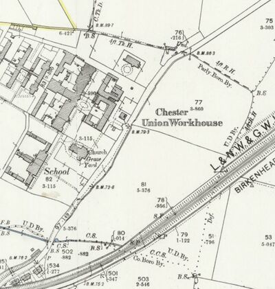
The terminology used on maps can be confusing but the following abbreviations are fairly common. "4ft R. H." means four feet from the "root of the hedge", indicating that the planter of the hedge has ensured that the hedge is set back from the actual boundary to allow it to grow without taking land from the neighbour. On modern maps this may be written as "1.22m RH". The distance differs between 3ft and 5ft depending on which parish the land lies within. "C.Tk.D" means the center of the track of a ditch (or drain), with similar for stream (C.Tk.S). "CS" may also be used for the mid-line of a stream, and "CCS" for the centre of a covered stream. "FW" is "follows wall" and is obviously associated with a more modern landscape. "Und" is used for boundaries which are "undefined": one where there was no real-world feature to align the boundary to when it was surveyed. "Def" does not mean defined, but rather "defaced", meaning that the original feature that the boundary was aligned to no longer exists: often this was probably a hedge that was uprooted and removed. Where one type of boundary stops and another starts this is often indicated by a short line with a circle at each end. The most notable boundary marker is often the boundary stone (marked on maps as "BS"): these are also the most expensive to install and may have a special history associated with them, such as memorial stones for mayoral "beating of the bounds".
25-inch maps give a particularly detailed record. The show all public boundaries, including civil parishes, municipal wards, as well as burgh and county boundaries. Field names were omitted after 1888. That said, in general, only the names of fields which are of particular importance or historical significance (such as open fields, "ings" or glebe land) were collected and recorded before and after this date. Individual field names were never systematically recorded, but after 1888 there was clearer official guidance to OS surveyors to not publish field names. The new Ordnance Survey Archaeological Officer, Osborne Crawford, appointed in 1920, led to improved recording of antiquities on Ordnance Survey maps from this time, but the level to which this was actually done fluctuated. The 25-inch maps record acreages of all largish land parcels. Land parcels were numbered consecutively within each parish, and acreages of fields were recorded in separate Parish Area Books or Books of Reference. Those counties surveyed before 1879 often include land use information, although this is sparse. The 25 inch maps record acreages of all land parcels on the map below each parcel number (with varying degrees of accuracy). On the paper map 1.0018 square inches on the map supposedly equals one acre on the ground, but this is of little use when viewing the map on a computer screen. From 1889 until ca. 1907, built up areas for which were too detailed for individual land parcels were edged by a yellow band, and the acreage shown for this wider area. From 1897 to 1909, stipple bands were used. Smaller land parcels were sometimes grouped together through the long 'S' (or "brace" symbol) crossing over parcel boundaries, with the acreage given for the total of the land parcels.
To go back befor the Ordinace Survey, the classic method of dating hedgerows using the "Hooper rule" - that one species (in a random 30 metre section) colonises every hundred years - is not a reliable method of ageing hedgerows. It pre-supposes that hedgerows planted 1000 years ago were planted with a single species of shrub. Much evidence exists to counter this, suggesting that hedgerows were formed using a mixture of species collected from nearby areas of shrubby vegetation. In some cases there is evidence suggesting that hedgerows were deliberately planted with a mix of species to fulfil different requirements. Basically, using a count of the number of hedging shrubs is a rather blunt instrument when it comes to interpreting the history of a hedgerow, but remains an interesting pastime as a rough guide.
Bounds of Hoole
As noted above, neither the township of Hoole nor the parish of Plemstall are mentioned in Domesday, but there is suggestive evidence that the parish of Plemstall is based on an ancient foundation. These include the likely association with it of Plegmund and the fact that while there is a church at Plemstall there has never been a township associated with it, and yet the parish is moderately extensive in terms of area. The township of Hoole lies immediately outside the liberties of the city of Chester from which it was separated by the original course of Flookersbrook.
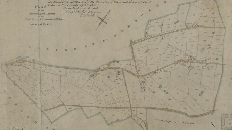
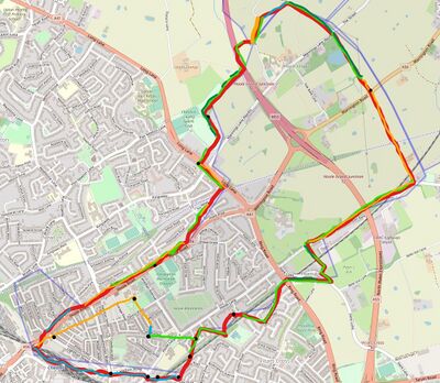
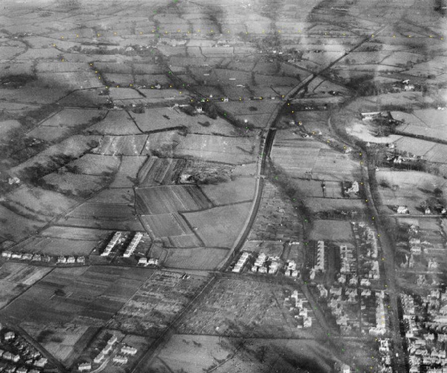
The actual bounds of the township of Hoole have varied over the years, especially as it has lost portions to the City and gained parts of Newton. The bounds from the Tithe Map may however be traced using the 25-inch OS maps. Parts of the boundary may be investigated on foot, although there appear to be no surviving boundary stones as the sites of many have being built upon over the years. A complete circular perambulation is not possible but much of the course of the boundary can be followed on maps, and some parts can be explored on foot.
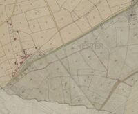
The circuit of the bounds of Hoole can be started at the former site of Flookersbrook bridge (see fig 1.). This was located in line with Brook Street and was situated near the entrance of the present railway car park (map). This would have possibly been along the course of the road before the construction of the railway and the somewhat curving Hoole Bridge. The course of Flookersbrook has been much altered and it now flows in a covered culvert to the north of its original course. Many people are unaware that the stream even existed to the east of Hoole Bridge.
From here the township boundary headed NE along the un-named stream which flows through the Flookersbrook plantation and into Flookersbrook itself, formerly the site of "St Annes Lakes", and stays to the west of what was once a drovers road and is now Hoole Road. The Tithe Map and the 25-inch maps differ as regards the location of the boundary, with the Tithe Maps having the boundaries running along the edge of St Anne's lakes while the 25-inch shows the boundary running through the center of where the lakes once lay. The boundary here is marked as "Def" (Defaced) meaning that there was once some feature which indicated it, but that this no longer existed at the time of the 25-inch map. A slight "wobble" indicates that the original boundary may have been a stream. For those wondering about the yellow line on map, as noted above this indicates the area within which individual plot sizes are (generally) not indicated as the area is built-up. Those plots within the yellow line where an area is given may or may not once had some special significance.
The boundary joins edge of the modern Hoole Road a little short of Newton Lane, and follows the wall of the the houses fronting on this almost as far as Hoole Cottage, passing the site of a former boundary stone on the way. This meant that there was a small sliver of Hoole on the Newton side of what is now Hoole Road. This is probably explained by the actual boundary being the edge of a drovers track that existed prior to the turnpike and was somewhat wider. The original route from Chester to Manchester through Frodsham and Warrington followed what was roughly the course of a Roman road to cross the Mersey by Warrington bridge. This was largely a trade road rather than the somewhat straighter military road. In the 1370s the road left Chester by the Northgate and turned right along Bag Lane (later George Street), but later the route went from the Eastgate along Cow Lane, a road which in the 19th century was successively renamed Warrington Street and Frodsham Street. Beyond Flookersbrook bridge the original course was along the line later taken by Kilmorey Park, Newton Hollows, Mannings Lane, and the Street as far as Trafford Bridge. The road was realigned through the villages of Hoole and Mickle Trafford when it was turnpiked as far as the existing turnpike at Warrington in 1786. It was disturnpiked in two parts in 1870 and 1883.
It is worth noting that near the corner of Kilmorey Park Road the boundary passes clean through a house and that no attempt has been made to divert it such that the occupant's living room and kitchen are in the same parish. At Hamilton Street the parish boundary is almost met by the Urban District boundary and the Parliamentary Boundary. These are not discussed in any detail in this article but it is interesting to note in passing how the ancient parish boundary would influence whether neighbours would have the same MP or not.
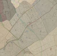
At Hoole Cottage (see fig 2.), the township boundary swings away from the modern road, possibly again following the edge of a widening of the original drovers road as it approaches what may have been the last remnant of Hoole Heath. These "funnels" at each end of the drover track would have made herding of cattle more convenient. There was a boundary stone near Rose Cottage, again long vanished. It then followed a hedge to where the modern Greenfield Lane crosses the cycle-path. At this point it turns to follow the southern edge of Greenfield Lane until a point just past the junction with Mannings Lane, where there was once a boundary stone. Here the Tithe Map shows that a short section of lane protruded into the adjacent township. This occurs at several points on the bounds of Hoole but in very few other places on the Cheshire Tithe Maps set. There is another notable landscape change at around this point which is best seen on LIDAR: south of this line the land is built upon but north of it hedges and ditches largely survive.
From here the boundary follows the track of the former Roman road NNE, but is spaced away from the current road by what have now become a series of plots to the west of the course of the Roman road. Such plots are known as "Slangs" and are relics of the cleared area on which the Roman road was centered. Encroachments into this area from differing sides can add slight kinks or a slight wavy character to the original straight track of a Roman road. Reference to LIDAR often shows the original width of a Roman road as compared with a modern lane. Eventually the boundary reaches a well in the grounds of Field House and the conincidence of the location of the well and a change in direction of the boundary may indicate that the well is of some note (although there is another well in the garden).
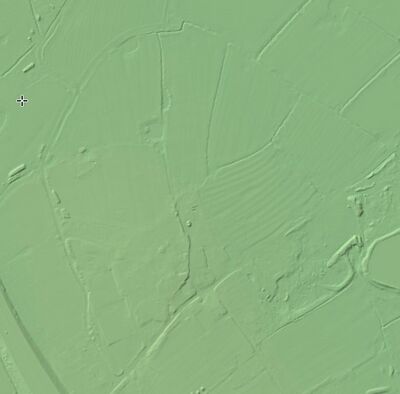
The boundary skirts around the hedge surrounding Field House until it reaches the location of another boundary stone, from where it heads NE along the line of a thick hedge. Originally the boundary met a significant ditch at a small pond but both of these are now beneath the motorway. The ditch eventually flows into Picton Dale and belongs to a set of topographical features which define the western boundary of the parish as defined at Picton.
A wealth of bounary stones in one particular area may indicate that the ownership of land in that place was more contentious than in others, or that the tennants at some point had a particular liking for marking their bounds. At various times in the history of Chester and its surroundings there was a fad for "beating the bounds" and lord mayors or other notables would often have a boundary stone added as a personal commemoration with a date and their initials. Thus, a lot of boundary stones in one area could indicate it was a place of dispute, but could also indicate it was a convenient location for a small ceremony and not too far from a suitable place of refreshment.
The core of old Hoole
The boundary of Hoole township peels off the ditch to reach Picton Gorse Lane. From here the boundary follows the lane or track NNW and then NNE following a conspicuous curved line which is part road, part hedge and part ditch until it returns to cross the line of the Roman road. For one part of this curve the boundary follows Picton Gorse Lane and where it joins and leaves it there is a notable elbow in the road. The ditch may have been purpose-dug as a boundary marker rather than having a drainage function. At the point where it crosses the Street there is a slight kink in the roadway where the "slang" shifts from one side to the other. This kink is still visible today and may have arisen because two different townships would have been responsible for maintaining the road. It is not recorded how many near-collisions or actual accidents such relics of the past may have caused.
Within the curved feature, just to the West of Hoole Bank, in what is named on the Tithe Map as "Mill Hay", LIDAR shows clear strip-marks which refect the agricultural practices once used here. The name of the field being derived from "mill" and "smithy" also indicate that this (now Hoole Bank Farm) may well have been the original site of Hoole Village, and it is a part of the highest piece of ground for 3-4 miles in any direction. Indeed in Baldwin's Airopedia (page 122) it is described as "an Eminence called Hoole-Mill Field, a Couple of Miles from Chester" as being one of the places from which his balloon was seen. More information on Hoole Bank House can be found online. It's role as an auxilliary Hospital is covered on the Hoole History Website. If there was a windmill hereabouts it may have vanished before the survey for the maps contained in John Ogiby's Britannia (1675), which often marked windmills as useful navigational features.
From here the boundary is straight for some distance (next to the Acid Tar Lagoon, a former clay-pit). Here the boundary marks that between Hoole and the adjacent township of Mickle Trafford. At the crossing of the A56 there was another boundary stone of which no trace can be found. After the A56, and possibly before, the boundary is in a large part following the center of the course of a track marked on some maps as "Garner's Lane". Garner's lane now is little more than a pleasant footpath in places and meets the border with Guilden Sutton at the end of what is clearly an ancient "Green Lane" that is effectively a continuation of Guilden Sutton Lane and Hoole Lane. However, the age of Garner's Lane is attested to by the mature trees growing on either side of it and the high biodiversity exhibited.
The Green Lane is a very extensive boundary feature which, including its continuation forms the entire boundary between Mickle Trafford and Guilden Sutton. In fact, the boundaries of Mickle Trafford and Picton, two of the other townships making up the parish of Plemstall are relatively simple, being defined by the original course of the River Gowy to the north, a ditch running from a spring near Acres Lane to the west and the aforementioned Green Lane. The boundary between Mickle Trafford and Picton is defined by the Roman Road and a drain running into the Gowy. Bridge Trafford, to the north of the Gowy has quite a complex boundary and was probably once combined with Wimbolds Trafford.
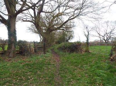
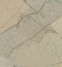
The boundary of Hoole township then follows the edge of Guilden Sutton Lane to the SW (the lane itself is in the parish of Guilden Sutton) until it reaches a point which would once have marked the continuation of Greenfield Lane, (see fig 3) where it turns SE to eventually meet Hare lane. Clearly the actual detail of the boundary would have been modified by changes to the line of the lane brought about by the construction of the railway and later modern roads such as the M53.
According to Arthur's history: "The Growth Of A Township", Guilden Sutton was originally in the ecclesiastical parish of St Oswald's in Chester and, in accordance with the practice of establishing a church in each manor, St John the Baptist Church was built and endowed as a rectory in Guilden Sutton about 1105 when Bishop of Chester, Robert de Limesey was lord of the manor. Given that the Bishop was associated with St Johns and not St Oswald this is somewhat confusing. It is not known how the Bishop gained the manor, althought it appears to have partly belonged to the church since before 1066 and partly belonged to the possibly Scandinavian "Toki" who may or may not have also held Picton. What is known is that at the dissolution of St Johns (see below) Guilden Sutton was worth proportionately more than Plemstall, possibly indicating that it was better land. LIDAR seems to indicate that it was better drained as fewer ditches are in evidence and the value of the land in 1066 was a total of four pounds. It has been said that the place-name element "Guilden" is from "Golden" and arises due to the high fertility of the soil.
So far, the boundary has followed a series of linear and curvi-linear features which comprise a stream, the edge of what was probably once heathland, drovers tracks, ditches and other trackways. Southwest of Hare Lane the boundary becomes more complex, following a zig-zag line along what were once field edges. This is despite there being some nearby linear features which could have been followed, including the former Brook Lane. These form the boundary with the adjoining township of Great Boughton which is in the parish of St Oswald. Just when the boundary was fixed along this zig-zag isn't clear, but it may not have been the original boundary of the township. The zig-zag ends when the boundary reaches the site of the former Hoole Lane Farm where it turns SSW and its course is hidden beneath modern housing. The course of the boundary here was marked by a hedge and there was once a boundary stone marking the point where it joins the boundary of St Johns parish (see below).
South of the boundary stone Greenwood's map of 1819 shows the boundary following a brook or ditch, but this is not marked on later maps. When the boundary reaches the former course of Flookersbrook it turns west to follow the stream back to the starting point at Flookersbrook bridge. In some places the course of this stream has obviously been modified and in places the boundary follows the initial meandering track whereas in others it follows what appears to be a section which has been converted into a straight ditch. There are some boundary stones marked along the stream here - notably where the line of the stream co-incide before and after straightening. Swire's Map (1830) is even more confusing about the status of Flookersbrook as a boundary, as it used a faint dotted line which is not used elsewhere on his county map and is unclear as to tne boundary of the parish in which modern-day Hoole is to be found.
Hoole and St Johns
The map of the township of Hoole also shows another boundary which is that of the "parish" of St Johns which includes a corner of Hoole township. This boundary can be seen to have had some influence on the topography of Hoole by constraining building plots and possibly controling the alignment of some roads and alleyways. Sources are divided as to whether St Johns either simply owned land in Hoole or actually conducted some parochial functions. The earliest reference to "(ecclesia de) Pleymundistowe" dates from c.1129 (Staffordshire Records Office), but it does not seem to have been associated with St John's until sometime later.
After the Norman Conquest St. John's became briefly the principal church of Lichfield diocese. In 1075 Bishop Peter formally moved his see to Chester, but by 1102, and probably in effect as early as 1087, his successor Robert de Limesey had removed to Coventry. St John's history is complex vis-a-vis its subsiduary parishes. In 1291 St. John's derived its income almost wholly from spiritualities. By 1318 it held the appropriated benefices of Farndon, Holt (Denb.), Shocklach, Guilden Sutton, and Overchurch, and of St Martin's, St Bridget's, and St Chad's in Chester. Plemstall appears to have been obtained by Shrewsbury sometime around 1280 when it is mentioned in their cartulary (NLW MS 7851). In 1304, the Shrewsbury Records state that William de Bromyerd was made Rector: he resigned as rector in 1314. Plemstall was transferred to St John's by Shrewsbury abbey (St Paul's) in 1382 (for what consideration is not known) and appropriated in 1393 (at a value of 50 marks - £33/ 6s/ 8d per year). All the livings were served by stipendiary curates drawn from the lesser clergy, except Plemstall, where the bishop ordained a vicarage a decade after the appropriation. However in 1395 it was farmed for five years to Wiliam Venables of Trafford and others. There was much dissent between the Dean and the cannons of St John's in the 14th-15th Centuries which eventually resulted in (by the 1530's) in the deanery only retaining Plemstall.
In November 1545 James Walker was presented as the Rector of Plemstall, by Richard Walker, Dean of St John's (1542-8). Finally in 1547 or 1548 the college, with its staff of dean, seven canons (five with livings elsewhere), and four vicars, was dissolved. The appropriated churches, the prebendal lands and other property in Chester, the obit lands, the chantry rents, and the possessions of the fraternity of St. Anne were all taken into the king's hands. At that time the rectory of Plemstall was worth £18/10s, while that of the smaller Guilden Sutton was worth £11/-: possibly indicating that it was better land. The impropriation, and advowson of the vicarage were passed through several hands after the dissolution before being purchased by Bishop Bridgeman. They stayed in his family until they passed to Earl of Bradford. However after c.1843 "modern day Hoole" passed out of the orbit of St Johns and Plemstall and became first a part of Chester Christ Church and later a "parish" in its own right.
Later Parish Boundaries
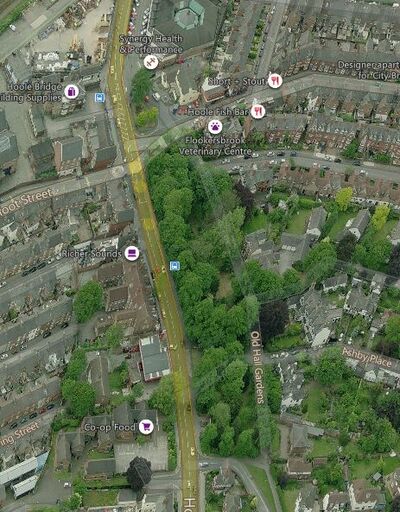
In Hoole, as in many places there were significant parish boundary changes after 1800. In the 1880s the intramural boundaries of the older parishes were rationalized. Within the walls St. Peter's was enlarged, while St. Oswald's and St. Mary's became wholly extramural when parochial functions were transferred to new churches built in the suburbs north of the city and in Handbridge. Further changes were made in 1960 when St. Peter's parish was again enlarged and Holy Trinity became wholly extramural, the city-centre church being replaced by one in Blacon. In 1967 Little St. John's, which had acquired parochial functions, was united with St. Oswald's parish. More significantly, under a Church Commissioners' Scheme of 1972 a united Chester parish for the central part of the city was created by merging the parishes of St. John, St. Oswald with Little St. John, Christ Church, St. Bridget with St. Martin, St. Peter, and St. Michael with St. Olave. That scheme left the outer suburbs in the independent parishes of Holy Trinity without the Walls (Blacon), Lache cum Saltney, St. Mary without the Walls (Handbridge), St. Paul (Boughton), and Hoole, to which a new parish for Plas Newton was added (by dividing Hoole parish) in 1982. Later OS Maps show a whole range of variations on the parish boundaries.
The ancient parish of Chester St John was partly within the urban area of Chester, but, according to one source, it also comprised until 1843 part of the township of Hoole (the rest in Plemstall ancient parish). The "parish boundaries" of Hoole had also undergone some earlier changes. The new ecclesiastical chapelry's of Chester Christ Church and of Boughton St Paul were created about 1840 (one source gives 1843 for Christ Church and 1846 for St Paul; another states that the Christ Church registers and the St Paul registers begin in 1838). All Saints Hoole was built in 1867 as a chapel to Chester: Christ Church. In 1872 it became the district church for the township of Newton by Chester and part of the township of Hoole (i.e. that previously served by Chester: Christ Church).
To summarise the changes to St Peter at Plemstall:
- In 1843 — it was reduced when part of the township of Hoole was transferred to Chester: Christ Church;
- On August 17, 1934 — it was again reduced when the following area was transferred to Chester: St. Paul: "All those portions of the said Parish of Plemstall which lie to the south-west of the Parish of Guilden Sutton, in the said County and Diocese, and to the south-east of the middle of the said Chester and Warrington Line of Railway". At the same time a further area was transferred to Hoole: All Saints. The 1954 map shows the boundary of a very small township of "Hoole Village": the boundary between it and Hoole is a trackway between Hoole Old Hall and Heath Bank (with railway bridge) for which the only evidence is a Soviet Era Military Map. Evidently at the time that the 1954 map was published there was some uncertainty as to which township Piper's Ash belonged to as there is a break in the boundary line.
- On January 23, 1959 — it was reduced again when when the following area was transferred to Hoole: All Saints: "All lhat part of the parish of Plemstall which lies to the southwest of the middle of the Chester By-Pass road (numbered A41 on the map)". However, according to the 1954 map there was no portion of Plemstall parish unless this was to sort out the confusion that existed over Piper's Ash.
Thus, the boundaries of ancient parishes which have been defined by streams, hedges and ditches for hundreds of years have slowly become defined by ring-roads and railways (one of which railroads is now a cyclepath). This leaves very few interesting anomalies, save that required to bring in Pipers Ash and the fact that the convolutions of Flookersbrook leave the last few dwellings in Lightfoot Street in a different parish. Hardly visible, but marked on the map are a set of War Department boundary stones around properties at Western Approach, which are believed to have marked the bounds of War Department properties associated with Western Command (number 2 can still be seen).
Technically, Hoole All Saints is not a parish church but the church of a Conventional District, i.e. a defined area placed under the care of a curate in charge (called the Minister of the Conventional District) with a district church council, by agreement between the incumbent(s) and bishop. They are not parishes but can have all the apparatus of a parish.
In 2015 changes were made to the Civil Parish boundaries: the Bridge Trafford, Hoole Village, Mickle Trafford, Picton and Wimbolds Trafford group of parishes were dissolved and the existing Parish Council of Mickle Trafford and District was wound up, while a new civil parish of Mickle Trafford and District was created. It is perhaps unfortunate that the name "Plemstall" no longer appears in the civil parish name.
Despite all these changes the ancient routes and boundaries which passed and defined Hoole still leave their footprints today. These take the form of street alignments which mark the course of the Roman road passing through Newton Hollows and some parish boundaries still evident in the grain of urban development.
Prior to the Tithe Act 1936, various Acts made provision for the extinction of liability to pay tithe rentcharge by redemption of the charge. The Tithe Act 1846 (9 & 10 Vic c73) was the first to make such provision. Until 1918, redemption could be effected only by payment of a lump sum. The Tithe Act 1918 (8 & 9 Geo V c54) made provision for the redemption of tithe rentcharge by means of terminable annuity payments, initially for a period not exceeding 50 years, but extended by the Tithe Act 1925 (15 & 16 Geo V c87) to a maximum of 60 years. The 1936 Act sought to phase out tithes by annuities which would become extinct. In 1976, the Government announced that as there were sufficient funds in the tithe account to service the existing redemption stock, and that because of the high administrative costs of the scheme tithe redemption annuities should be extinguished. The Government proposed a normal payment in 1976 followed by a final payment in October 1977 equal to twice the normal payment. Legislative effect was subsequently given to this in the Finance Act 1977.
Sources and Links
This article is intended as a general introduction to the subject of Parish boundaries and as such uses the Ancient Parish of Plemstall as an example. Hopefully the links below and the words above show how it is possible to trace the boundaries of other Ancient Parishes and open up access to the past of those who inhabited them.
Related Pages
- Flookersbrook: for the boundaries of Chester overall;
- Plegmund: for some informatiom on the parish;
- Hoole: for a general discussion of the township;
- Newton Hollows: for more on the local topography;
Online
- Hedgerow dating: a huge subject on its own but only an approximate method;
- Parish and Township in Cheshire and North-East Wales;
- ASPECTS OF THE TOPOGRAPHY OF EARLY MEDIEVAL CHESTER;
- The Parish of Guilden Sutton: by H Arthur (1981);
- Hoole History and Heritage Society: on the origins of Hoole;
- Parish Administration: a general guide to how it worked;
- The Church in Chester 1300-1540: Douglas Jones (1957);
- Johns, W. S. (1902). A short epitome of a paper on Plemstall parish church: Journal of the Chester Archaeological Society 8. Vol 8, pp. 45-47.
- CHESHIRE IN DOMESDAY BOOK:
